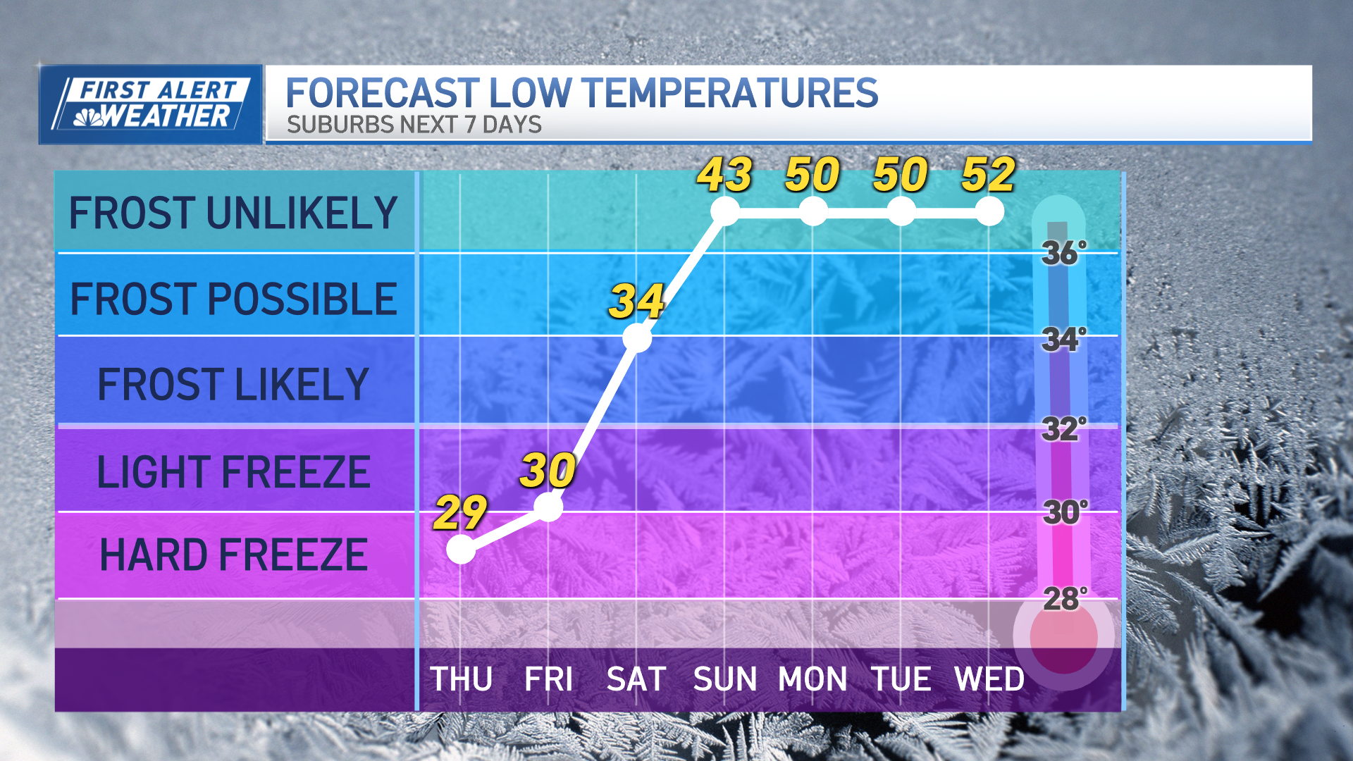
This week actually brings busy weather high in the sky – multiple energetic disturbances will drop southeast from Canada across the Great Lakes and into New England – but at ground level there’s not a lot of impact, except periods of clouds, flurries, sprinkles and steadily cooling temperatures.
With a cooling trend ahead, that makes Monday the mildest day not only of this week but probably of the next 10 days, with morning sunshine outside of the mountains coupling with a southwest breeze to bump temperatures all the way into the middle 40s before clouds build in the afternoon with a disturbance arriving aloft.
Some of the billowing clouds will grow heavy enough to drop light rain and snow showers on southern New England Monday afternoon and evening, especially near and south of the Mass. Turnpike, exiting via Cape Cod and the South Coast Monday evening for a partly cloudy overnight.
Tuesday’s disturbance will be weak, and with dry air in place New England won’t see more than building clouds mixing with sun, though temperatures will top out about five degrees cooler than Monday.
Wednesday brings another disturbance aloft, strong enough to deliver many clouds and some flurries, but little impact with temperatures another five degrees cooler.
The coolest air of the workweek comes Thursday, when yet another disturbance aloft arrives from midday to evening, west to east, and encounters slightly milder air attempting to return to New England aloft – the clash of slightly warmer and more moist air with this disturbance will probably create a period of snow showers from west to east Thursday afternoon and evening, and open the door to slightly milder air Friday that will at least halt the cooling trend for a day.
By Saturday and Sunday, expect dry enough air for ample sunshine, but the air will be chilly with high temperatures only in the 20s to around 30 and a busy wind creating a wind chill factor some 10 degrees colder!
Weather Stories
Just as this cold air relaxes early next week, the door opens behind it for moisture and warmth to attempt a return to New England, and this means the door opens to more significant snow, or perhaps snow and rain in far southern New England.
For this reason, we continue to feature a storm potential centered around next Tuesday in our exclusive First Alert 10-day forecast, but we’re also realistic that while the chances may look elevated right now, it’s still several days out…so we’ll keep you posted, as always!


