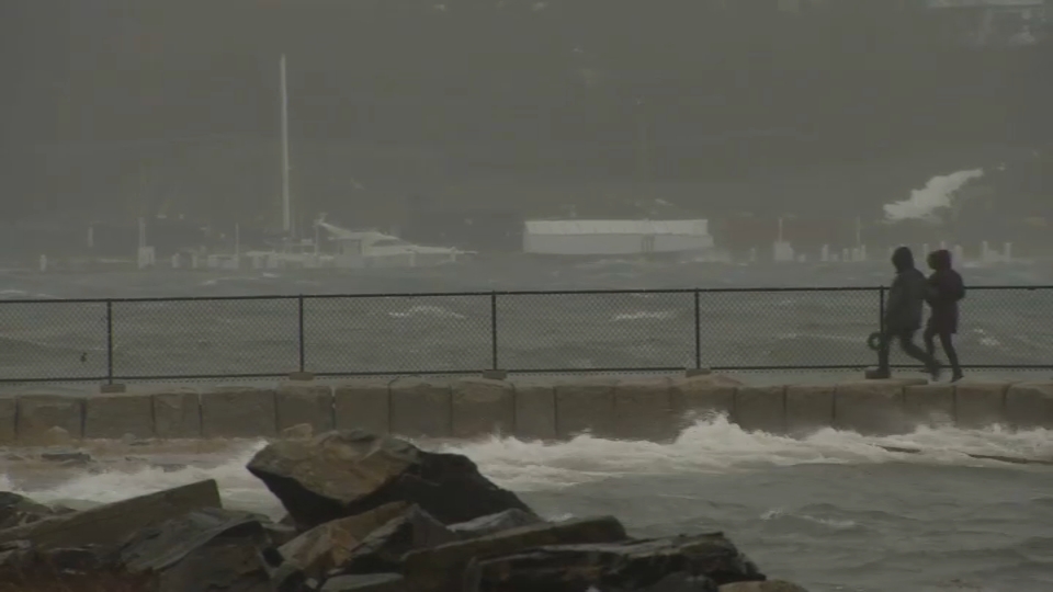
We’re still in the grips of yesterday’s storm, but it’s less wind and more cold today. Numbing wind chills return as winds gust near – or slightly above – 30 mph all morning and afternoon.
It’s a cold reminder that we’re still in the throes of midwinter and the coldest part of the season. Quite literally, in fact. Boston’s average temperature from Jan. 20 to Jan. 26 is 29.3 degrees, representing the coldest part of winter.
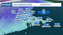
We’re close to that for high temperatures today. With the wind, it will feel like teens all day. Thankfully, the winds ease tonight under a past-full moon. Temperatures will plummet, however, as we sink to the low teens in the suburbs and low 20s downtown.
Get Boston local news, weather forecasts, lifestyle and entertainment stories to your inbox. Sign up for NBC Boston’s newsletters.
And just like that (no relation to the HBO series), the temperatures swing in the other direction tomorrow. Under a mostly cloudy sky, we’ll jump back to the mid-40s late in the day. It’s a quick-moving system so the cold should come rushing back into the picture on Thursday, after a few early showers of rain or snow.
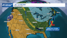
Then we’ll hold our breath as a weekend storm tries to take shape along the Eastern Seaboard. The guidance has been split on this, but the European model has had a banner winter so far and it shows a solid storm in our area by Saturday.
The track is farther offshore, the snow plume is well-defined, and the air is plenty cold. If this keeps up, it’ll be go time. More to come through the week.