
Temperatures dropped to the 20s and 30s this morning, with areas of frost north and west. A weak cold front heads offshore and most of us won’t even notice it. The wind direction changes, a few clouds roll through, but no showers.
Snow showers develop in northern New Hampshire and Maine with around 1” of snow in higher terrain at best. We continue our mild and quiet weather pattern through midweek. Today’s highs reach the upper 40s and lower 50s again with mostly sunny skies.
Clouds increase again Wednesday and our temps cool by a few degrees. Still looking at highs slightly above normal (average highs are in the upper 30s north, and low 40s south). A system heads in from the Great Lakes late Wednesday night.
There is a lot of warm air with this system as it heads in, so we will see mostly rain. Before the warm front lifts to the north, there is a brief chance for light snow showers in central and northern New England. That quickly changes to rain as temps warm up overnight.
Get Boston local news, weather forecasts, lifestyle and entertainment stories to your inbox. Sign up for NBC Boston’s newsletters.
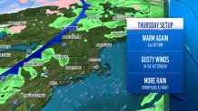
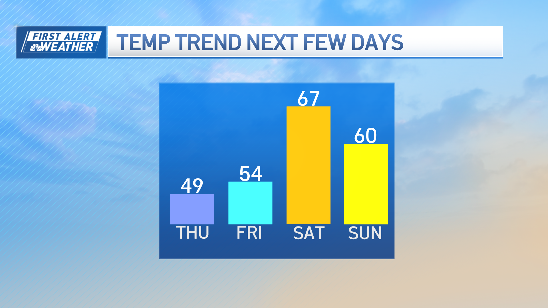
Thursday we will be between the warm front and cold front in southern New England, so temps soar to the 50s and 60s on a gusty southwest wind. Scattered showers move through Thursday night and temperatures slowly fall into Friday.
We eventually reach the mid 40s Saturday, and around 40 on Sunday. There is another system moving through Saturday, but this one is also trending warmer so as of now it looks like rain.
Weather Stories

The next chance for any wintry weather may not be until the beginning of next week as our pattern shifts to “cooler.” Stay tuned!
