
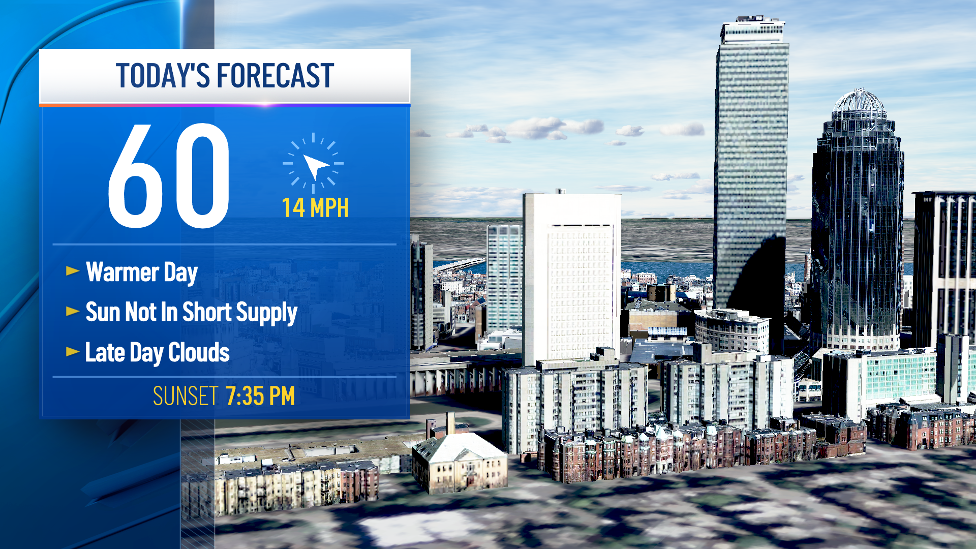
High temperatures reached the 70s in many communities yesterday. Today we will cool down a bit, thanks to a weak cold front. This morning we have some patchy fog and clouds around southern New England.
It was a soggy night north, with scattered showers off and on. Those showers weaken as they head southeast this morning. Only a few sprinkles may reach the Cape and Islands by mid morning.
The clouds dissipate this afternoon, a north wind may gusty up to 25 mph, and we should rebound to the 50s and low 60s before that 4:30 sunset.
We have another great night to stargaze, and to view Jupiter, Saturn, the waxing crescent moon, and Venus in the evening. Lows tonight drop to the 20s and 30s with a mostly clear sky.
Get Boston local news, weather forecasts, lifestyle and entertainment stories to your inbox. Sign up for NBC Boston’s newsletters.
Temperatures will be even cooler on Veterans Day with highs in the mid 50s. A mix of clouds and sun will hang around, with more clouds that evening.
A First Alert was issued for Friday for wind and rain as a system moves through. A low pressure system tracks through the Great Lakes, and will actually bring in snow to the upper Midwest. While we stay in the warmer sector of this system, we will see rain.
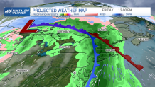
A warm front first lifts in Friday morning, giving us showers and a gusty south-southeast wind. By afternoon, peak wind speeds reach 35-45 mph along the coast and the Cape & Islands. Inland gusts reach 20-30 mph.
Weather Stories

Rain will be off and on all over the northeast all afternoon and through the evening drive home. 1-2” of rain is forecast, but it shouldn’t create any major flooding headaches. However, ponding on the roads will be an issue for the commute home.
The storm heads out by Saturday, but a spot shower is possible in the afternoon both Saturday and Sunday as the airmass overhead is very cool. Northern New England may see snow showers in higher elevations too.
Temps fall to the 50s Saturday, and the 40s for Sunday. Cool temps are here to stay next week with highs remaining in the 40s.
