
Our weather pattern has turned quieter as the week progresses, thanks to storms missing New England to the south.
The jet stream has jogged a little south, so that means low pressure systems will track more through the mid Atlantic states instead of across the northeast.
There is a system that passes close enough by tonight into Thursday that we keep a few flurries around along the south coast. Certainly more clouds around for Thursday and through Saturday.
The cold temperatures are here to stay as the storm tracks remain far south. Lows tonight fall again to below zero across the North Country, single digits and teens elsewhere, with a clear sky, calm wind and snowpack.
Everything refreezes tonight, so it will be icy again in the morning. Wind chills won't be too much of an issue unless you live in the crown of Maine, where the northwest wind will make it feel like -20 degrees by Thursday morning.
In fact, wind chills are forecast to be below zero across northern New England each night, through at least Saturday morning. Highs in the teens and 20s each afternoon through Saturday.
Weather Stories
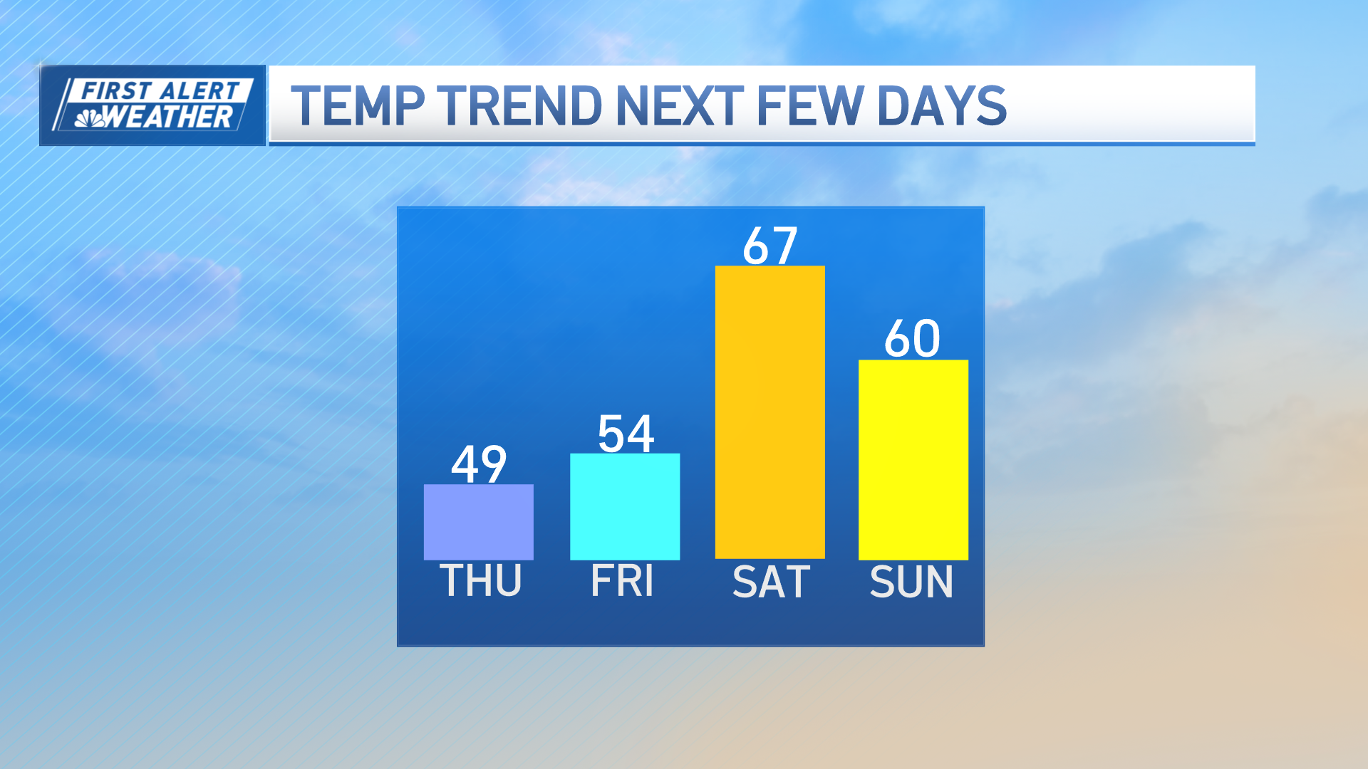

The next storm chance is still Sunday, but with a low confidence track and the speed of the storm increasing, it's shaping up to be a minor event. Snow and rain are possible, with a few inches of accumulation now being estimated to fall across interior spots and all of New England. We will watch this one closely, as nothing is set in stone yet.
Tuesday may be our next bigger chance for several inches of snow, as a system moves through again. Then, the jet stream will eject another wave for sometime late next week, while temperatures remain below normal through the 10 day.
