
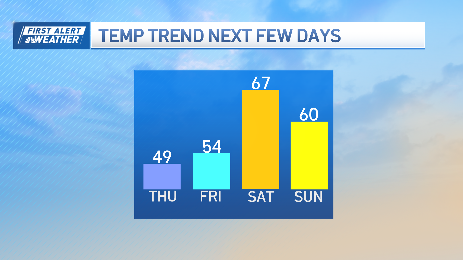
Delightful sunshine with a fresh west breeze is bumping Wednesday’s high temperatures to between 65 and 70 degrees for most of New England, with the air a bit cooler in the North Country and especially northern Maine where the showers just ended in the Crown of Maine Wednesday morning.
There’s no question Tuesday’s rain was beneficial – amounts ranged from one to two inches for most, with locally higher amounts in places like Worcester, with near two and a half inches of rain, and dramatically lower amounts west of the Berkshires and Green Mountains and on the Outer Cape to Nantucket, with Chatham receiving only 1/100th of an inch of rain.
Get Boston local news, weather forecasts, lifestyle and entertainment stories to your inbox. Sign up for NBC Boston’s newsletters.
It looks like we have another shot of meaningful rain on the way at the end of the week as a storm center approaches from the west, but well ahead of that storm and behind a departing dome of fair weather, a south wind will increase Thursday, gusting to 40 mph at times Thursday afternoon, enough to blow around lightweight objects but not enough to cause damage.
The gusty south wind will team with sunshine to boost Thursday’s highs into the 70s all the way to the Canadian border as warm air presses north in the counter-clockwise circulation ahead of the storm system pulling from the Great Lakes into Canada.
A cold front draped on the south side of that storm will slowly enter New England from the west on Friday, sparking increasing showers slowly from west to east, filling in as rain Friday night. As a bundle of tropical moisture connects with the slow-moving cold front, rain will become heavy Friday night.
Weather Stories

Because this is a cold front, there’s colder air just on the western side of it and the rain will become a cold rain Friday night into Saturday morning in Northern New England – cold enough that some summit snowflakes are possible Saturday morning!
Farther south, the most pressing question is what time it all draws to a close – our First Alert team sees one to two inches of rain likely Friday night into Saturday morning, but it’s quite possible the rain is wrapping up across southern New England Saturday morning, giving way to a blustery but drying Saturday afternoon with rain continuing in Maine.
Sunday is unequivocally the pick of our weekend – high pressure, fair weather, settles in for a fair sky and cool but dry day.
We see a few limited chances for showers next week in our exclusive 10-day, but no deep moisture connections until we’ll watch a possible shot of moisture next weekend, though it’s early to say whether that can make it as far north as New England.
