A cold front quietly crossed New England overnight.
Now we are back to sub-freezing air to start our Wednesday. Weak, high pressure comes in Wednesday with a good amount of sunshine. High temperatures will be 20 degrees north to 32 degrees south.
Clouds race Wednesday afternoon ahead of a weak wave of low pressure set to transit south of New England early Thursday morning. High up in the sky, the air is not as cold as it is down near the ground, so rain should break out in much of Western New England Wednesday evening. However, the lowest layer of the atmosphere is sub-freezing so it looks like we may have sleet and freezing rain for several hours.
From the Northeast Kingdom of Vermont, through much of New Hampshire, into western Maine, it is cold enough for snow.
And along the immediate south coast, it is warm enough for just rain from the coast of Connecticut to Cape Cod and the islands.
Precipitation is mostly after dark and through about sunrise Thursday. A few inches of snow north, a slight coating, to perhaps as much as a third of an inch of freezing rain accretion is possible inland central and south.
Local
In-depth news coverage of the Greater Boston Area.
The precipitation will be shutting down early Thursday. The nighttime weather probably results in delays and cancellations possible Thursday morning.
This wave of low-pressure Wednesday night is just the first of several waves of low pressure. Another wave comes in Thursday afternoon with a cold rain or some leftover icing late day and into the evening.
Between the rain, we will have plenty of fog and drizzle. High temperatures will be in the 20s north and east, to near 40 degrees south and west.
Temperatures should rise Thursday night as yet another wave of low pressure. An actual storm center, moving across Ontario, will be well to our north.
That should lift the warm front through with just plain rain and temperatures rising into the 40s for much of us Thursday night and the first thing Friday.
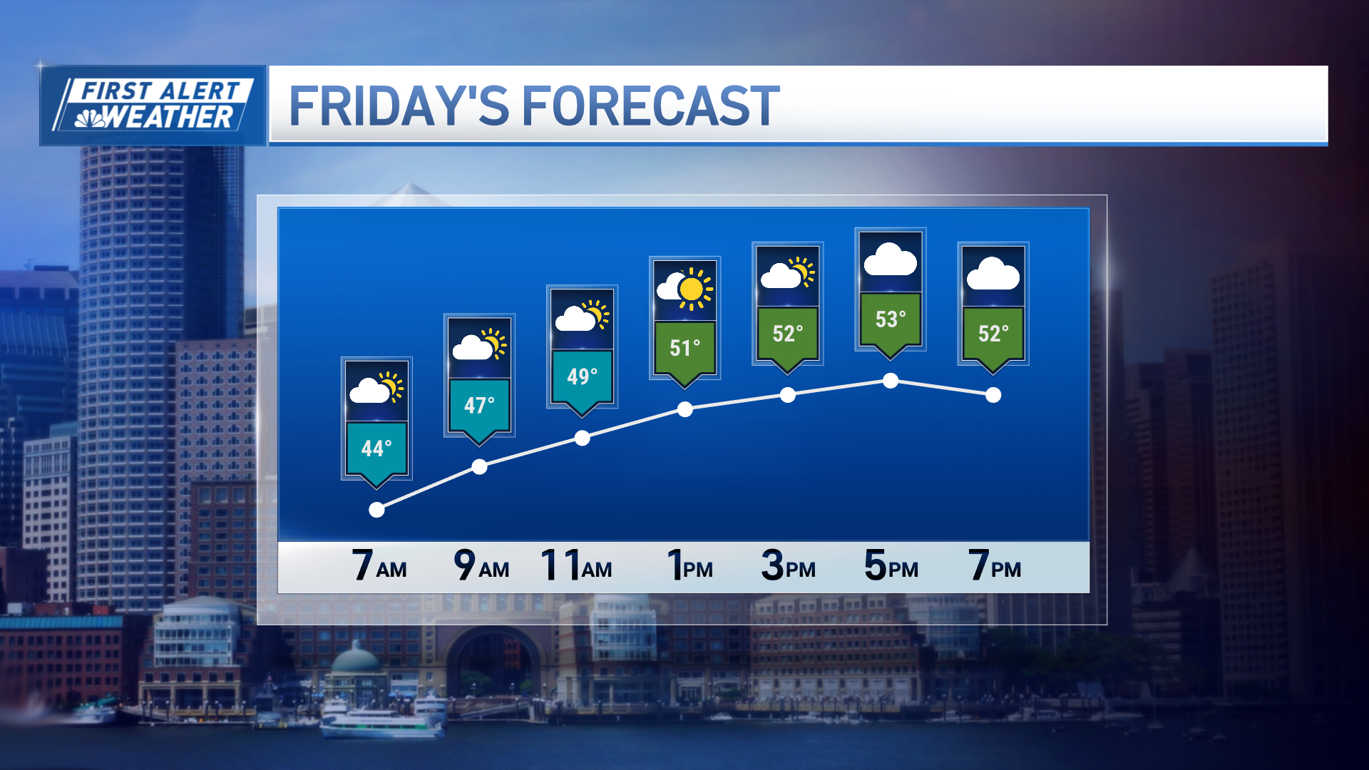
A cold front will sweep from west to east during the day Friday shutting down any rain pretty early in the day. The cold air will lag behind and not really come in until Friday night.
Temperatures holding in the 40s and 50s for much of Friday before falling back.
A massive area of cold high-pressure will stretch from Western Canada all the way down to the southeastern United States this weekend. That, combined with their departing strong storm in eastern Canada, will generate a biting cold wind for much of New England Friday night into Saturday morning.
[NATL] Extreme Weather Photos: Record Heat Threatens Europe
The temperature will fall to about 15 degrees to start our Saturday.
It should be a bright weekend, but on the cold side. Highs Saturday in the 20s south, and teens north.
Another cold one Saturday night, then a high temperature back to near freezing Sunday afternoon.
Next week offers a significant challenge. If the backside of the high-pressure system moves out, we should see a warming trend. But a series of storms coming in off the Pacific will ensure that something develops here at some point by Tuesday or Wednesday we expect another wintry mix, likely on the colder side this time.
Perhaps this will be the first significant snowfall for southeastern New England. But I would not hold my breath. Stay tuned in our first alert 10-day forecast.


