


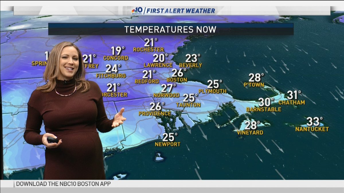
Tuesday: Sun and clouds, cold, not too windy. Highs in the 20s.
Overnight Tuesday: Mostly clear. Lows in the teens south, 0s north.
Wednesday: Sunny with some melting. Highs in the 30s.
Cold and dry air remains entrenched not only in New England but throughout the eastern two-thirds of the nation Tuesday morning as a mammoth area of high pressure – a fair weather dome – is sprawled across the eastern United States.
Given the sheer size of the fair weather cell, New England is assured several days of storm-free weather until the upcoming weekend. To be storm-free doesn’t mean absent of any change at all, however, with subtle features like periods of wispy clouds and more pronounced changes like warmer air.
The subtle features come first: energetic disturbances aloft, starved of moisture but able to carry varying amounts of high and middle altitude clouds through the area. Dry air in the lowest several thousand feet of the atmosphere prohibits these clouds from producing any snow, though one exception to the rule is just offshore of Outer Cape Cod, where a north wind over the water picks up enough ocean moisture to produce some ocean-effect flurries, driven by the temperature difference between ocean water and cold air. Nonetheless, with the wind unlikely to blow onshore, these light snowflakes will stay offshore.
Temperatures steadily moderate in the days ahead, rising into the 30s by day Wednesday and 40s by Thursday, bringing melting to most of New England by the end of the week, continuing into Friday.
The next storm, developing on the west side of our dominant dome of high pressure, trudges east from the Rockies to the Ohio Valley late this week, and moves into New England Saturday. Though it’s early for details, the timing seems similar to our most recent weekend storm – arriving later Saturday and lasting into Sunday, though this one could linger a bit longer.
Local
In-depth news coverage of the Greater Boston Area.


The noteworthy difference between the two storms will be less cold air this time around, meaning a rain/snow line is likely to be involved and ride inland from the coast Saturday and Sunday. The storm should be gone by Monday, dropping plowable snow in at least northern and western New England, with amounts to be determined in southern New England, particularly near the coast, and next week looks storm-free through at least Thursday in our exclusive First Alert 10-day forecast.

