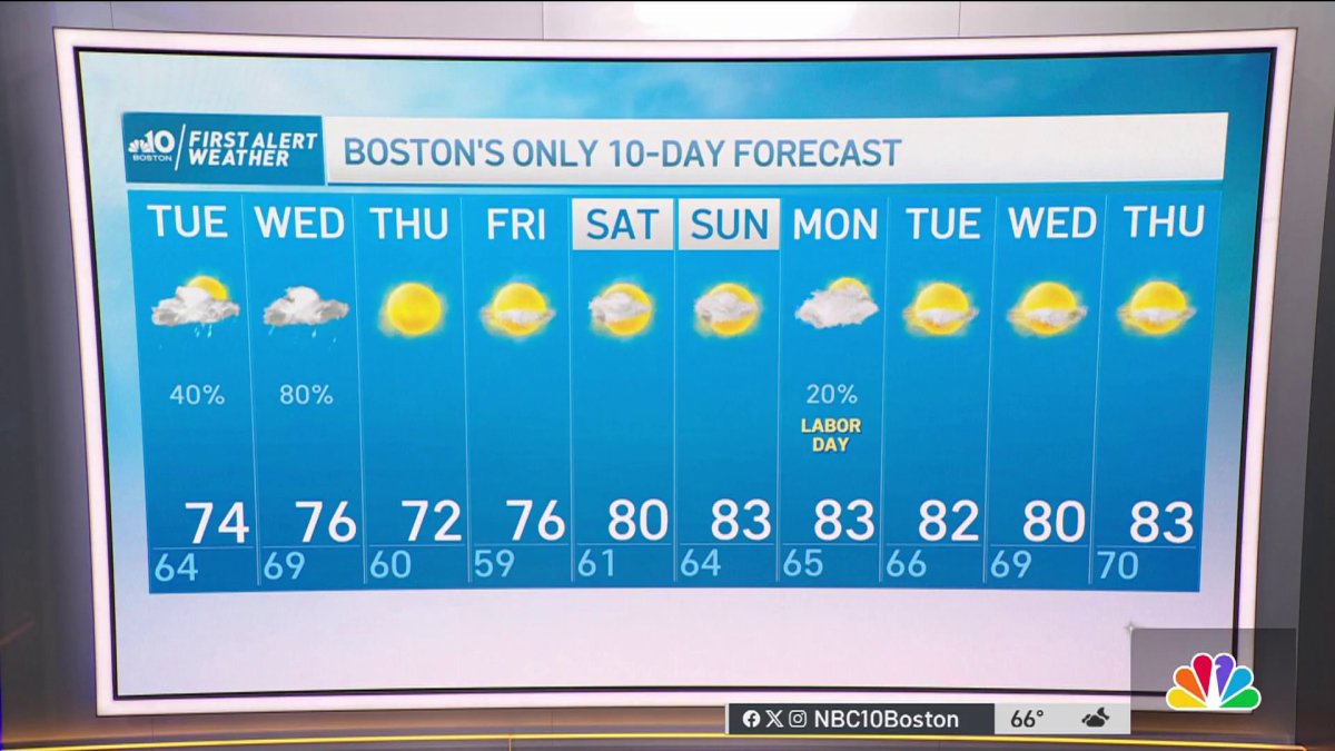
Monday night: Clouds fill in. Lows around 60. Tuesday: Cloudy with sprinkles, showers south. Highs in the 70s. Wednesday: Humid, a bit breezy, showers and thunder. Highs 75-80.
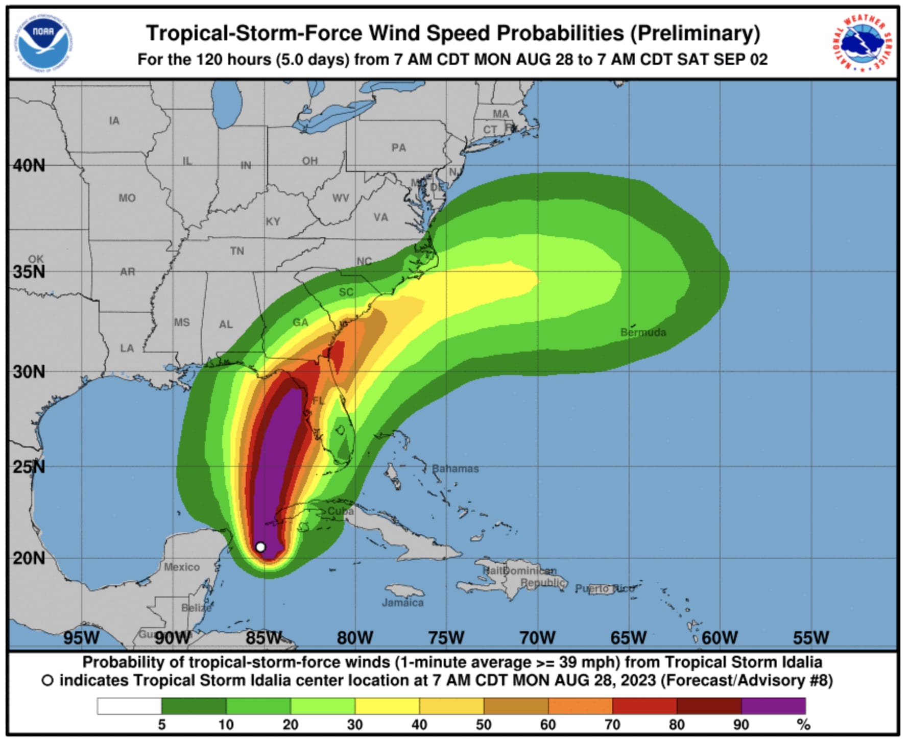
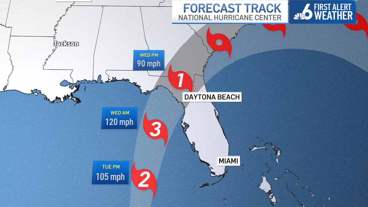
Tropical Storm Idalia continues to strengthen as it nears the western tip of Cuba as of Monday afternoon. The 2 p.m. update from the National Hurricane Center (NHC) shows the storm has 70 mph sustained winds with gusts to 75 mph putting her just shy of Category 1 Hurricane status.

Idalia will continue to move north around 8 mph through tonight, then pick up a bit of forward speed and shift slightly to the north-northeast tomorrow and Wednesday, with her eye set to make landfall along the west coast of Florida, perhaps near Cedar Key, sometime Wednesday morning as a MAJOR hurricane (Category 3 or a possible Category 4).

Get Boston local news, weather forecasts, lifestyle and entertainment stories to your inbox. Sign up for NBC Boston’s newsletters.

Floridians and those farther north along the Gulf Coast continue to make preparations as life-threatening storm surge, damaging winds, tornadoes and localized flooding will occur through midweek. Idalia will then curve northeast, paralleling the coast of Georgia and South Carolina (as a Tropical Storm again at that point) bringing flash flooding and strong wind gusts through Thursday afternoon. After that, Idalia will move east and pass likely north of Bermuda by the start of the weekend.

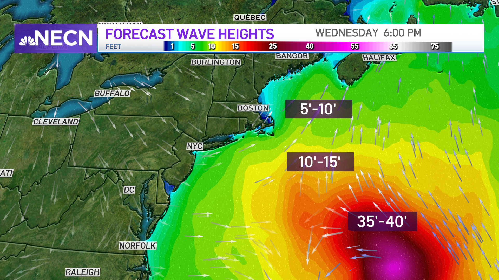
Meanwhile, Hurricane Franklin has undergone rapid intensification and is now a Category 4 storm with 145 mph sustained winds. Thankfully, Franklin is not impacting land at this time, and is expected to take a track well northwest of Bermuda making its closest pass to the island on Wednesday morning with tropical storm conditions likely.
Franklin is such a large and powerful storm that the entire East Coast will feel an effect in the form of rip currents and dangerous surf and swell. Here at home, expect building surf and seas through midweek with an increased risk of rip currents, particularly along the south coast to Cape Cod.
Be prepared for your day and week ahead. Sign up for our weather newsletter.