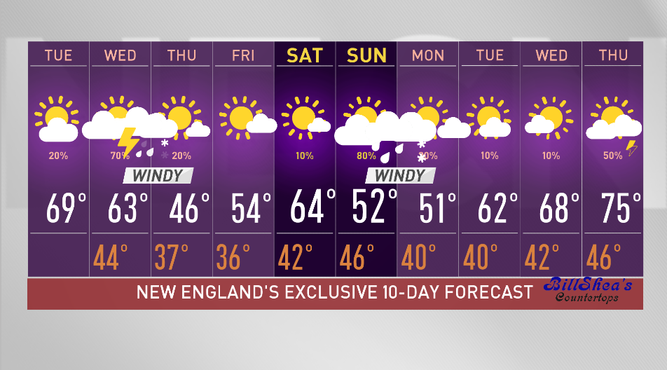
Tuesday night: Early shower. Partly cloudy. Lows in the 40s. Wednesday: Partly cloudy, breezy, scattered rain and a storm. Highs in the upper 60s.
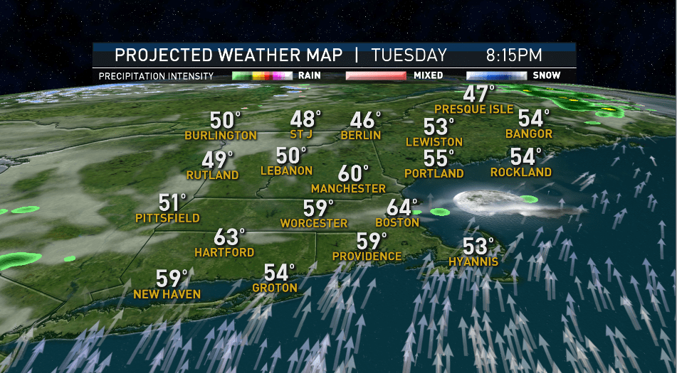
New England is divided by a weather front on Tuesday afternoon.
With partly to mostly sunny skies, we are in the 60s and low 70s in southern New England, thanks to a gusty southwest wind. At the same time, we are in the 50s north, with wind from the west and northwest and partly to mostly cloudy skies. A cold front is losing its push southward Tuesday evening and will turn around and head north as a warm front Tuesday night.

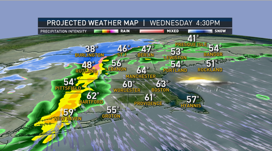
After a dry evening, clouds will build with a stripe of rain and snow developing from central New York, across northern Vermont and New Hampshire into western Maine.
Get Boston local news, weather forecasts, lifestyle and entertainment stories to your inbox. Sign up for NBC Boston’s newsletters.
That front divides us even further on Wednesday, from upper 60s south, 40s to 30s north as a cold front sits across the northeast. Northern New England and the mountains will see snow accumulation through Thursday from this system.
Several inches of accumulation is expected, with a widespread 6 to 12 inches in higher elevations. Southern New England will see highs in the 60s thanks to a gusty south wind and some early sunshine. Low pressure on the front will strengthen rapidly as it tracks across northern New England on Tuesday afternoon and night. Rain and isolated thunderstorms move through late afternoon and evening, so the day won’t be a washout across the south.
We don’t expect much rain -- about a quarter inch at best in southwestern New England with the rain amount forecast decreasing by evening in southeastern New England.

Much colder air rushes in on Thursday, with highs only in the 40s and near 50 degrees. A gusty west wind will dry us out and cool temperatures will be in the 30s and 20s in northern New England. Some daytime clouds are expected with the cool pool of air aloft. In the mountains across the North Country, snow showers will linger into Friday.
Local
In-depth news coverage of the Greater Boston Area.


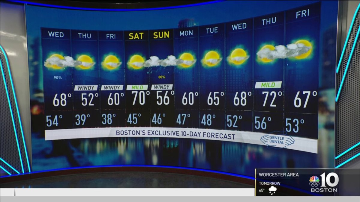
Friday’s highs rebound to around 60 degrees with sunshine. Warmer temperatures return for Saturday with sun and upper 60s. On Sunday, we are watching a coastal storm that will bring us scattered rain and wind. The storm is moving pretty fast, so by Monday we see some improvement.
Highs go from the 40s and 50s Sunday back to a warming trend next week, with another shot at some 70s and sunshine midweek as seen in our First Alert 10-Day Forecast.