


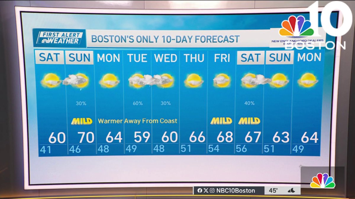
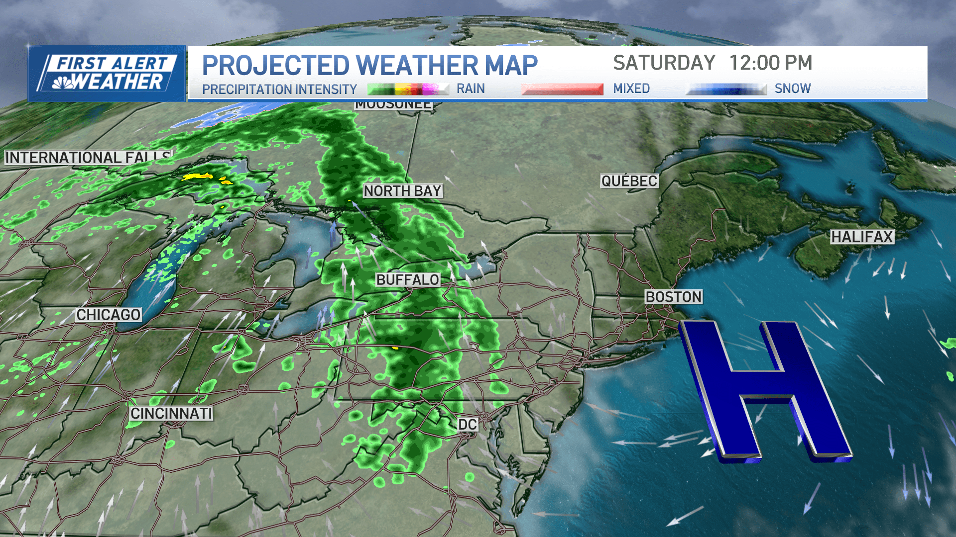
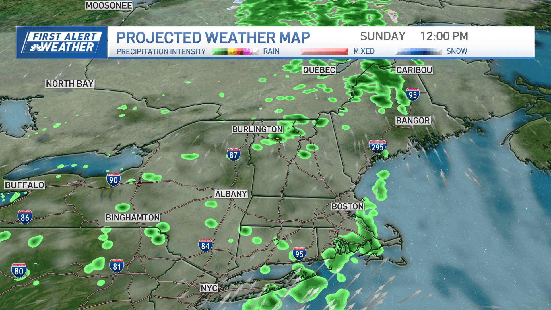
Friday night: Clear skies. Lows around 40. Saturday: Sunny. Easterly wind of 6-10mph. Highs in the low 60s. Sunday: Scattered morning rain, then sun. Highs in the upper 60s.
We had another widespread hard freeze across all of New England with freeze warnings Friday morning in southern New England and along the coast.
Temperatures dropped to the 20s in many more spots compared to Thursday morning. This afternoon will be nice and sunny again thanks to high pressure settling in.


Once the afternoon, sun warms us up a bit more, temps reach the mid to upper 50s to near 60 inland. However, the classic sea breeze keeps our temps in the low 50s for Boston and the coast.
Get Boston local news, weather forecasts, lifestyle and entertainment stories to your inbox. Sign up for NBC Boston’s newsletters.
The center of high pressure slips offshore to our east, southeast and our wind direction changes to be more from the south Friday night. Overnight, lows drop to the 30s but it won't be quite as cold, still watch for patchy frost. Temps warm to the 60s for Saturday and to near 70 for Sunday.
Sea breezes are still likely at the coast both days, so expect some cooler temps there. More clouds will be around for Sunday as a system is nearby.
The forecast models have actually decreased our rain chance for Sunday. Though a few showers will be around from morning to midday. As the jet stream amplifies more north, south and we build in warmth under a ridge.
With that, temps reach the low to mid 70s for early next week inland. Either sea breezes or a backdoor front early next week will keep us at the coast in the 60s to even 50s. Inland we stay in the low 70s through at least midweek.

