


Today: Cloudy, SW-W wind, highs in upper 30s, slight chance of a few scattered snow flurries. Tonight: Decreasing clouds,. Lows in lower 20s, nw wind, breezy. Tomorrow: Highs in mid to upper 30s, sunny am with increasing clouds PM. Snow takes place overnight into Monday morning. Monday: Snow showers much of the day, chance to turn to rain Tuesday evening in east-southeastern MA. Early am commute affected.
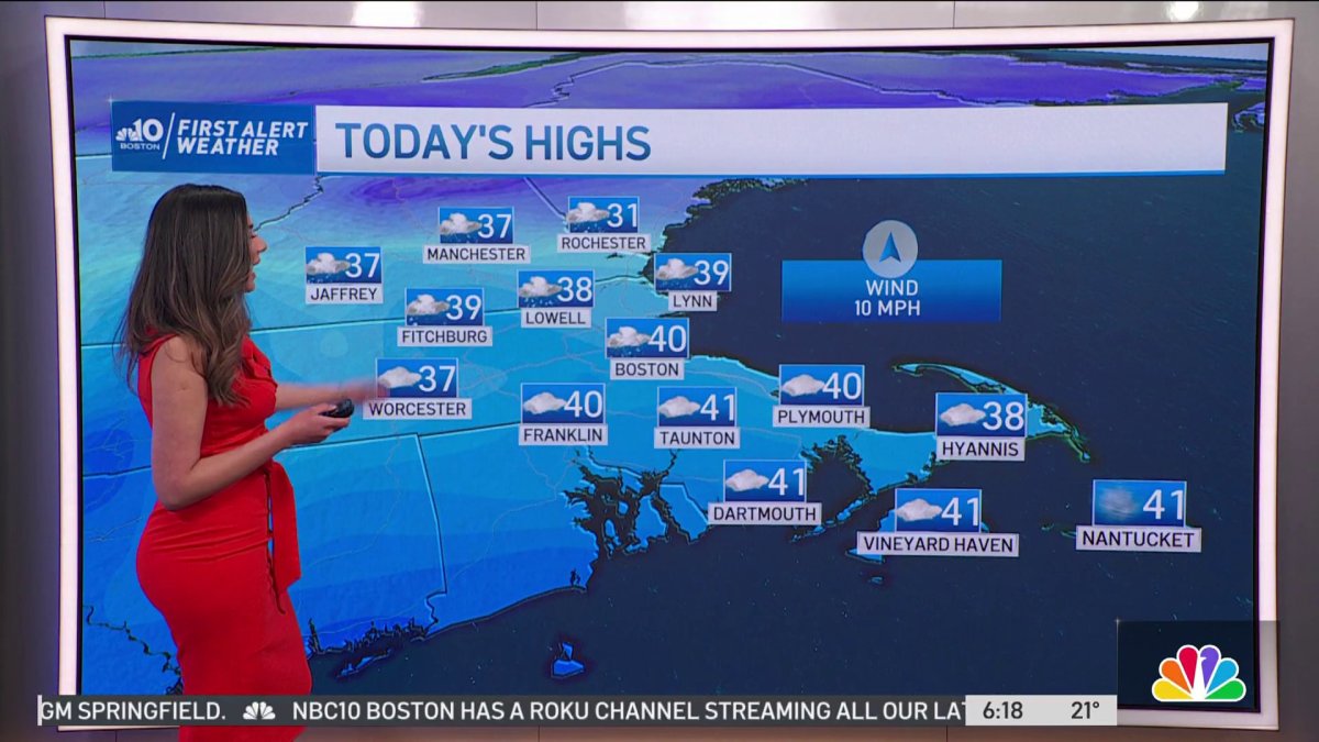
A cold start for Sunday, but with a mostly cloudy sky, and Southwest breeze we warm to the upper 30’s. A passing flurry or snow shower is possible during the afternoon.
Sunday Night, skies slowly clear, and temperatures drop to the middle and upper 20’s.
Monday is a mix of sun and clouds, and eventually skies become cloudy by evening. Highs are colder in the middle 30’s. Snow arrives late Monday or early Tuesday.
The Tuesday morning commute will be tricky, but by midday with a higher sun angle, and highs in the middle 30’s, roadways in Eastern Massachusetts should improve. Worcester County, and Northwestern Middlesex County likely see a solid accumulation of snowfall. As much as 6-8 inches possible in the Worcester Hills, and a general 4-6” of snow will fall along and West of I-495.
Get Boston local news, weather forecasts, lifestyle and entertainment stories to your inbox. Sign up for NBC Boston’s newsletters.
Closer to Boston, 2-4 of wet snow is likely, and that range tapers to 1-2” working South to the Canal on the Cape. Snow ends late Tuesday evening, and skies slowly clear. A milder Wednesday is likely, with highs in the lower 40’s. Rain in the forecast for Thursday, with highs near 50.
Be prepared for your day and week ahead. Sign up for our weather newsletter.

