


Wednesday: Mostly cloudy, AM drizzle. Highs in the 40s, 50s where splashes of sun emerge inland.
Overnight Wednesday night: Showers to rain. Lows in the 40s.
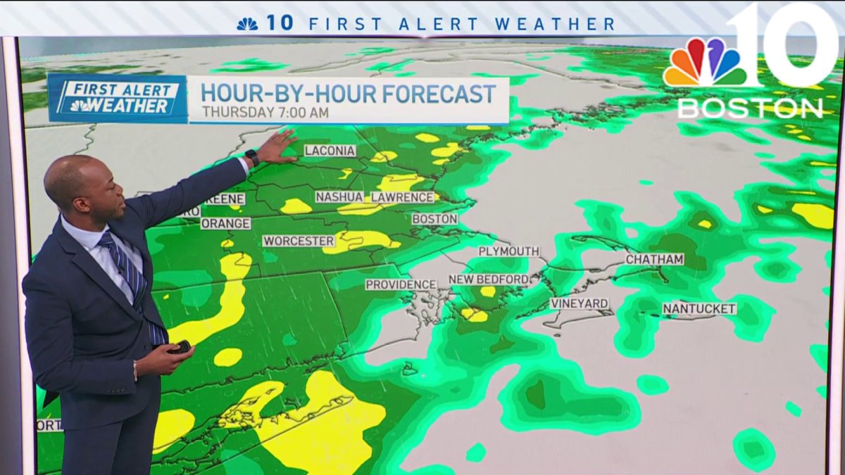
Thursday: First Alert for rain impacting both commutes. Highs in the 40s.
Friday: AM light rain departs for PM drying, cool breeze. Highs in the 40s, wind chill 30s.
Temperatures get a much-needed boost Wednesday thanks to an end of the nagging northeast wind. Sure, we're still on the cool side of things at the coast with a feeble sea breeze but away from the water, we have a chance to hit 60 (or better).
Sun is clearly the elusive element to the forecast. With the solar angle much higher these days, it should be enough to burn through the low overcast in the afternoon. Even with "bright spots in the overcast," we could make the 60s.


It's that much of a factor. Of course, time is of the essence. More clouds and showers are moving in from the west and will arrive by evening.
Get Boston local news, weather forecasts, lifestyle and entertainment stories to your inbox. Sign up for NBC Boston’s newsletters.
This is the slow-moving storm system that's been battering the Upper Plains, Midwest and Deep South over the last couple of days. It's arrival in New England is vilified in this wet pattern, but we'll trudge through, nonetheless.
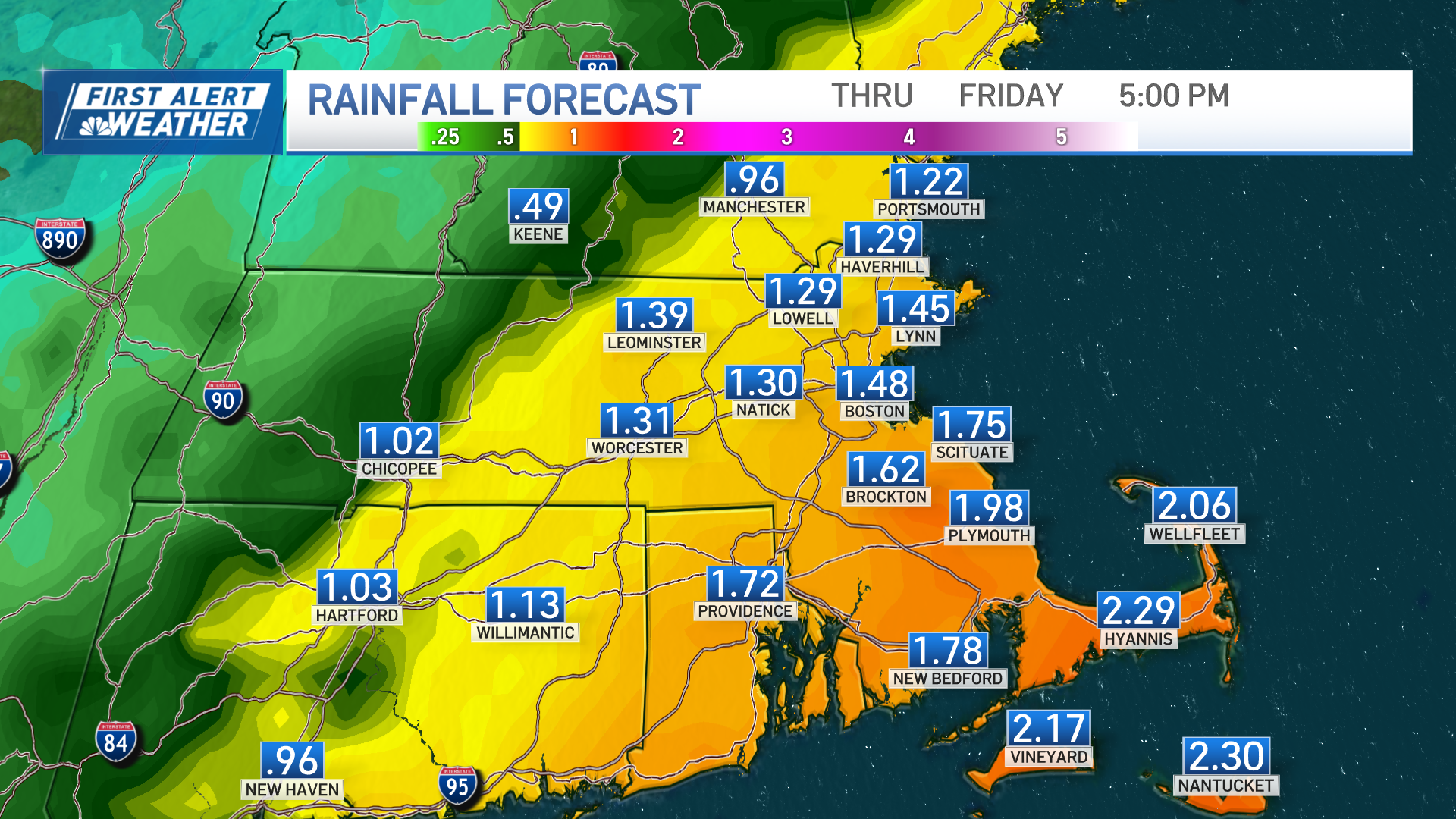
At stake is another 1 to 2 inches of rain for eastern Massachusetts, with a focus on the Cape/Islands for the 2+ amounts. (Ugh.) Steady rain will break out later Wednesday night and carry through all of Thursday as the system slows overhead. We'll finally see it inch away on Friday, with clearing moving into Worcester in the afternoon, then Boston late day.
This sets us up for a dry weekend, but winds on Saturday will make it feel chilly. Sunday sees a few more clouds than Saturday, but we're not looking a gift horse in the mouth.
Weather

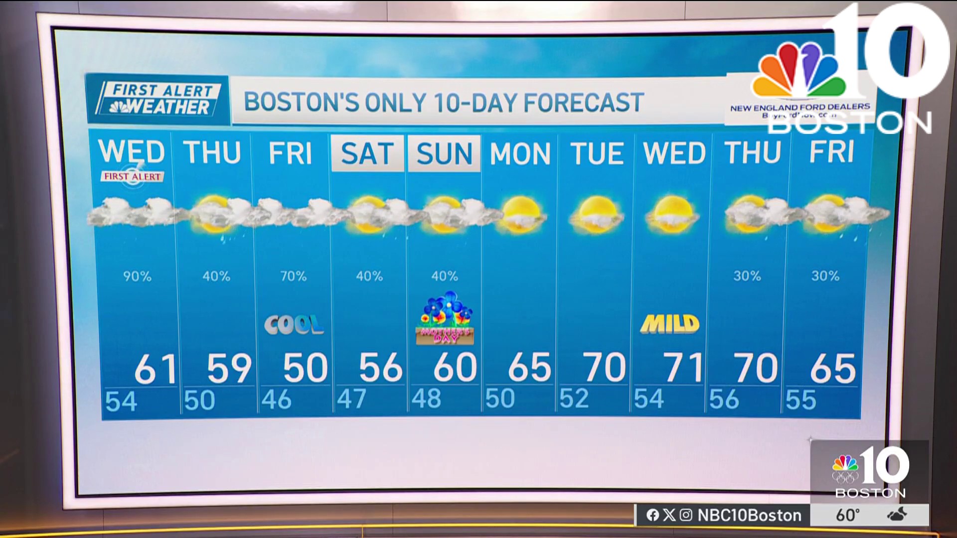
Both days in the 50s, with a small chance we hit 60 in spots Easter Sunday. (Yay!)

