


Overnight tonight: Mostly cloudy, showers late. Lows around 40.
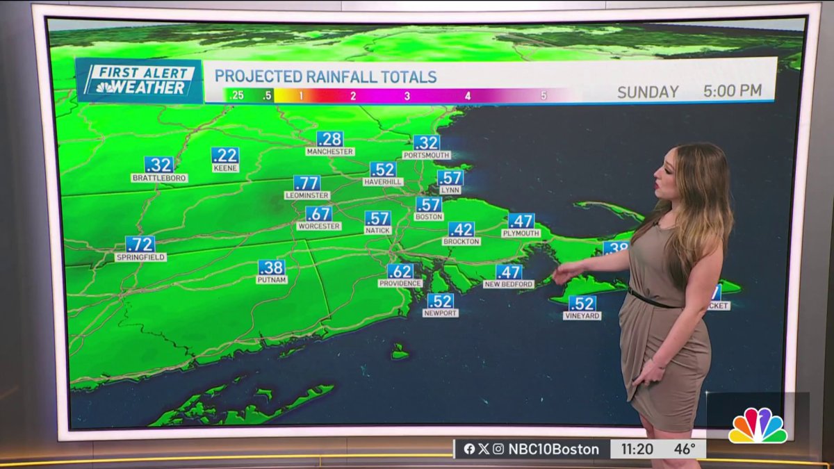
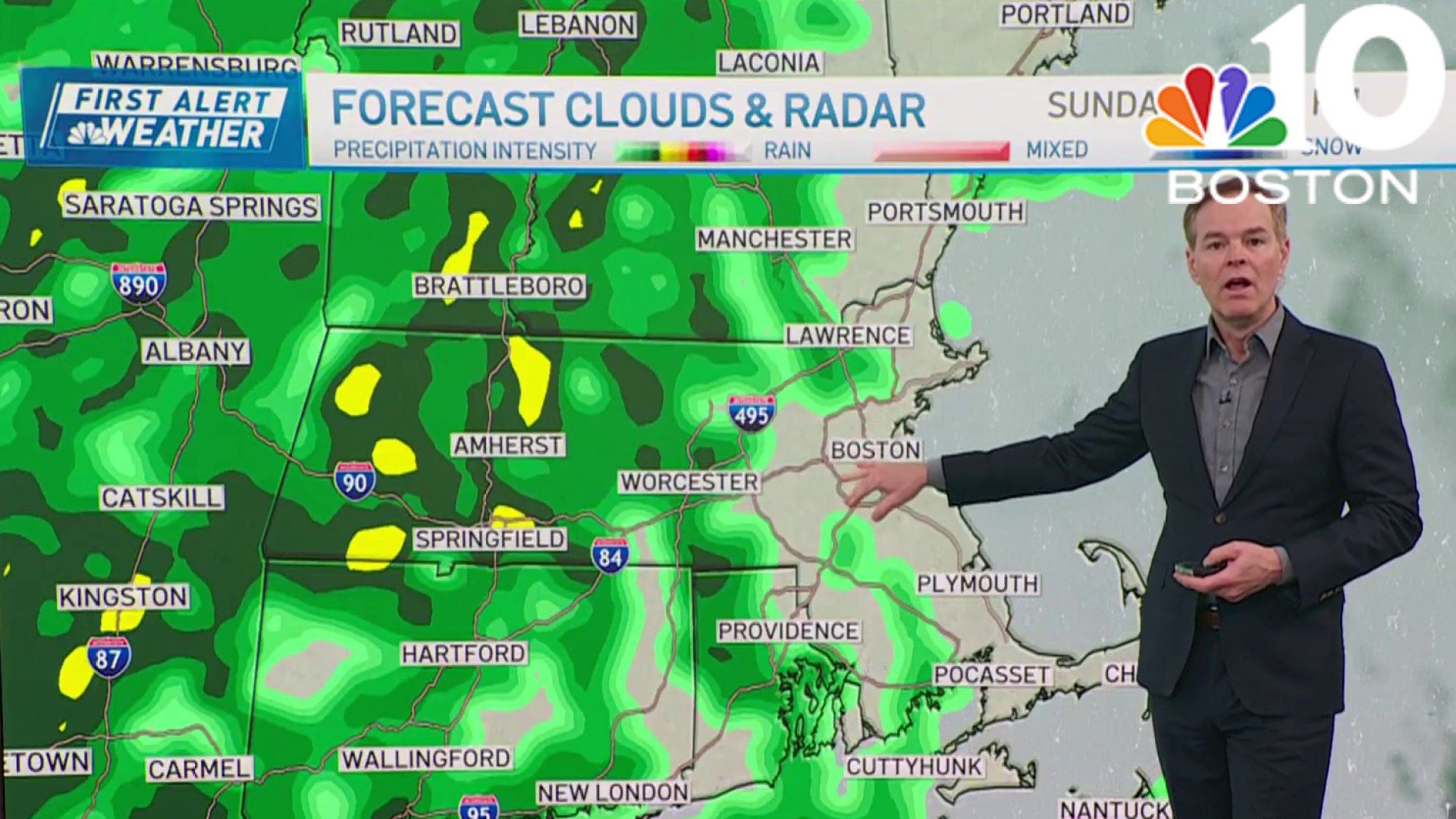
Sunday: Afternoon rain south, snow north. Highs in the 40s.
Sunday Night: Rain tapers off, some fog. Lows around 40.
We’ll remain in a southerly wind flow on Saturday which will allow our temperatures to stay on the mild side, especially across southern New England.
Clouds will stick around most of the afternoon with a few breaks of sunshine from time to time which will help temps nudge up a bit, but not too much since we’re dealing with a low sun angle this time of year.
Northern New England will stay in the clouds and remain on the cool side with a few showers around through the mid-afternoon, snow across the higher elevations and northernmost Maine. Highs reach the 50s south, 40s north, 30s northern Maine.


Get Boston local news, weather forecasts, lifestyle and entertainment stories to your inbox. Sign up for NBC Boston’s newsletters.
Low pressure will move off the mid-Atlantic coastline overnight tonight with clouds increasing and thickening as it tracks northward. Much of the night looks dry, but rain showers will be knocking on the door along the south coast by daybreak, watch for some areas of patchy fog developing, perhaps some black ice northern areas. Lows in the 40s south, 30s north.
Rain develops from south to north during the morning as low pressure develops south of New England. Winds will increase out of the northeast making for a raw feel to the day with highs reaching the mid to upper 40s south.
Cold enough air will be in place to support snow, especially over the higher terrain of northern New England during the day Sunday and as low pressure moves off the eastern New England coastline late in the day and Sunday night. We’ll have to watch the rain/snow line as it collapses closer to the Maine coastline and south during that time period, but should remain north of the MA/NH border.

Also time is of the essence south as precipitation shuts down early Monday. Right now it looks like central and northern New England has the best chance for accumulating snow, with a bit possible across the higher terrain of western Mass, which is featured on our in-house snow forecast model.
Weather

Conditions improve across southern New England Monday with a few stray rain showers possible as the system pulls into Nova Scotia, snow will continue across the north during the morning and taper off by late in the day. Highs in the 40s south, 30s north.
High pressure builds into the region Tuesday and Wednesday providing us with drier and cooler temperatures. The next shot of precipitation arrives late in the work week as a ‘Clipper’ types system dives through New England with some rain south, snow north which is featured on our exclusive 10-Day Forecast.


