


Overnight: cloudy skies, a few showers possible South and East. Lows in the middle and upper 30s. Monday: early shower, then mostly cloudy and cooler. Highs in the lower 40s.
Monday Night: Mostly cloudy, possible snow showers North. Lows In the lower 30s.
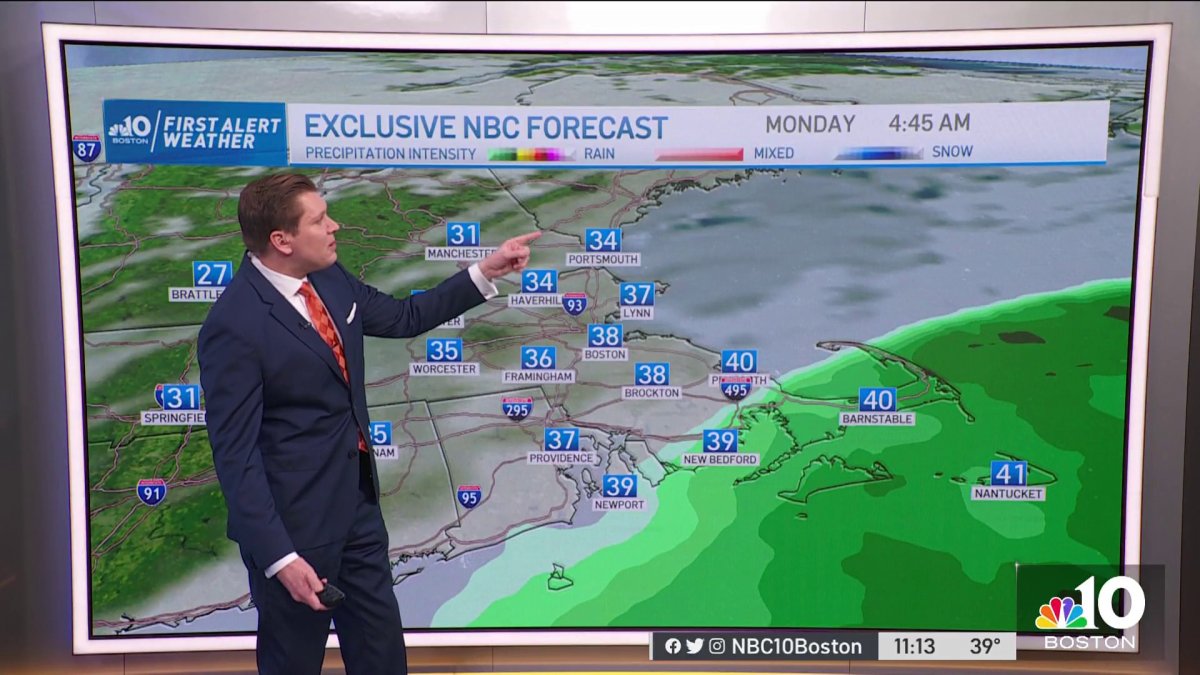
The mild air is back with highs climbing into the 50s and welcoming clouds Sunday afternoon. The coastal low approaching the south coast will bring showers overnight into Monday towards Buzzards Bay and Cape Cod and the Islands as well as southeastern Massachusetts.
Normal highs should sit in the 20s and 30s across the region by this time of the year, but our 66 degrees this past Friday in Plymouth, Mass., sure showed how crazy February can be.
Winter isn’t done yet in New England, we’ve seen it snow plenty by the end of the season before. And while the 30s seem to only be dropping by for a day next Saturday, the end of February is trending for another 24-hour cold snap.
Other than that, a quick cold front will push through New England late Monday night, which may produce snow showers from Vermont to New Hampshire and Maine. This is the window of opportunity for northern and northeastern Massachusetts to also see some snow showers early before drier air takes over with a high pressure system stalling over by midday and into the early afternoon Tuesday.
Get Boston local news, weather forecasts, lifestyle and entertainment stories to your inbox. Sign up for NBC Boston’s newsletters.
The second half of the week will see another round of possibly record setting highs reaching the 60s, a widespread low will also bring wet weather across New England. Next Saturday features highs dipping to the 30s and quickly rebounding to the 40s by Sunday.

