


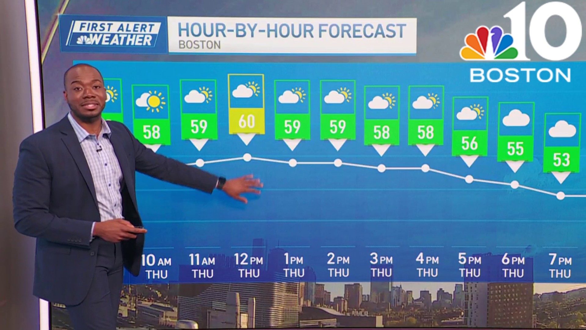
Today: Morning sunshine, increasing PM clouds. Highs in the 60s, cooler coast. Overnight Tonight: Mostly cloudy with a few showers. Lows in the 40s. Sunday: Slight risk for a shower early, clouds with sunny breaks. Highs upper 60s, cooler coast.
Low pressure over the Great Lakes will track into southern Canada, ahead of it, we’ll see increasing high, thin clouds as a warm front approaches New England from the west.
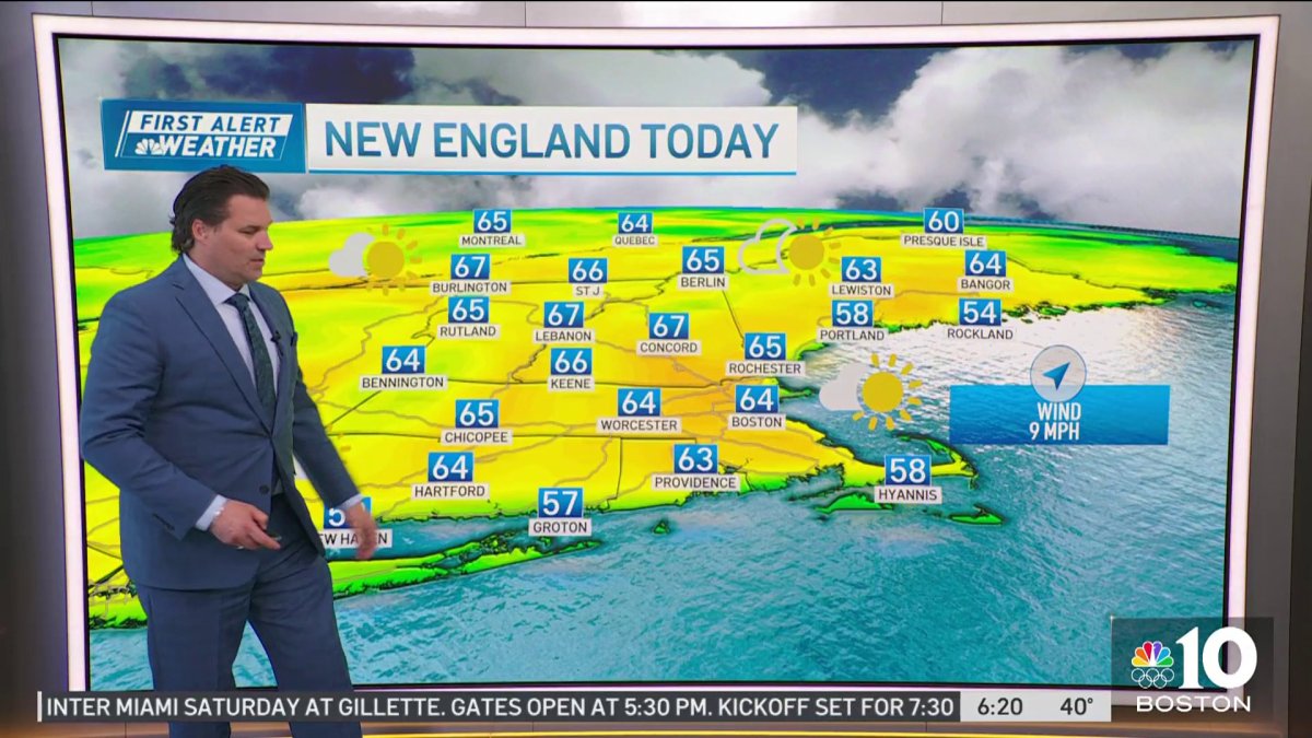
A decent afternoon is setting up, as a matter of fact, the entire weekend is looking pretty good except for overnight tonight into early Sunday morning, that’s when we’re expecting a round of rain showers for portions of the area.
The rest of this afternoon we’ll deal with some high, thin clouds dimming out the sun with highs mostly in the 60s, afternoon sea breezes will bring coastal communities back into the 50s.

Get Boston local news, weather forecasts, lifestyle and entertainment stories to your inbox. Sign up for NBC Boston’s newsletters.
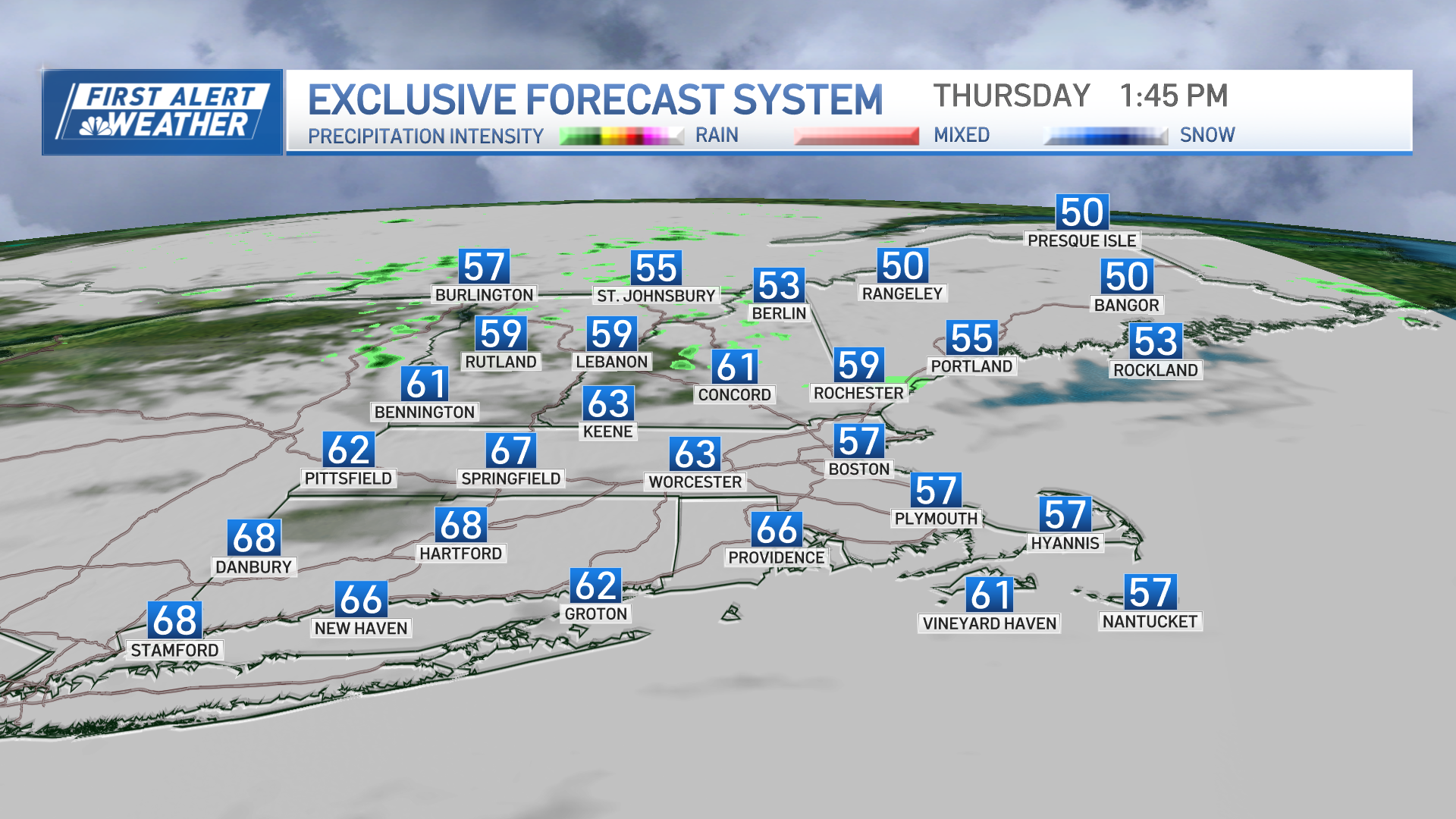
Overnight tonight, clouds will thicken as a warm front pushes through the region. Showers will be more widespread across western and southwestern New England late tonight into the early daylight hours of Sunday morning, a few rumbles of thunder possible.
Keeping the threat for showers across the Boston metro area as well overnight, but latest model trends keep the bulk of the action to the west. Lows in the 40s.
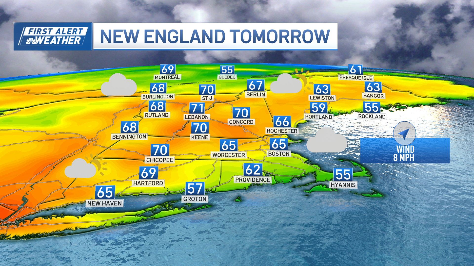
A few lingering showers Sunday morning, especially across Connecticut, but overall, the trend will be drier through the course of the morning into the afternoon. We’ll be stuck with more clouds than sun Sunday with an isolated shower/sprinkle, but most will remain dry with temperatures soaring well into the 60s with a few 70s across the interior.
Weather
There will be a bit of a battle with the land and sea breeze tomorrow afternoon, temps may drop off a bit along the coast if the southwest wind relaxes, cooler across the Cape where highs will be mostly in the 50s with wind off the water.
Another round of showers moves through quickly Sunday night and exits by Monday morning. Looking dry to start the work week Monday with highs well into the 60s and low 70s, however, a back door cold front may play spoiler during the afternoon cooling off the coastal plain…still some tweaking to do with the timing of that…stay tuned!
Have a great Saturday!

