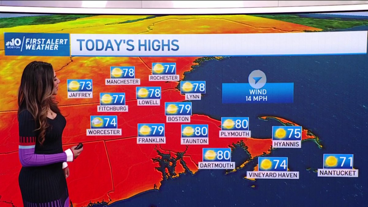
Today: Sunny, highs in the low 80s, west wind, gusting near 20 mph. Tonight: Partly cloudy, lows near 60, light west wind. Tomorrow: Partly sunny, highs near 80, wind shifts from the east PM.
TGIF! And what an incredible day of weather we have in store for us. Behind yesterdays’ front, a refreshing new airmass has moved in. You’ll notice the difference right away when you step outside – dewpoints have dropped considerably and it’s much less humid.
Dry air warms quickly though, so it won’t be long before we’re rising into the 70s to near 80 for high temperatures. Aside from a North Country sprinkle, we’ll be dry and mostly sunny – so enjoy!
Tonight some clouds will move into the region, and will be with us off and on for our Saturday. At times, there will be sun…and at other times, we may be mainly cloudy. I can’t rule out an isolated shower but it would be just that. Most of us will stay dry.

Get Boston local news, weather forecasts, lifestyle and entertainment stories to your inbox. Sign up for NBC Boston’s newsletters.
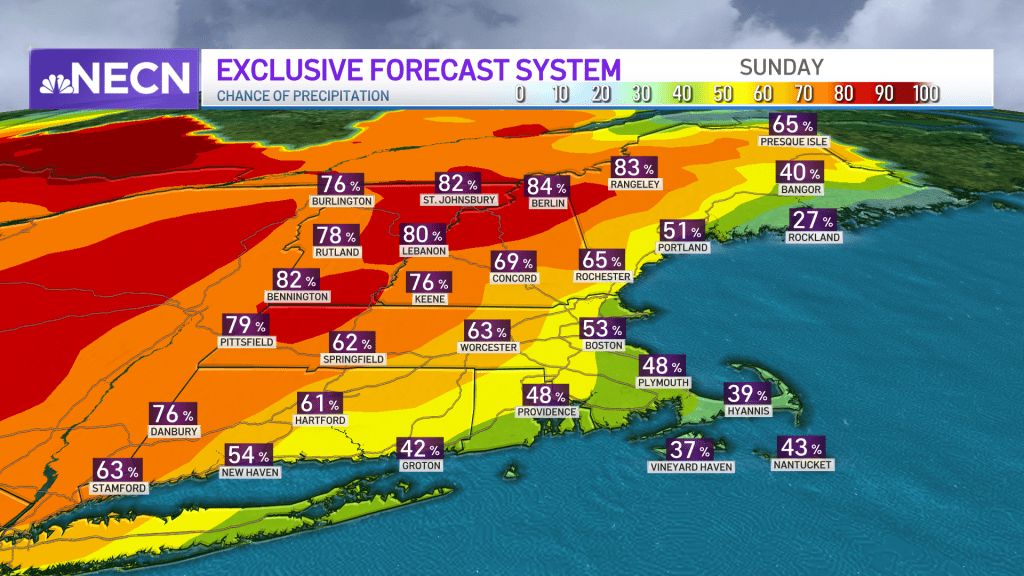
Sunday, our chance for rain increases again, particularly in western, central and northern New England, where scattered action is anticipated. So while it won’t be a washout by any means, we’ll be dodging some raindrops from time to time. The rest of us will be mostly cloudy and highs will be in the 70s.
An approaching disturbance Sunday night into Monday will cross the region, bringing with it showers and the risk of embedded thunder. Otherwise, next week looks fairly quiet with a few showers possible again as we head towards the end of the week and highs generally in the 70s.
Right now, next weekend (Father’s Day) looks pretty good with highs 75 to 80 and a risk of some passing showers, mainly on Saturday. We’ll keep you posted on that in the days ahead!