


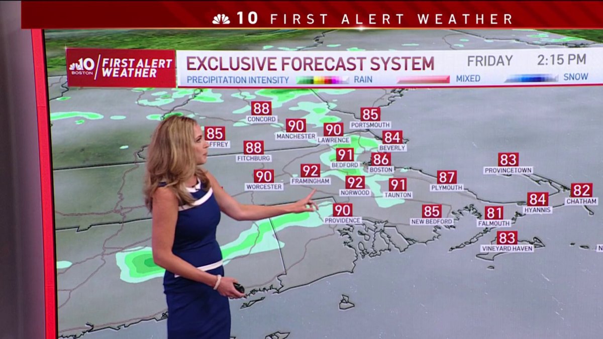
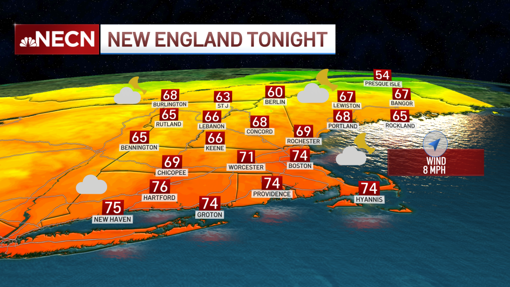
Today: Hot & humid with clouds and sun, a few PM storms. Highs in the 90s, heat index near 100 degrees. Overnight Friday Night: Any storms dwindle, muggy, patchy fog. Lows around 70. Saturday and Sunday: Hazy, hot, humid with sun and clouds to a few PM/evening storms. Highs in the 90s, heat index around 100 degrees/
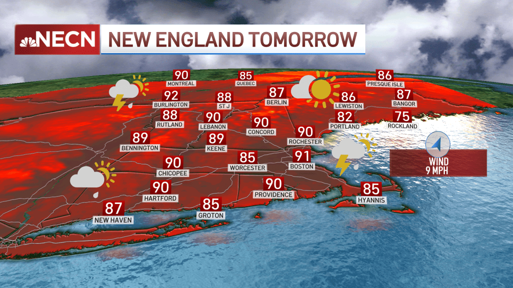
Heat and humidity along with afternoon showers and storms continue to be the main weather regime. This hot stretch will remain through the weekend with higher humidity than Thursday, as well as a higher potential for scattered showers and thunderstorms.
Our chance for showers and storms will also pop up Saturday with localized heavy rainfall possible at times. While this brings a much needed drink to our lawns, it also provides the potential for some wind damage as localized gusts may near 60 mph with the strongest storms.
We had some damage Thursday, and Friday is another set up for impactful weather. Lightning, downpours and strong localized wind gusts continue to be the main threats. Hail may also come along the strongest thunderstorm activity. Plan ahead and make sure to have shelter nearby if you’re setting up to be outdoors this evening. Our showers and storms will likely continue moving through tonight.

Get Boston local news, weather forecasts, lifestyle and entertainment stories to your inbox. Sign up for NBC Boston’s newsletters.
Temperatures don’t change much this weekend, we’ll continue with highs in upper 80s to 90s Saturday, increasing to mid-90s Sunday. Dew points don’t drop until our next cold front pushes through on Monday, enhancing a new risk of showers and thunderstorms with it.
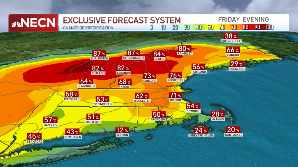
A wetter pattern now takes over New England and we see the chance for showers and storms during the next six days! Heat and humidity interact with a new cold front arriving late Monday that will produce showers into Tuesday through Thursday.
This will allow for our temperatures to drop from Tuesday on, and we’ll finally see our lower 80s as high temperatures again taking place for several days. Our expectation is to see more seasonable highs lasting through the beginning of next weekend.

