


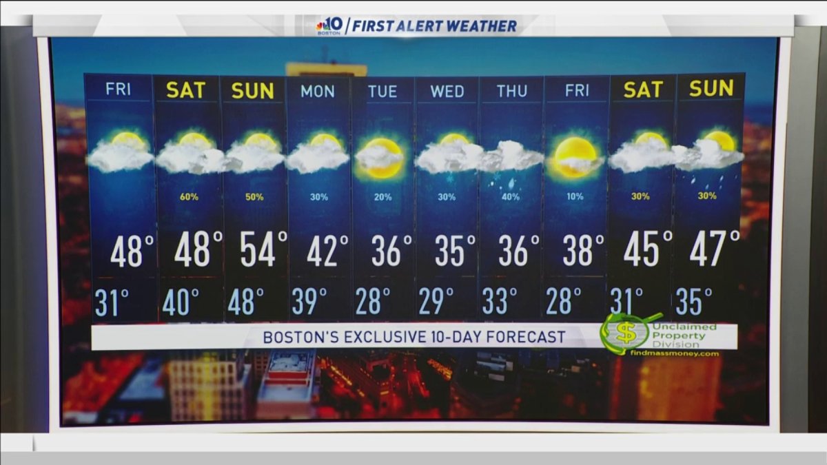
Thursday night: Mostly clear. Lows in the 20s. Friday: Mostly cloudy. Highs in the 40s.
For some of us, today was the most sunshine we have seen all week. But the clouds came back with a weak cold front passing by north to south. Now we have drier and colder air coming back in overnight.
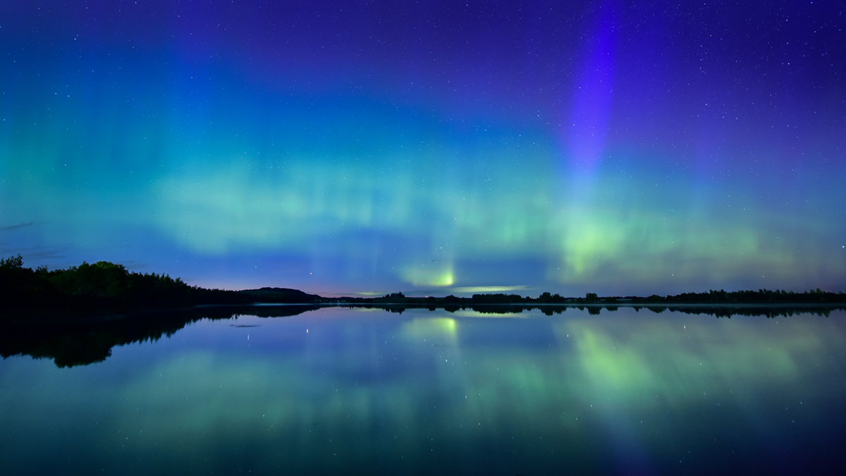
Our clearing evening sky comes just in time for the second surge in the ongoing geomagnetic storm in the highest levels of the atmosphere, where radiation emitted from the sun in a solar flare is exciting particles in the outer reaches of Earth's atmosphere, causing the illumination we call Aurora Borealis or Northern Lights.
The next surge in radiation comes between 7 p.m. and 2 a.m. Thursday evening, coincident both with a clearing sky and the start of Hanukkah's Festival of Lights, this will be New England's best opportunity to view the Northern Lights low on the northern horizon from dark locations in most of New England, and perhaps even somewhat overhead in the North Country.
More on the Northern Lights


After 2 a.m., not only would the opportunity for Northern Lights start to fade, but clouds will start moving in and get ready to take over for most of Friday in New England with highs in the 40s and an increasing southerly wind that filters warmer air.
On the very front edge of this warmer and slightly more moist air, patchy black ice is possible on and near Cape Cod and the South Coast Friday morning, but is unlikely to be widespread in New England.
This weekend a storm pulling northeast across the Great Lakes into southern Canada will not only continue the flow of warmer and more moist air into New England, but also will deliver a round of precipitation starting as rain showers Saturday afternoon into night in southern New England and starting as a wintry mix of snow and ice in the northern mountains Saturday night before changing to rain showers Sunday morning just before ending.
In fact, it looks like most of New England will see at least a tapering of showers Sunday morning and in southern New England some breaks of sun aren't impossible Sunday afternoon with temperatures rising into the 50s it's possible Sunday afternoon turns out decent for some of the area.
There are a couple of storm chances next week in our exclusive First Alert 10-day forecast, both of which need to be watched carefully with temperatures marginal enough either rain or accumulating snow would be possible. The best chance is being highlighted by our exclusive in-house Forecast System with a 60% chance of occurrence – rather high so far out – next Wednesday into Thursday and would have a better chance of being all or mostly snow. Stay Tuned!

