


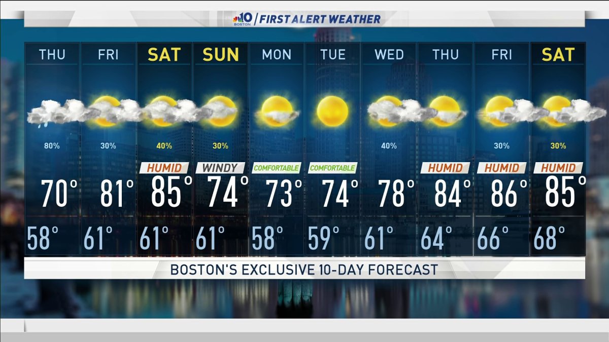
Wednesday night: Mostly clear and cool. Lows in the 40s and 50s. Thursday: A chance of morning showers, afternoon rain and thunder likely. Highs in the 70s, 60s north.
New Englanders welcomed a gorgeous fall-like day today. Highs were 10-20 degrees cooler than yesterday and the cool northwest breeze helped give our air conditioners a break.
Tomorrow brings another round of severe thunderstorms for southwestern New England as a warm front moves in and nudges its way into the northeast.
Depending on the position of that front, we could see severe weather or no rain at all and cool temperatures.
Maine, northern Vermont and New Hampshire will be the lucky ones with no severe weather threat and highs in the 60s. Everywhere else, we need to be on guard for any type of shift in the frontal boundary.
If it creeps a bit farther northeast, Manchester, Boston and Rutland could see isolated severe storms in the afternoon.
We are confident that between 2 and 10 p.m., Connecticut, Rhode Island, and western and central Massachusetts will see severe storms. Some of those storms could rotate so damaging wind is the highest concern as well as tornadoes. Heavy rain and lightning will accompany any storm that develops. Stay tuned!
Friday will be partly cloudy and around 80 degrees as we prepare for some heavy rain potential from a low-pressure system and the remnants of now Hurricane Laura. The exception will be southern New England that could still see clouds and a few showers.
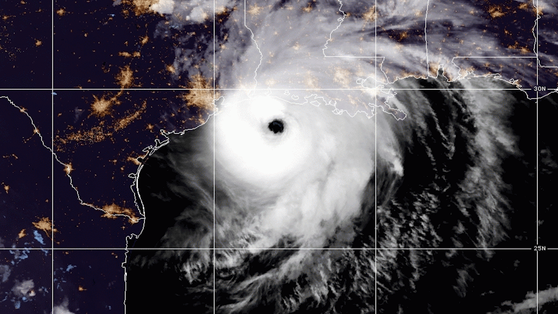
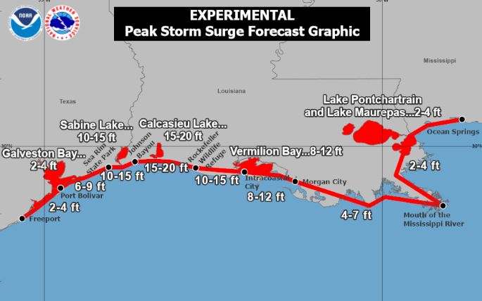
More on Hurricane Laura


Saturday morning will be showery with some heavy rain in northern New England. By evening, the remnant low of Laura passes south and the rain gets scooped up by the low-pressure system over us. Heavy rain will be possible Saturday night into Sunday, right now 1-2 inches looks likely.
Sunday's highs will be in the 70s to 80s, and will be dry by afternoon as long as the system moves out. Then a brief dry stretch settles in early next week.
Parts of Texas and Louisiana are bracing for the major Hurricane Laura to make landfall tonight somewhere near the state line. This storm will bring catastrophic winds and damage across those areas. Storm surge of 10-20 feet in some places, 10-15 inches of rainfall, and a tornado threat across Louisiana are expected as the storm heads inland.
Stay tuned for updates on the storm track from our First Alert weather team.

