


There is a high wind watch in effect for eastern New England Monday.
A powerful storm is going to bring torrential downpours, thunderstorms and damaging wind to much of the region by sunset on Monday.
For now, though, we enjoy a Sunday beauty. After a frosty start temperatures rebounded to close to 50 degrees this afternoon with wind coming in from the southwest of 10 to 15 mph.
The full moon occurs before sunrise tomorrow morning, we will have a nice view of the moon this evening, then a ring may form around the moon as high altitude ice crystal clouds create the halo phenomenon. The old saying goes “ring around the sun or moon, snow or rain soon.”
In this case, it’s going to be rain, developing in southern New England by lunchtime Monday and advancing quickly to the Canadian border by dinner time. Low pressure is going to track from north to southwest of the Hudson River valley, circulation around low pressure is counterclockwise that gives us a powerful wind from the south pushing the temperature up to 60 degrees tomorrow night.
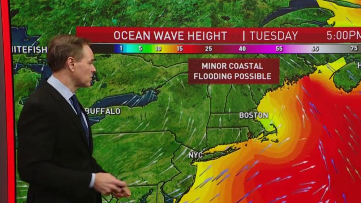
There’s potential for wind gusts in excess of 60 mph, especially in the higher elevations and in eastern New England.
Rainfall will become intense before the sun goes down Monday afternoon with thunderstorms likely by evening- even without thunderstorms we can have damaging wind, but any thunderstorm may also generate additional wind - perhaps in excess of 65 mph.
Local
In-depth news coverage of the Greater Boston Area.


The action calms down dramatically after midnight Monday night, with the exception of eastern Maine. In Maine, we will still have heavy rain and wind ongoing at sunrise Tuesday. Otherwise, the day looks much better with a mixture of sun and clouds and temperatures close to 60 degrees in the morning, cooling through the 50s into the 40s by sunset.
Slightly colder air will come into the mountains Tuesday night with a chance of a few snow showers otherwise mostly clearing and colder by Wednesday morning low temperature back to the 20s and 30s for the second day of December.
Thursday and Friday look mostly quiet, maybe a few higher elevation snow showers, temperatures mostly in the 40s. There is the potential for another powerful wind and rain storm here next weekend, perhaps mixed with some snow, stay tuned to our first alert 10-day forecast for the latest developments.

