


Friday night: Thickening clouds, cool, a shower late. Lows in the 30s, 20s north. Saturday: Showers, freezing rain in northern New England through early afternoon. Highs in the 60s late. Saturday night: Showers, downpours through midnight, very windy with gusts 40-50 mph from the south, becoming northwest. Lows in the low 40s. Sunday: Breezy and cool with sunshine. Highs in the 40s.
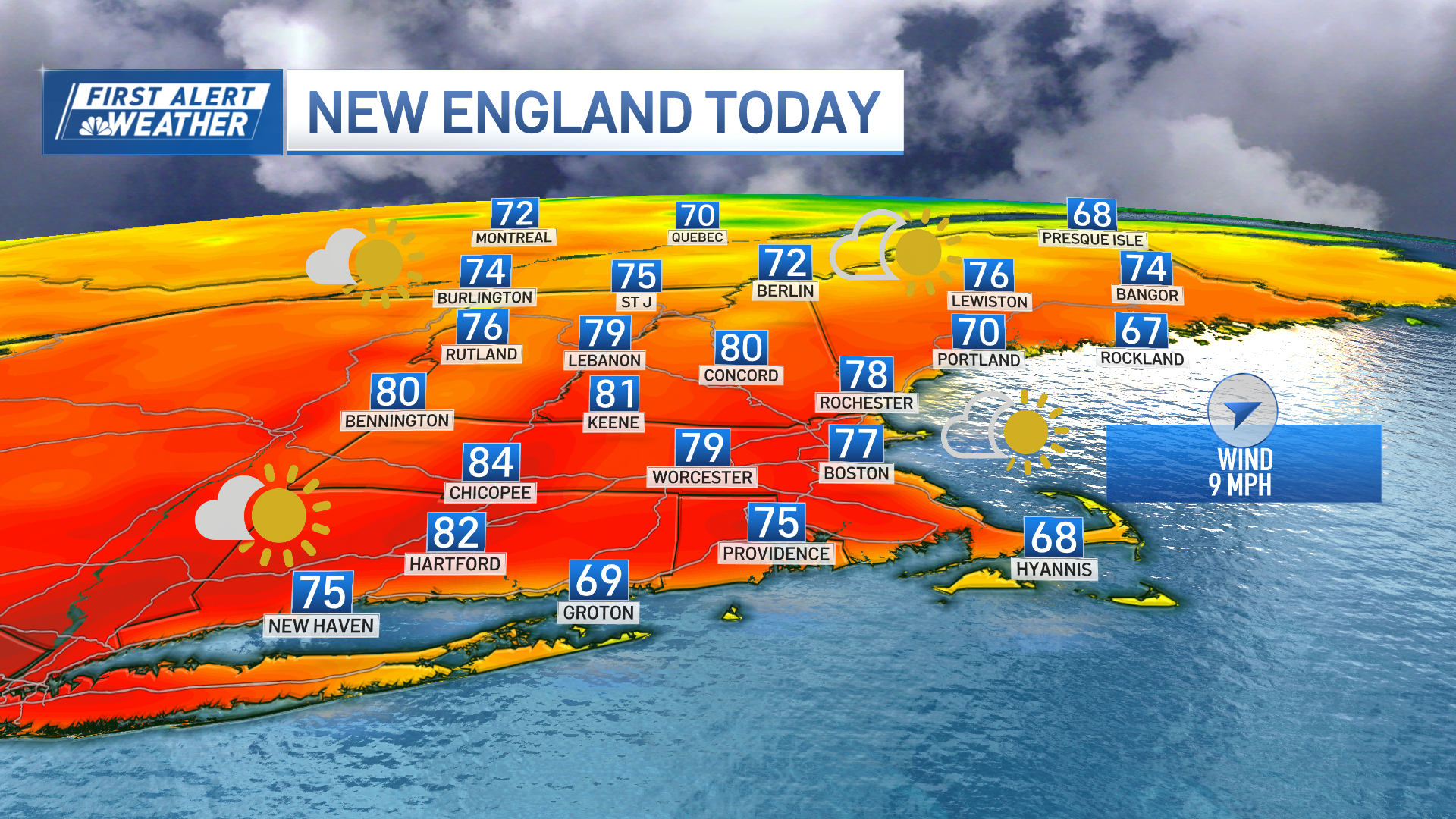
We saw milder temperatures across portions of New England Friday as a warm front slowly pushed north. Meanwhile, to our west, a strong system is getting ready to make a pass to our north, which means we’ll be on the warm side of the storm!
The tricky part of the forecast is the timing of how fast the milder air moves through New England Saturday morning into Saturday afternoon.
This may be a slow process, especially across central and northern New England, where cold air will hang on a bit longer. Add the precipitation shield moving through the area during this time and we could see some icy conditions developing early Saturday morning into Saturday afternoon, especially across portions of east central New Hampshire into central Maine -- something our First Alert Team will be monitoring closely!
Get Boston local news, weather forecasts, lifestyle and entertainment stories to your inbox. Sign up for NBC Boston’s newsletters.
Take it slow if you have to travel through those areas. You may want to wait it out until later in the day Saturday.
We’ll see mostly rain showers south, but could start out with a very brief period of freezing rain in northern Massachusetts into southern New Hampshire early Saturday morning, but that should be very short lived. During the day, milder air will surge northward through the six-state region, bringing an end to any frozen precipitation.

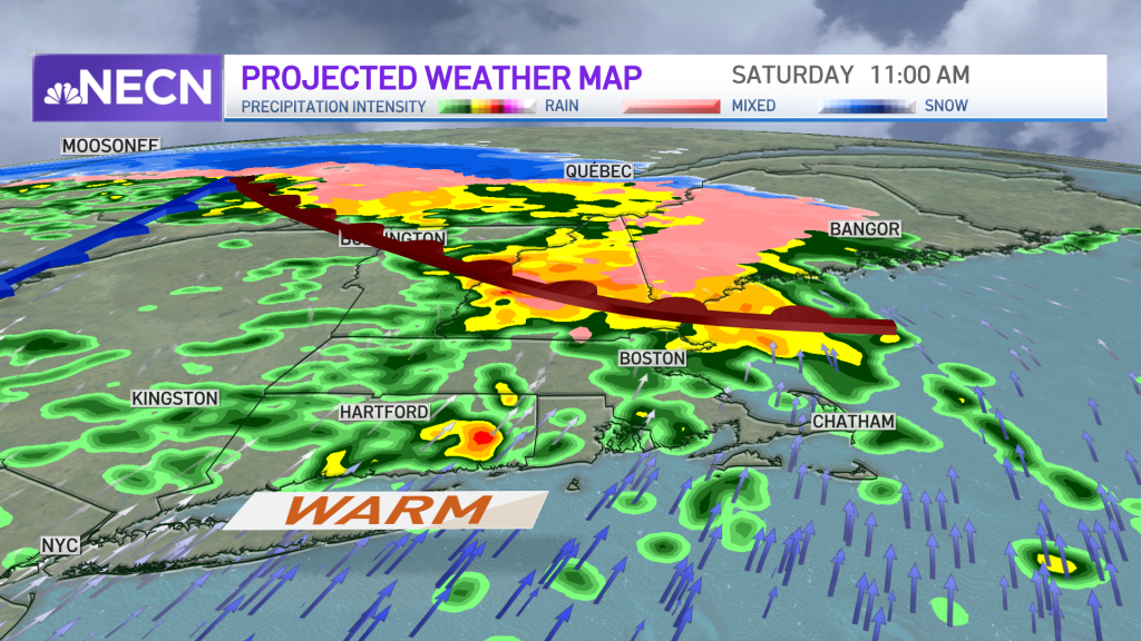
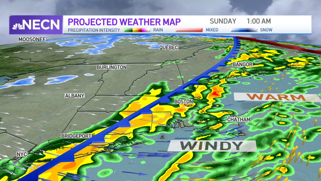
The trade-off will be a developing southerly wind which will crank up ahead of an approaching cold front during the evening hours into the first half of the night, especially across southeastern New England. Wind gusts could exceed 50 mph, with isolated power outages possible during the first half of Saturday night.
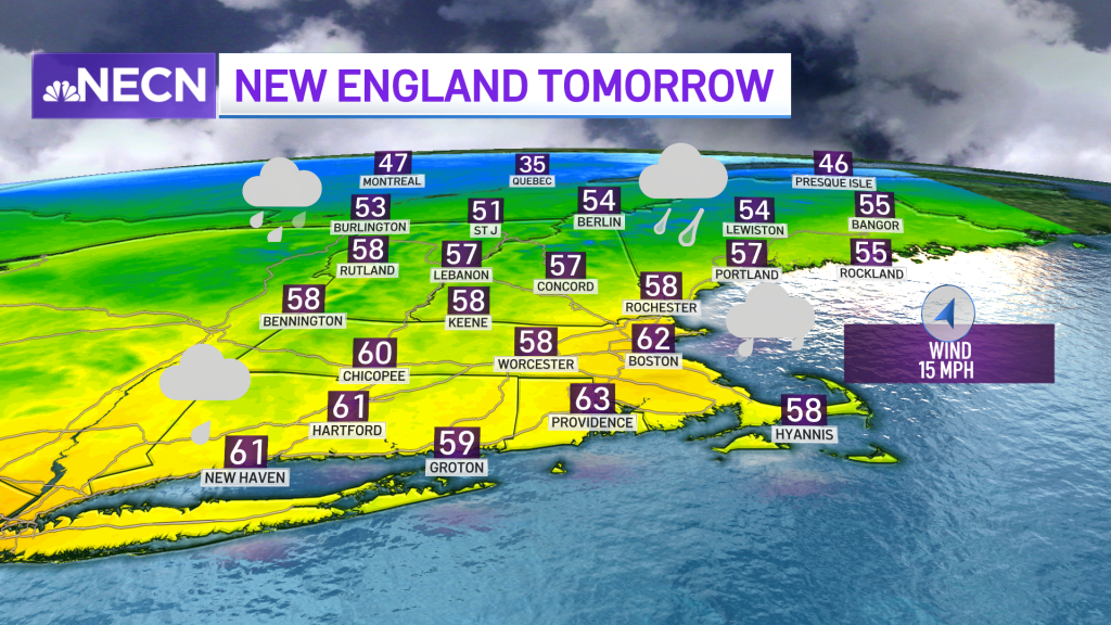
High temperatures reach the 60s by late in the day south, 50s north and 40s in far northern Maine.
Once the front passes late Saturday night, we’ll be left with gusty winds and improving sky conditions. Lows Saturday night will be mostly in the 40s south, 30s north.
Sunday is the pick of the weekend with sunshine breaking out, but we’ll still be dealing with a gusty northwest wind at times making it feel cooler. Highs reach the mid 40s south, mid 30s to low 40s north.
Weather Stories


Our exclusive 10-Day forecast features warmer-than-average temperatures for much of next week with quiet conditions.
Have a great weekend!

