


Today (Saturday): Mostly sunny, breeze diminishes. Highs in the mid 50s to near 60. Tonight: Clouds increase. Lows in the 30s to around 40. Sunday: Developing showers to rain. Highs in the mid 50s, 40s north.
For the second weekend in a row, we have a gorgeous Saturday filled with sunshine and mild temperatures. The breeze continues to ease so we are left with a pleasant afternoon and highs in the 60s but cooler at the coast.
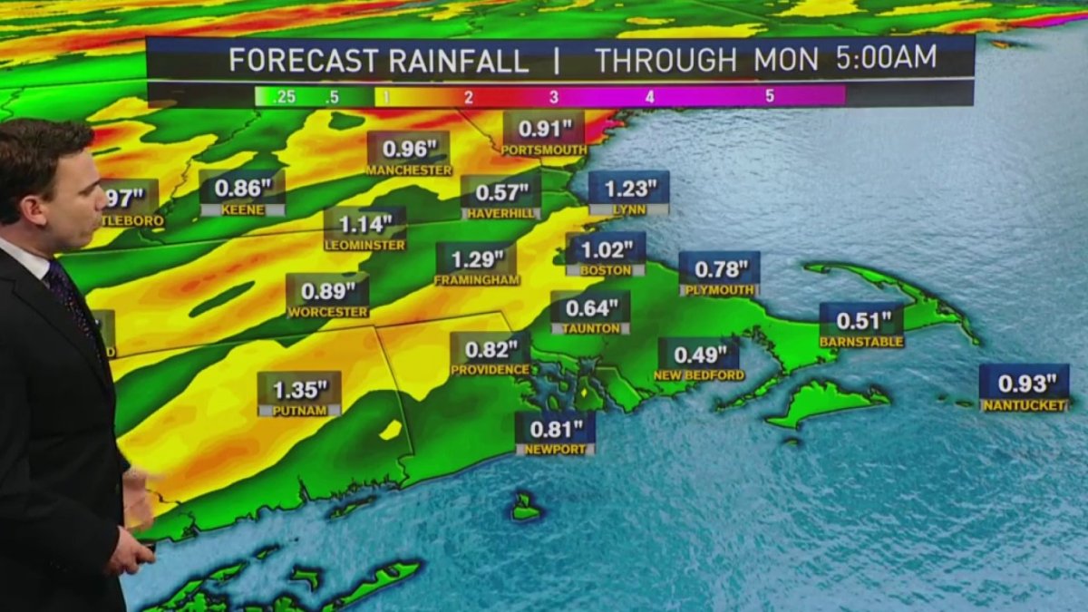
Clouds increase tonight ahead of our next rainmaker tomorrow- clouds will greet us Sunday, followed by showers that will transition to downpours in the afternoon. Highs Sunday will be in the 50s, 40s north.
Windswept rain continues through the night for all. Gusts up to 55 mph Sunday night into Monday morning so there’s a possibility for downed trees and power outages.
Get Boston local news, weather forecasts, lifestyle and entertainment stories to your inbox. Sign up for NBC Boston’s newsletters.
Northern Maine and higher elevations in northern New England could get a few inches of snowfall before the system exits Monday morning. Monday will be cool and windy with highs in the 40s again as we dry off.
High pressure takes over Tuesday into early Wednesday, temperatures go from the 50s to the 60s. A system will head in for late Wednesday into Thursday, bringing in mostly rain at first, changing to mountain snow.
Thursday into Friday there may be cooler air and a chance for showers or snow showers as another front moves through. It's tough to get anything significant with snow this time of the year with the strong sunshine, so Southern New England more than likely will see rain and not snow.
Weather Stories


That system will move out in time for a drier weekend with temperatures in the 50s and dry for Easter Sunday.

