


Today: Highs in lower 40s to upper 30s, chance for some flakes, sleet- switching to rain after. Mountain snow. Breezy, wind gusting 25 mph +. Tonight: Lows in the upper 30s, leftover patchy rain, cloudy skies. Sunday: Increasing sun up through the day, highs in the lower 50s. gusting 35mph+.
The weather will slide downhill quickly today.
That doesn’t buy us a lot of time to warm things up after a chilly night in the 30s. As rain moves in, some spots may see a brief period of sleet or wet snow (NO accumulation) late this morning and early this afternoon.
The rest of the day is spent in the general showers, with raw winds from the east and temps only making it to the low 40s. With milder air trying to weasel in later tonight, we’ll see the numbers hold into the morning. That same milder air may also instigate a few rumbles of thunder – or plain downpours - after midnight.


Get Boston local news, weather forecasts, lifestyle and entertainment stories to your inbox. Sign up for NBC Boston’s newsletters.
We’ll wake to sunshine on Sunday morning. As the day progresses, winds will increase from the northwest as colder air tries to move in. That won’t stop us from making the mid-50s by afternoon, however.
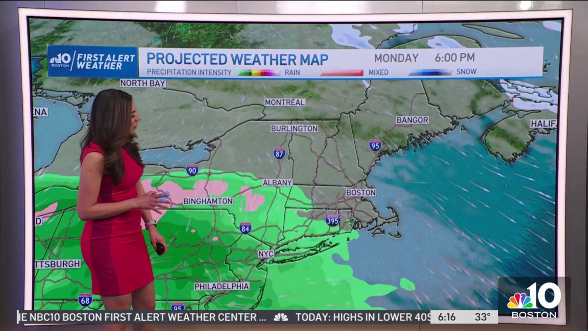
Our next concern revolves around a storm forming on Tuesday. Right now, it appears that most of the storm will remain offshore of Nantucket, while leaving us in the lighter precipitation.

That spells light rain, with the possibility of some wet snow in the elevated terrain of Mass and NH. We’ll keep a close eye on the storm’s evolution and track in the coming days.

