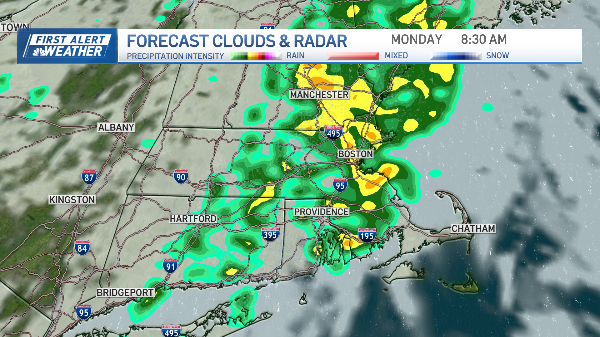
Bands of heavy rain are moving north out of southern New England, and into New Hampshire and Maine. Bands of snow are intensifying from northern New Hampshire throughout much of Vermont, to western Massachusetts and Western Connecticut.
Near the center of the low-pressure system, the wind is fairly light along the Massachusetts coast for a time Friday morning.
Gusts will initiate from the northeast past 40 mph, then diminish to near calm, then increasing from the southwest Friday afternoon. On the Maine coast, wind from the east will become lighter, and then pick up from the west late Friday night and Saturday.
In a rapidly intensifying storm like this, we often get surprises. One of the unusual aspects of the system is that it’s warmer in parts of eastern Maine than southern New York and Connecticut Friday. This is due to such a powerful counterclockwise circulation pulling warm air north on the front side, and cold air north on the backside.
A winter storm warning is in effect for Vermont where, much like the November 27th storm, it’s a very heavy at least 10 inches of snow. Power outages are likely due to the weight of the snow on trees, causing branches to break over the powerlines.
Timing of the wind reduction lines up close to the time of high tide. Nevertheless, we still may have some minor coastal flooding due to the astronomical high tide early Friday afternoon.
Local
In-depth news coverage of the Greater Boston Area.
Temperatures Friday are rising into the 40s in eastern New England, but cooling through the 30s in western New England. Rain tapers to showers early this morning in southern and eastern New England, but changes to snow in the hills west.
Most of the mountains see snow all day. The exception is eastern Maine, where rainfall amounts in excess of an inch or resulting in deep puddles. We may have some flooding.
Rain showers change to a period of snow overnight Friday in southern New England with the coating possible right to the coast and Cape Cod and the islands. So we all may wake up to slippery weather Saturday morning. Once again, the exception is in Maine where it may still be too warm for snow.
As most of New England dries out Saturday afternoon, Maine will get a period of snow. The big story Saturday is wind from the northwest gusting past 50 mph, additional scattered power outages are possible due to wind damage.
[NATL] Extreme Weather Photos: Record Heat Threatens Europe
Temperatures Saturday in the 30s and low 40s.
A warm front moves north of us Sunday, with a reduction in wind speed and plenty of sunshine. We should make it into the 50s and southern and eastern New England.
A very cold front for this time of year crosses New England from north to south Monday. It is likely a wave of low pressure develops on the front. That means we may have rain changing to snow once again all the way to the south coast. Temperatures may be near 50 degrees in the morning, but cooling rapidly late day.
Cold, to record cold air moves in on Tuesday with increasing sunshine, and a stiff breeze from the north. High temperature in the 20s in northern New England, 30s to low 40s and southern New England. Wind may be gusting past 30 mph adding to the chill.
Looks like another cold and bright Wednesday, and then a late week warm-up may get us into the 60s to start next weekend. The next front not expected until later Saturday.
Stay ahead of it all with our First Alert 10-Day Forecast.


