
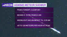
High pressure over the mid-Atlantic states will provide the region with mild and dry conditions over the next couple of days. In terms of cloud cover on Monday, the mid to high altitude clouds we’ve been dealing with much of the day will start to thin out and exit the region this afternoon and evening, which is great news because Monday night we will have a chance to see the Geminid Meteor Shower!
STAY IN THE KNOW
Watch NBC10 Boston news for free, 24/7, wherever you are. |
|
Get Boston local news, weather forecasts, lifestyle and entertainment stories to your inbox. Sign up for NBC Boston’s newsletters. |
Though the moon will be bright for the first half of the night, you still may be able to see a few of the brighter shooting stars, but by the second half of the night around 2:30 a.m. Tuesday during the meteor shower’s peak, the moon will be setting and viewing will improve tremendously with the darker sky!
It is estimated that we could see between 60 to 120 meteors per hour! In terms of overnight temperatures, it won’t be too cold either for viewing, at least by December standards! Lows Monday night will be in the mid 30s south, around freezing north, and in the mid 20s in far northern Maine! Happy viewing, and don’t forget to share some of your pictures with our First Alert weather team on Twitter or by emailing us at shareit@nbcboston.com.
Get top local stories in Boston delivered to you every morning. Sign up for NBC Boston's News Headlines newsletter.
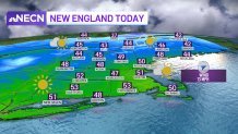
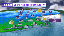
As far as the rest of the week’s forecast goes, high pressure provides us with another decent day on Tuesday. Expect a good amount of sunshine with a few clouds. Highs reach the upper 40s to 50 south, the upper 30s to low 40s north, with colder air across the higher mountain tops.
By Wednesday, we’ll be watching a weak system over the Great Lakes which will move through New England late in the day and into Wednesday night. It’s warm front will bring some rain showers to the area Wednesday night into the early morning hours of Thursday south, and a mix of rain and snow to the north.
Local
In-depth news coverage of the Greater Boston Area.

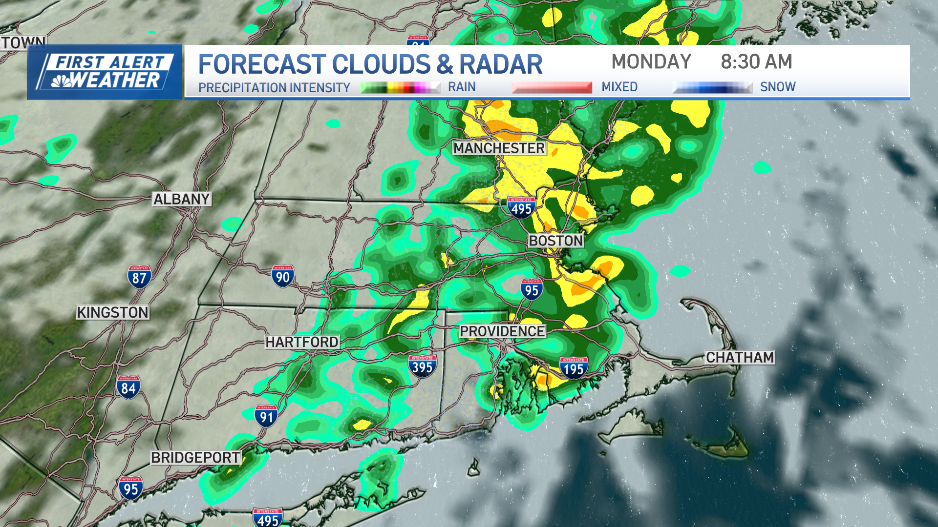
Right now, it doesn’t look like too much of a big deal in terms of wintry conditions since milder air will be directly on its heels, but we could see an inch or so of snow before the changeover to rain.
Thursday will be the pick of the week as milder air flows into the region, with high temperatures reaching the 60s south and 50s north! Thereafter, a cold front ushers in colder air into the region Friday and sets the stage for a rain snow event by the start of the weekend. Currently it looks mostly wet south, but may yield some accumulating snow northern areas. Stay tuned!