Overnight Tonight: Light snow. Lows in the upper 20s.
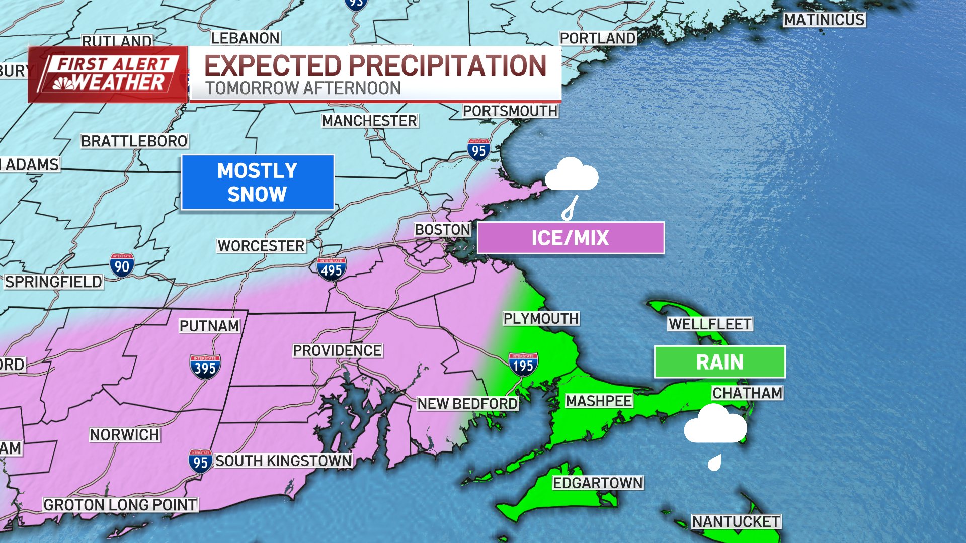
Tuesday: Morning snow, changing to rain through the southeast. Snow Totals: 2″-4″ accumulation. Highs in the 30s,
Wednesday: Cold with bright sun. Highs in the 20s.
Follow NBC10 Boston on…
Instagram: instagram.com/nbc10boston
TikTok: tiktok.com/@nbc10boston
Facebook: facebook.com/NBC10Boston
X: twitter.com/NBC10Boston
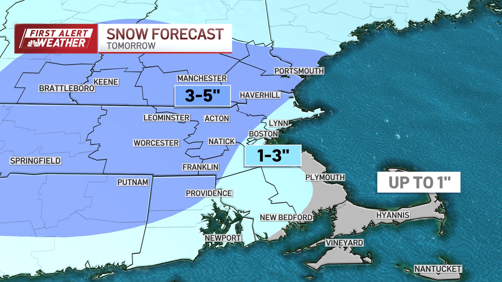
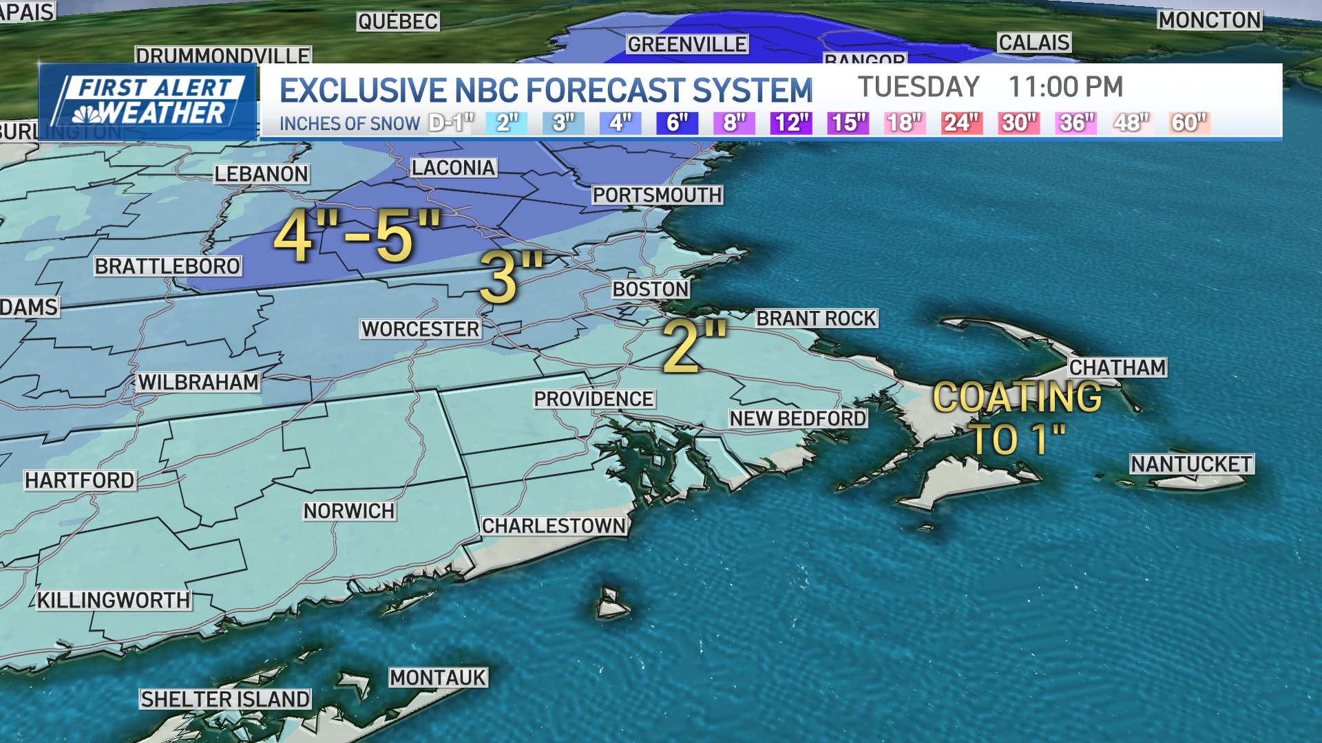
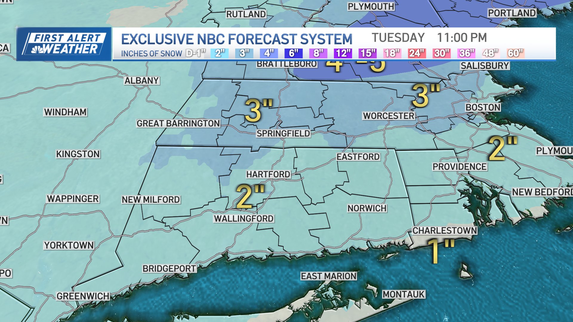
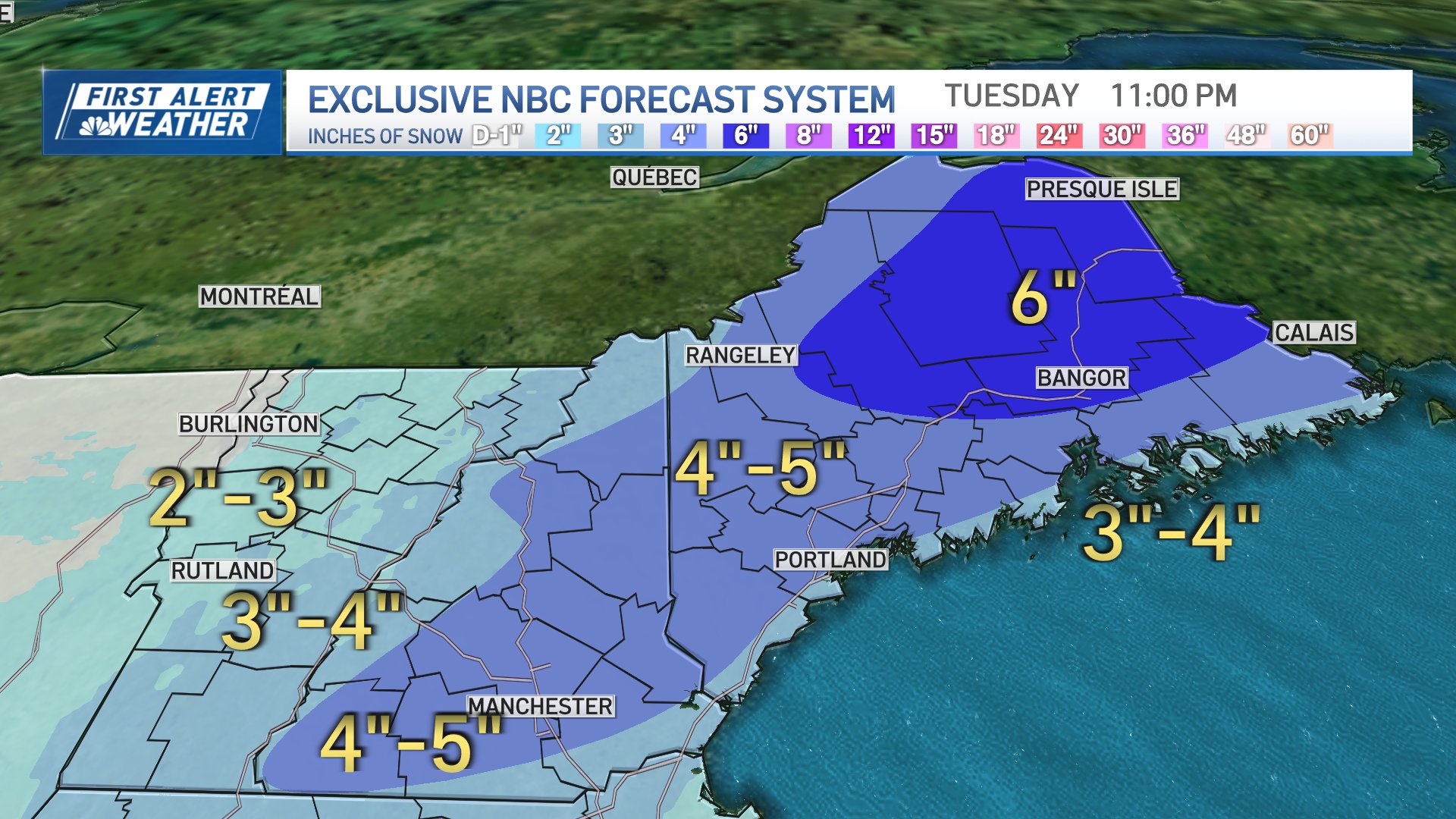
Tuesday's snowstorm is expected to bring plowable snow to most of New England. But how much depends on where you live.
Snow Monday night should start around 9 p.m. at the South Coast of New England, around midnight at the Massachusetts Turnpike, later to the north. The snow will continue into Tuesday, but gets noticeably less intense mid-morning onward for southern New England, mixing with rain at the coast and in the southeast.
STAY IN THE KNOW
Watch NBC10 Boston news for free, 24/7, wherever you are. |
|
Get Boston local news, weather forecasts, lifestyle and entertainment stories to your inbox. Sign up for NBC Boston’s newsletters. |


Here's a look at the latest snowfall maps for our area, updated as of 4:30 Monday:

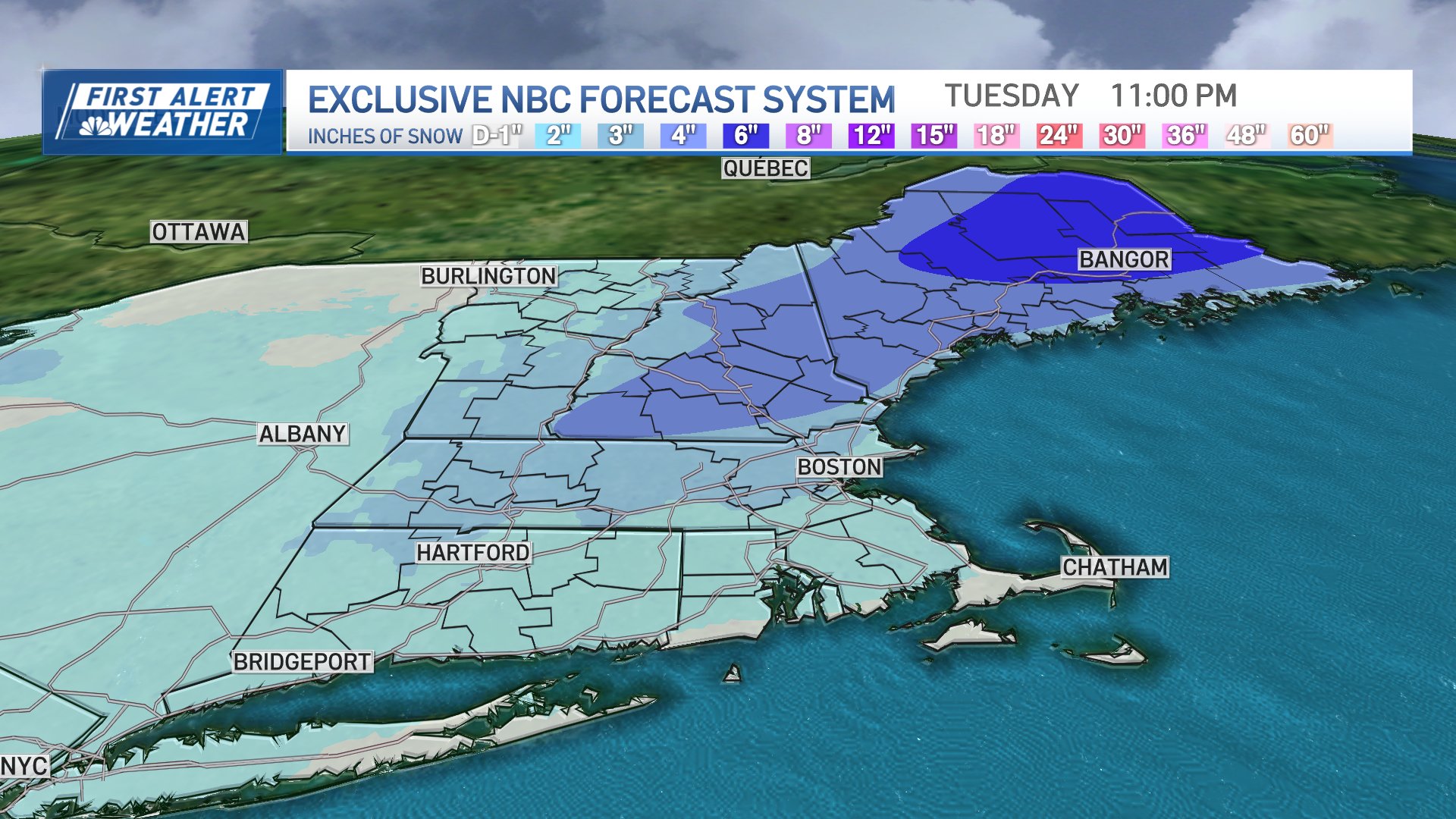
Here's a look at the original projected snowfall maps from Monday morning:
Local
In-depth news coverage of the Greater Boston Area.


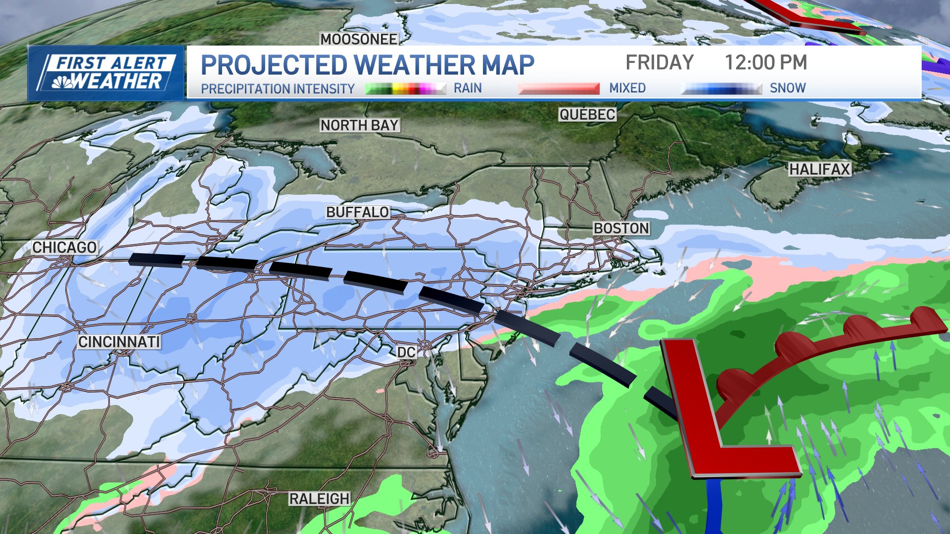
And Tuesday's storm isn't the only storm we're tracking this week. There's another storm headed our way on Thursday night into Friday that should bring more accumulating snow. Exactly how much is still to be determined.
Here's a first look: