


Tuesday night: Increasing clouds. Lows either side of 50. Wednesday: Morning to midday rain then some leftover showers. Cooler. Highs in the low 60s. Thursday: Breaks of sun through many clouds. Chance of a shower, especially along the south coast. Highs in the middle to upper 50s.
The National Weather Service is warning of severe thunderstorms expected to hit the Ohio Valley Tuesday.
These storms are most likely to impact Indiana, western and central Ohio and northern Kentucky, including major cities like Louisville, Cincinnati, Columbus and Indianapolis.


Residents should be prepared for the possibility of large hail, damaging winds and even tornadoes. Some tornadoes could be particularly strong, reaching EF2 or greater intensity.
Get Boston local news, weather forecasts, lifestyle and entertainment stories to your inbox. Sign up for NBC Boston’s newsletters.
Localized flash flooding is also a concern.
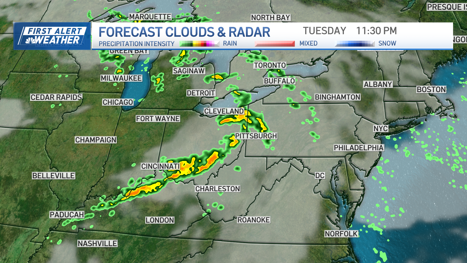
The risk of severe weather extends beyond the Ohio Valley, with a possibility of scattered storms reaching as far north as the southern Great Lakes and as far south and east as parts of the south and southern mid-Atlantic.
Here are some steps residents in the areas mentioned above can take, and that you can take to stay safe in any severe weather situation:
- Get Weather Alerts: Download the NBC 10 Boston Weather App to receive warnings directly. Ensure your phone is charged
- Have a Plan: Know where to shelter in your home in case of a tornado. If you lack a basement, choose the lowest floor and find a small interior room, like a bathroom or closet, or take shelter under a stairwell or in an interior hallway with no windows
- Don't Wait: Don't wait to see the tornado before seeking shelter. Tornadoes can be difficult to see in the dark or when wrapped in rain. Move to a safe location as soon as a warning is issued
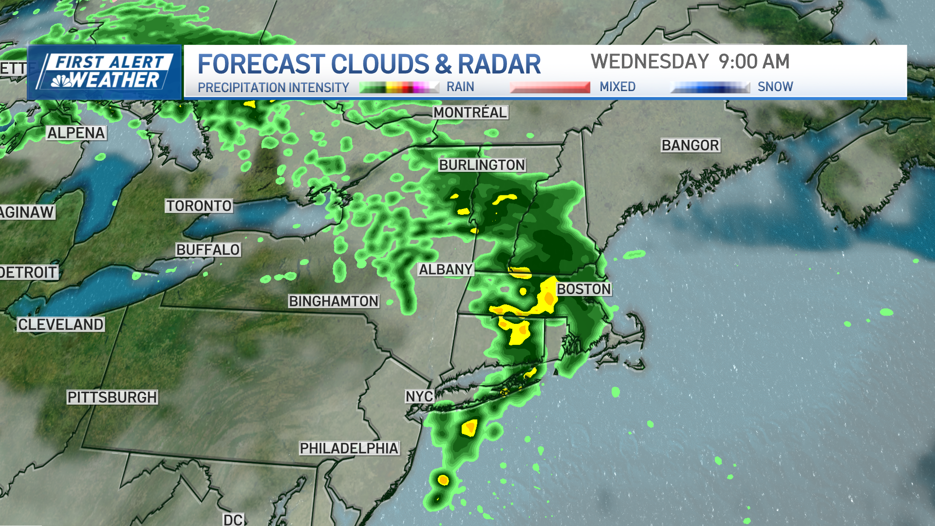
The threat for severe weather Tuesday will shift east Tuesday night, with a chunk of this same system headed to New England Wednesday.
A First Alert has been issued Wednesday due to the potential of rain and storms, including during the morning commute.

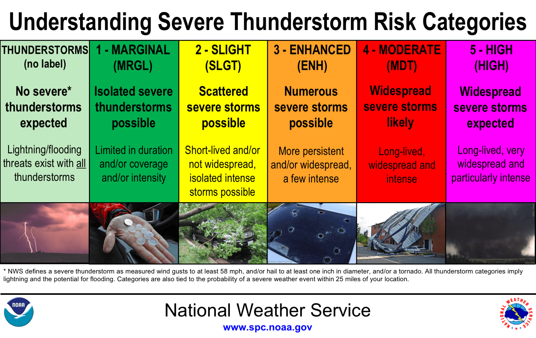
While widespread severe weather isn't anticipated here at home, we are in a "marginal" risk for an embedded thunderstorm or two, particularly in western New England Wednesday morning.
Stay tuned to the latest forecast for updates.


