


Today: Mostly cloudy, spot showers and a thunderstorm. High in the 80s. Overnight: Most cloudy, scattered showers and thunderstorms, low in the 60s. Monday: Mostly cloudy, spot showers and storms, high in the 70s. Cape Cod Today: Mostly cloudy, spot showers, Highs near 80. Wind from southwest, then southeast 10-15 mph. Overnight: Most cloudy, scattered showers and a thunderstorm, low in the 60s. Monday: Mostly cloudy, spot showers and storms, high in the 70s.
Sunday funday? It depends where you’ll be at.
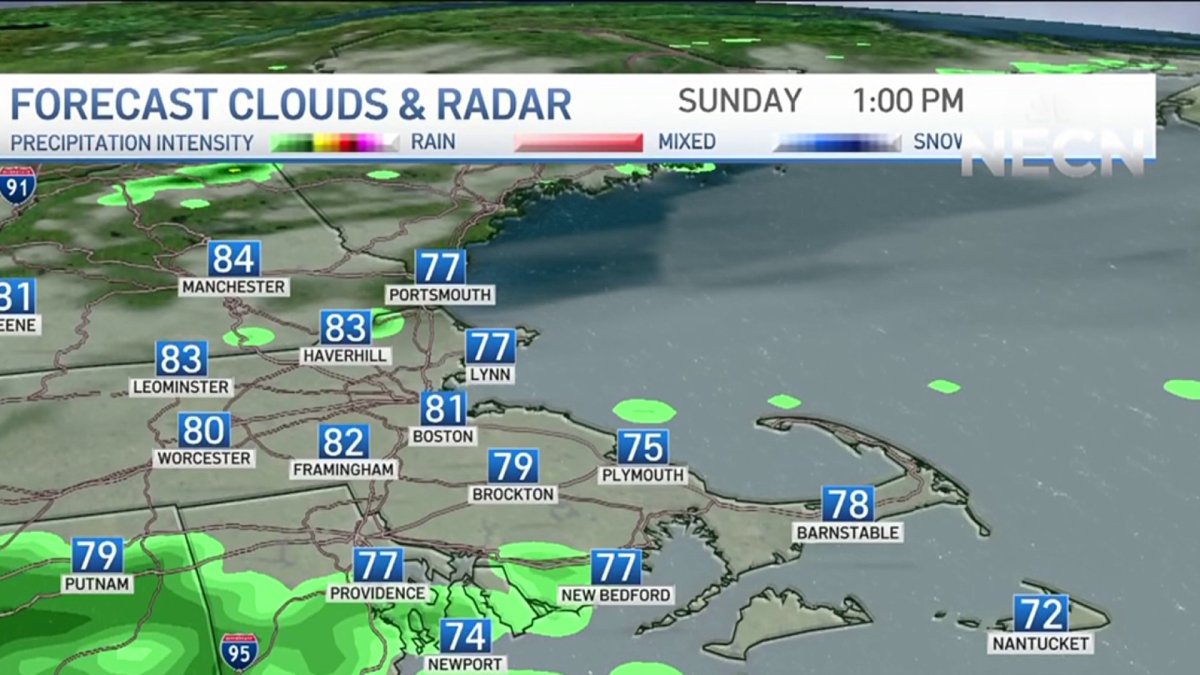
We have chances of rain coming back Sunday afternoon as a cold front pushes in from the north and will bring some pop-up thunderstorms in the northern states of Vermont, New Hampshire and Maine.
Now, a low pressure system will also make its way near our south coasts, also producing the probability of slight showers. Not expecting a washout by any means. This rainfall will be light and brief in the south but we could see some thunder with the storms up north.
If you live in southern Massachusetts and northern Connecticut, you have higher chances of staying dry although you won’t escape being covered by cloudy skies.
Get Boston local news, weather forecasts, lifestyle and entertainment stories to your inbox. Sign up for NBC Boston’s newsletters.
The benefit of this cold front is that it will take away the smoke in the air and our high dew points, meaning that Monday will be a mostly dry, clear day with better air quality, comfortable dew points and high temperatures in the 70s.
After that, get ready for a rapid temperature rise. Our temperatures climb up to the 80s again starting Tuesday and will even reach 90s by Wednesday, Thursday and Friday. Triple H weather will take over New England and plans to take its sweet time.
Our exclusive 10-day forecast shows we have nicer weather coming back next weekend.

