


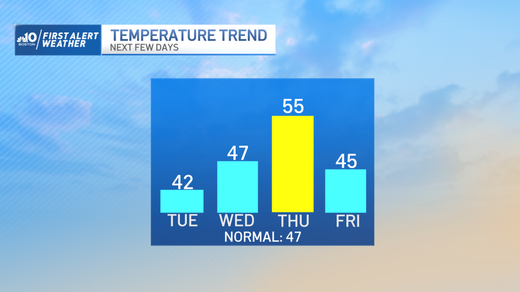
Today: Sun to clouds, chilly breeze. Highs near 40, wind chill 30s. Tonight: Variable clouds. Lows in the 20s. Wednesday: Sun to clouds, brisk breeze. Highs in the 40s.
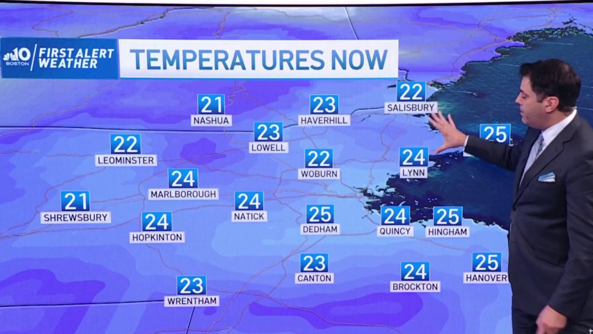
Waking to a pretty cold morning today and while the chill continues, it’s trending the milder direction through midweek. Today is a struggle, though. We’ve dug ourselves a hole with the cold this morning and clouds are advancing later this afternoon.
Tomorrow features another mini warmup as the winds turn to the southwest and high temperatures head for (nearly) 50. The Thursday forecast will provide the excitement this week, however.
Another fast-moving storm will roar through New England with a rain/snow line that retreats from southern New Hampshire to far northern New England early in the day, and some sun emerging by afternoon. Highs will spike to the mid-50s before a sharp cold front charges into the mix late day.

Get Boston local news, weather forecasts, lifestyle and entertainment stories to your inbox. Sign up for NBC Boston’s newsletters.
This front will have some downpours (thunder is a stretch) and quite a batch of wind. Colder air will rush in behind, dropping us to freezing in a matter of hours. Get the popcorn ready. It’s gonna be a show – and I’m not just talking about the Boston Common tree lighting, either.

Longer range, we may just have to sit tight for the answers. Sure, we’re known for our ten day forecast, but in this pattern, I’m not comfortable with anything after Saturday. With rapid-fire weather systems, the farther you go out, the more your errors compound.
Weather Stories


So let’s just say the storm “brewing” for Monday could also happen Tuesday. Or not at all. Enough said. Enjoy the day.

