


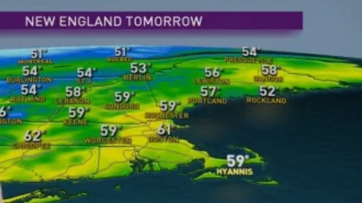
Today (Mother’s Day): Mostly sunny. Breezy. Highs around 60. Tonight: Increasing clouds. Not as chilly. Lows in the 40s. Monday: Scattered showers and thunderstorms. Highs in the low 60s. Cape Cod Forecast Today (Mother’s Day): Mostly sunny. Breezy. Highs in the mid 50s. Tonight: Mostly cloudy. Less wind. Lows in the 40s. Monday: Scattered showers. Highs in the low 60s.
A record cold morning for some with Boston and Providence both dropping to 34 degrees, tying the previous record set in 1902 and 1977.
The wind will be stiff today with gusts up to 40 mph possible for Cape Cod and Islands, keeping us quite breezy this afternoon. The wind direction will be out of the southwest so this will allow us to warm up closer to 60.
Showers and thunderstorms return Monday as an area of low pressure approaches from the west. There’s a slight chance a few storms could be strong to severe with the main threat being for damaging wind and hail across Southern New England away from the coast. Highs Monday will be in the low 60s.
Cooler weather moves in Tuesday and Wednesday behind the cold front, but at least the sun will be shining bright. Warmer air is in sight for the end of the week with highs in the upper 60s with even the chance of hitting 70 Saturday. Showers also look to return Thursday night into Friday with more rain late Sunday into Monday. For the latest changes in weather make sure to stay tuned to our First Alert 10-Day forecast.

