


Today (Saturday): Sun to clouds. Scattered rain with a few strong storms this afternoon. Highs in the low 80s. Tonight: Partly cloudy. Patchy fog. Lows in the 60s. Sunday: Patchy fog early, then partly sunny. Afternoon storms or showers. More humid. Highs in the mid 80s. Cape Cod Forecast: Today (Saturday): Sun to clouds. Scattered rain with an isolated storm this afternoon and evening. Highs in the upper 70s. Tonight: Patchy dense fog develops. Lows in the mid 60s. Sunday: Fog dissipates. Partly sunny, humid. Afternoon showers. Highs around 80
The best weather is early this morning as our New England rainfall lottery continues this weekend.
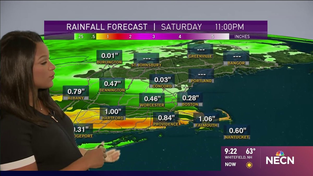
Low pressure coming out of the Great Lakes states will move across New England today and tomorrow. This means the most organized area of rain we’ve seen in weeks. But it’s still a challenge to tell exactly where and how much it’s going to be. Odds favor somewhere between I-90, and Route 302 in northern New England by midday through sunset.
This band of intense rain may be enough to cause localized flash flooding, even as the sun may be shining to the north and south. It’s one of those weekends where you don’t cancel your plans, you just keep an eye on our weather apps and radars.
It’ll be humid in southern New England with temperature in the 80s, cooler in the north with temperatures in the 60s and 70s both today and tomorrow. Dense fog may develop south after the rain ends this evening. Tomorrow features fog to sun and storms. Highs near 90 south, where storms may become intense during midday and afternoon.
Next week offers more of the same with a mixture of sun and clouds and often on showers and thunderstorms. The early call for our Independence Day weekend is for continued classic summer weather in New England, as seen in our First Alert 10-Day Forecast.

