Saturday: Heavy rain, changing to heavy snow from northwest to southeast. Becoming very windy late. Temperatures in the 40s early, 30s late. Overnight Saturday Night: Heavy snow tapers. Gusty wind. Lows in the 20s, wind chill teens. Sunday: Blustery but fair, North Country snow showers. Highs in the 30s, wind chill 20s.
Right now, it's raining in Greater Boston, and some areas are seeing snowflakes. By 3 p.m., we should be in the middle of the first big snowstorm of the year.
A nor'easter is arriving in New England, prompting winter storm warnings across much of the region. The First Alert Weather Team has found that the storm has been intensifying, and will continue to do so throughout the day.
Have a great pictures or video of the rain or snow? Send it to us and we may feature it on air! Email us: shareit@nbcboston.com
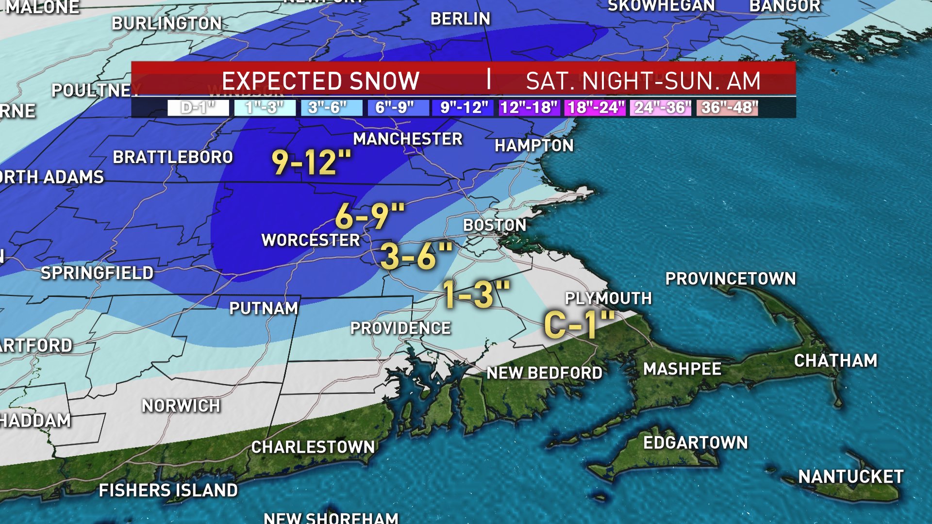
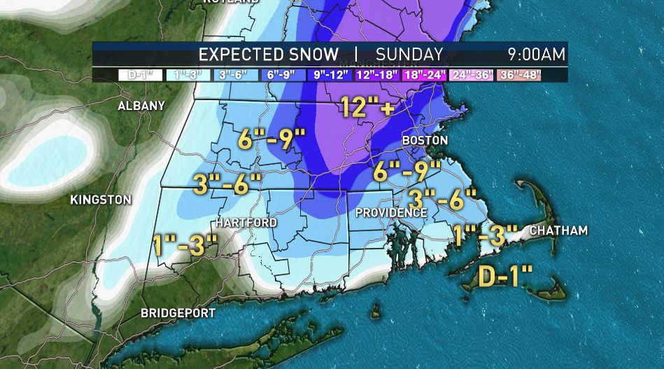
It may bring 9 inches of snow or more to the Boston area (estimates have been shifting) and is expected bring over a foot to many parts of New England.


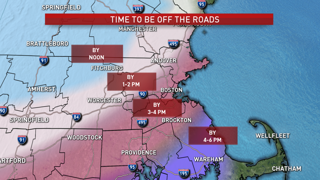
Driving could be impacted by the mix of heavy precipitation and wind.
This wet start was part of the plan all along.
Heavy rain and wind will hit the eastern part of Massachusetts after traveling the Interstate 90 turnpike, and wind gusts may hit 50 miles per hour.
We’re waiting for the storm to rapidly intensify later this morning and early afternoon, when most of us will see the turn from rain to snow. It will slowly weasel into the Worcester hills later this morning, then abruptly shift to the coast through the afternoon.

I liken it to a tennis player serving up a ball. The storm is the ball, and the cold rushing into the storm is the racket. When it makes contact, watch out.
What kept me up most of the night was the fact that our guidance is forecasting a smooth transition from rain to snow. We know, however, that that transition is more chaotic, or in some cases, sudden. That’s the worry with the accumulations, obviously.
With a faster turnover, more snow will accumulate near the coast. Or put more plainly, the 6-9 and 3-6 lines on the snow map shift closer to Boston and the South Shore.
Winds are issues with nor’easters, and this is no exception. We’re talking near-hurricane gusts. Communities along the coast will top 50-60 mph as the storm draws in heaps of air during intensification. This exchange of air means that some will be rising furiously. That could touch off thundersnow in spots, spiking snowfall rates to 1-3 an hour and causing roads to become impassable. Safe bet to follow the map and get off the roads. Power outages will be a problem as pasty, wet snow clings to power lines, trees, mittens, your neighbor snow blowing his driveway and etc.
Wrap on the storm won’t be until after midnight. As with most nor’easters, it just keeps snowing -- at a lighter pace, mind you -- on the backside. Plows will be out until the wee hours of Sunday morning.
This isn’t the final word of course. Plenty more updates to come ahead as we ride out the storm.