Today: Sunshine, biting winter wind gusts to 30 mph. Highs near 30, wind chill teens. Tonight: Clear, cold. Lows in the teens. Tuesday: Sun to increasing clouds, light wind. Highs near 40.
It turned into a wild weather day across the region yesterday. Temperatures started out around 50 degrees, winds ramped up and snow squalls blew through the region. Before the squalls, there were numerous brush fires across the region as well.
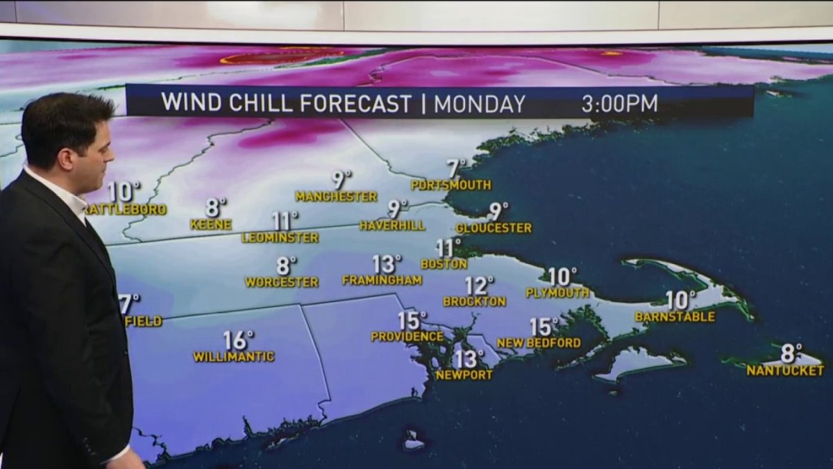
Frigid air returns Monday. Just because it’s cold, doesn’t mean we won’t see another fire threat. Gusty winds persist with very dry air in place. Officials advise against outdoor burning.
Highs will barely get to 30° with most locations staying in the 20s. If you factor in the wind, temperatures will feel like they’re in the single digits.
Get Boston local news, weather forecasts, lifestyle and entertainment stories to your inbox. Sign up for NBC Boston’s newsletters.
Get Boston local news, weather forecasts, lifestyle and entertainment stories to your inbox. Sign up for NBC Boston’s newsletters.
Another thaw will begin Tuesday with temperatures returning to the 40s. We’ll be back up near 50 for Wednesday and Thursday. Some rain or snow will be possible Thursday into Friday.
Saturday, the first day of Spring, will be sunny and cool with highs in the low 40s. But temperatures will return to around 50 by Sunday. The following week looks to be seasonably mild.