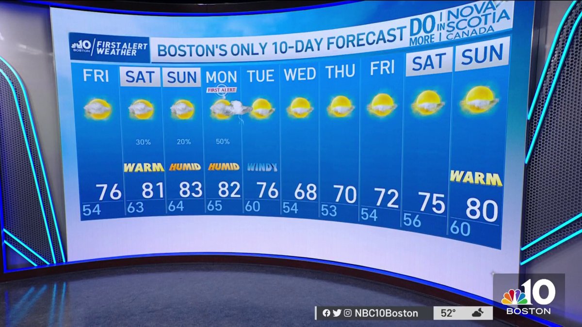
Thursday night: Pockets of fog and drizzle with clouds. Lows in the 50s. Friday: Morning clouds, drizzle and fog to emerging sun. Highs in the 70s to near 80.
Sunny skies along northern New England are bringing more warmth and record highs this afternoon in Vermont and Maine. Caribou, Maine tied a record yesterday with a high of 79, while today, Burlington, Vermont is expected to reach the upper 80s, a previously established record high back in 1985 reached 84 degrees.

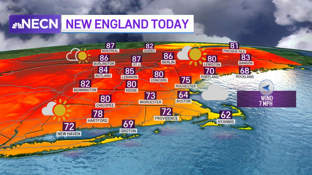
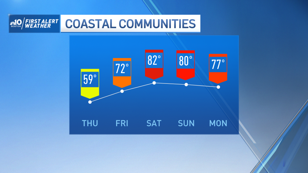
Meanwhile, Boston has experienced below average highs for over 60% of the month up to now. Having the 60s around this afternoon will likely be very nice for our coastal communities.
Get Boston local news, weather forecasts, lifestyle and entertainment stories to your inbox. Sign up for NBC Boston’s newsletters.
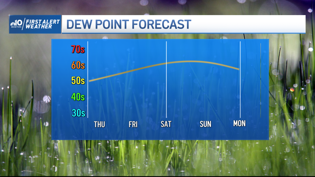
Cloud cover will continue tomorrow, it actually stretches a bit farther inland, while fog redevelops along the coast tomorrow morning. Isolated sprinkles will pop up tomorrow from morning through the afternoon, with higher dew points (reaching the 60s) this weekend and into Monday.
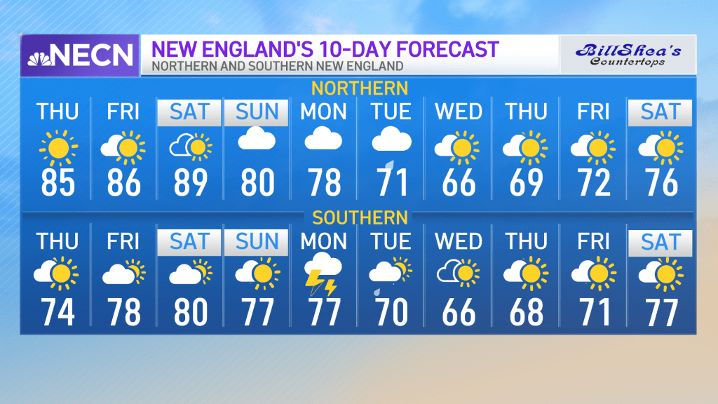
Showers will start to develop Saturday but won't stretch up across all of New England until Sunday. Sunday brings the potential for some lightning as does Monday, when rain will become more widespread along northern New England. The pick of the weekend will be Saturday, due to the warmer temperatures and less rain coverage. If you're looking for warmer temperatures, stay hydrated, the forecast rises as we run up north and towards the weekend, upper 80s will be seen near our Canadian border and even 90 degrees may be found in Berlin this upcoming Saturday. Sunday brings a slight cooldown with highs ranging in the upper 70s to the low-80s.
Next week features above average highs most of the week, with a slight dip on Wednesday. We’ll start our work week in the upper 70s, bringing the “coolest” temperatures for Wednesday with highs in the upper 60s.