


Overnight Friday Night: Snow developing, changing quickly to sleet and freezing rain after light accumulation. Snow continues in the mountains. Lows in the 30s, 20s north.
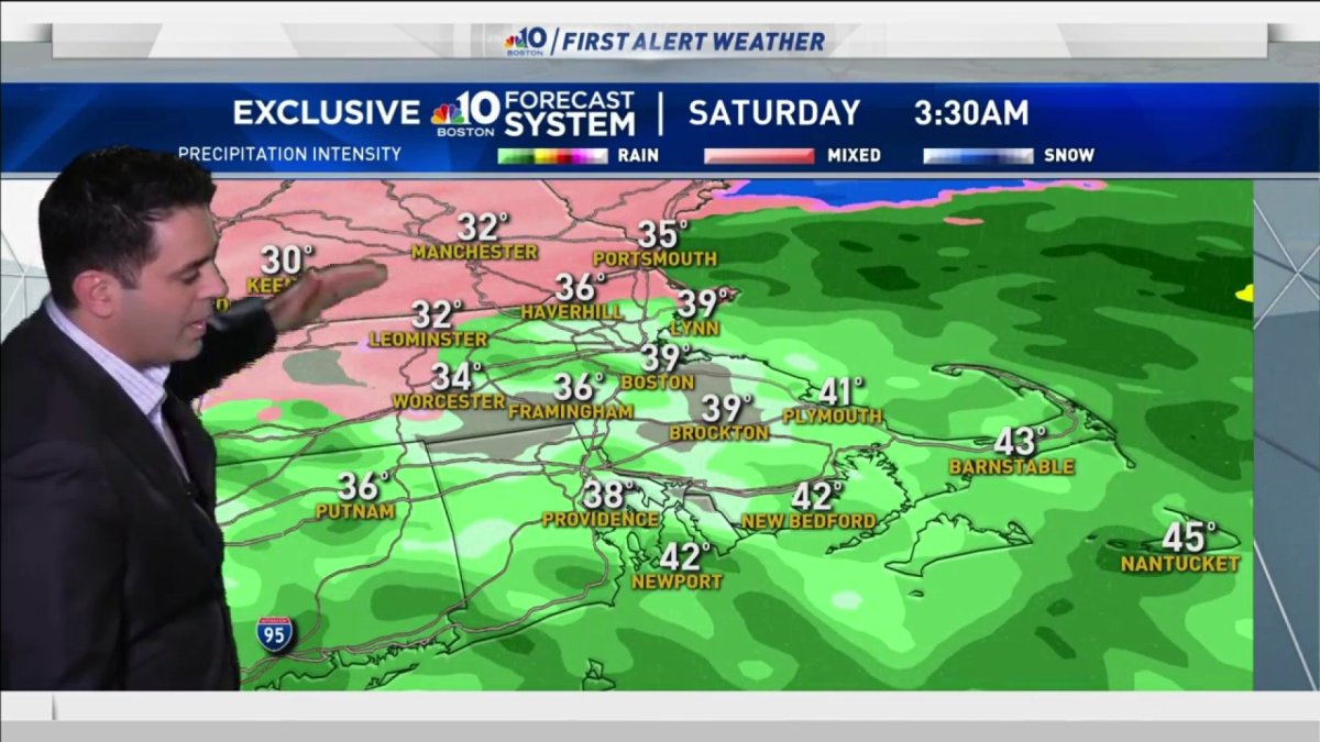
Saturday: Rain showers end early south, snow continues Northern New England with around half a foot. Highs in the 40s, 30s north.
Sunday: AM sun to clouds, night snow and rain. Highs in the 30s.
We did it! It’s New Year’s Day. The year is off to a quiet start until the overnight.
We’re tracking a storm system, that will be quick hitting, Friday night into Saturday. A burst of snow or sleet in southern New England will change to rain, but in northern New England where the precipitation stays in the form of snow, totals may exceed six inches.
Since the storm is moving quickly, this won’t be a blockbuster for the mountains, but we aren't done with the snow just yet.
As this storm departs, conditions will improve during the day on Saturday.
Southern New England may warm into the low 50s, with the fresh covering of snow in northern New England temperatures will stay in the 30s.
Sunday will start off sunny and chilly. Clouds will overspread the area by dinnertime and snow may start by the time you go to bed Sunday night.
Local
In-depth news coverage of the Greater Boston Area.


It’s still too early to discuss totals, but a few areas may see north of 6”. It is also possible that we could see accumulations at the coast. This storm will depart Monday afternoon.
The following few days look quiet with some unsettled weather returning by the end of the week. Temperatures will be seasonable.

