Temperatures continue to drop as an arctic boundary moves towards the south east. Light to moderate amounts of snow will continue through the night as the arctic burst moves off the coast.
An Arctic frontal boundary will pass through the area Sunday evening and night, delivering snow showers and snow squalls that could reduce visibility.
The squalls will not be as widespread or as strong as what we saw last week. However, residents of northern and central New England still need to be prepared for whiteout conditions and some heavy snow through the evening.
Get Boston local news, weather forecasts, lifestyle and entertainment stories to your inbox. Sign up for NBC Boston’s newsletters.
As the front slides into southern New England, the precipitation is expected to become less widespread. However, a few of the remaining snow showers and squalls could still reduce visibility briefly from around 7 p.m. through midnight.
Thereafter, arctic air will funnel into the region and produce bitter cold wind chills by Monday morning.
Lows Sunday night will be mostly in the single digits north to below 0, and low to mid teens south.
Sign up for our Breaking newsletter to get the most urgent news stories in your inbox.
Monday will provide mostly sunny skies, but that late February sun will struggle to warm anything up as Arctic air remains in place.
Gusty northwest winds will drive wind chills into the teens much of the day south, single digits north before it diminishes late in the day.
Highs reach the mid 20s south, upper 20s south coast and Cape, teens to around 20 north.

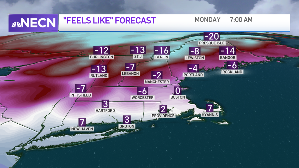
Clear skies and light winds will allow for another frigid night Monday with temps dropping into the low teens south. It will be a bit colder in the valleys, with the single digits north to below 0.
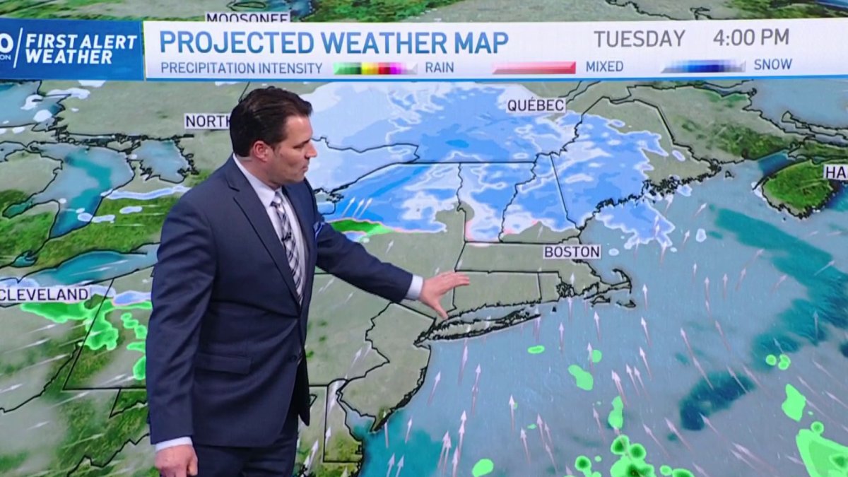
Tuesday will usher in slightly milder temps, in the 30s south and 20s north, ahead of a weak system which will bring a period of light snow north and light mixed precipitation and snow south.

It remains unsettled through Thursday as another system brings more light snow and mixed precipitation to the area Wednesday night into Thursday.