


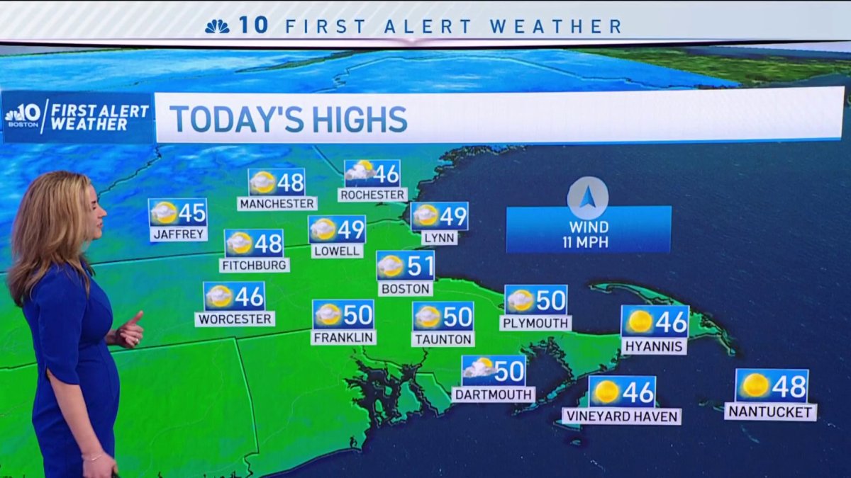
Today: Clouds, some sun, isolated shower, breezy. Highs in the 40s. Tonight: Clearing. Patchy black ice. Lows in the 20s. Friday: Bright. Highs in the 40s.
A mild stretch is unfolding in New England over the next few days. A recurring southwest wind will carry warming air up the Eastern Seaboard on Thursday through Saturday, culminating in a day of afternoon high temperatures in the middle 50s Saturday afternoon!
Between now and then, some of the standard winter thaw cautions apply: ice on ponds and lakes will be thinning and become less safe; melting snow and ice will re-freeze at night, causing patches of black ice; and areas of road spray from melting during the day will mean drivers will want to top off windshield washer fluid.
Get Boston local news, weather forecasts, lifestyle and entertainment stories to your inbox. Sign up for NBC Boston’s newsletters.
For the most part, this thaw will likely be welcomed by New Englanders and is a step toward the near- to above-normal monthly average temperature our First Alert Team predicted in our February monthly forecast at the start of the month.
As ice and snow melts from our roads, potholes will emerge and grow in the coming days, while a fresh breeze – particularly on Thursday afternoon and Saturday afternoon – may make spring-like highs feel a bit more brisk than they otherwise would, but will be responsible for transporting the warm air to our backyards.
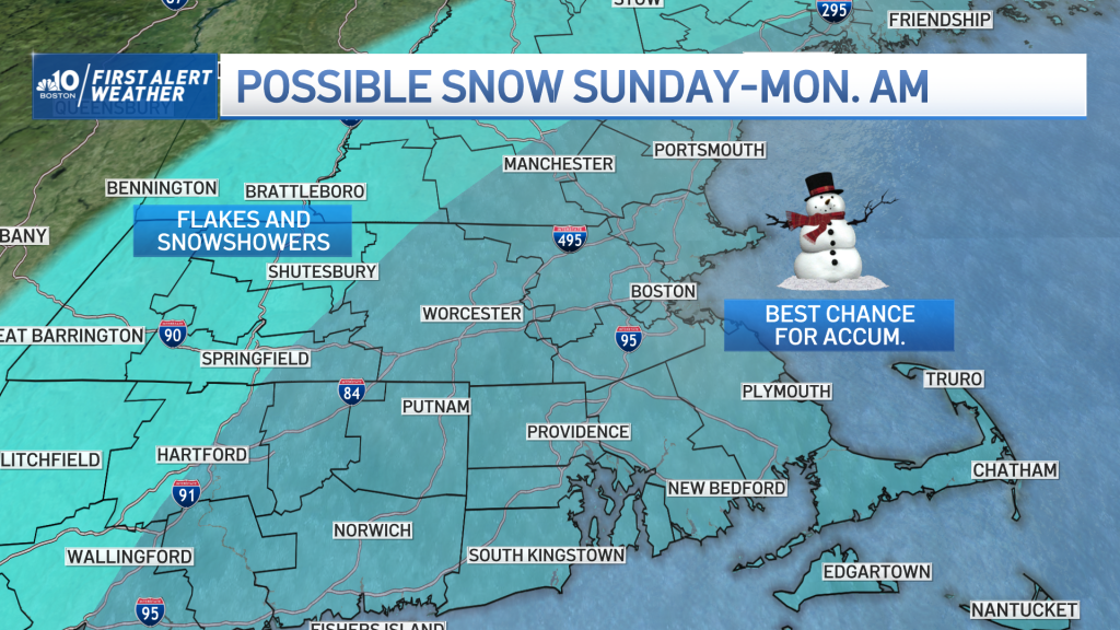
This time of year, it’s hard to string too many days together without a cold interruption, and that interruption is set for Saturday night – a sharp cold front will pierce the warmth with an abrupt shift in air that will leave high temperatures struggling to get to 30 degrees by Sunday!
This incredible change in air will be accompanied by a chance of snow. As the cold front settles south of New England and slows, a wave of low pressure – a weak storm center – will develop along it and strengthen as it moves east over the ocean to our south.
Weather Stories


As the storm develops, a shield of snow will spread north, and while it’s early to say just how much moisture spreads into southern New England, our First Alert Team continues a forecast of snow, aided by our exclusive NBC Forecast System, built here in Boston, which indicates a 70%-plus chance of snow from Boston through southeast New England, and preliminary estimates of two to four inches in southeast Massachusetts, with a coating to two inches for much of the remainder of southern New England.
As we near Sunday, the storm track and intensity will become clearer and the forecast will be fine-tuned.

Either way, the cold air here on Sunday sticks around into the early part of next week, but it’s a fairly small pocket of cold relative to the rest of the nation, and the result will be a short stay.
We expect temperatures to return above normal by the middle of next week, with 50s possible again by next Thursday in our exclusive First Alert 10-day forecast.
Get Boston local news, weather forecasts, lifestyle and entertainment stories to your inbox. Sign up for NBC Boston’s newsletters.

