Meteorologist Tevin Wooten joined NBC10 Boston in June 2022 and can be seen anchoring weather segments at 4 and 7 p.m. on NBC10 Boston.
He holds the Certified Broadcast Meteorologist seal of approval from the American Meteorological Society, and is an Emmy award winning weather reporter and meteorologist.
Prior to joining NBC10 Boston, Wooten spent four years as an on camera meteorologist with The Weather Channel television network in Atlanta. During his time with the network, Tevin forecasted in studio but also from the frontlines covering major weather events such as hurricanes Florence, Michael, Laura and Delta; numerous winter storms including here in New England; and reported in the aftermath of countless tornadoes across the country.
Tevin is an advocate for bringing diversity to the STEM discipline and providing communities of color with access and awareness to broadcast meteorology.
Wooten is a member of the American Meteorological Society and the National Association of Black Journalists. He currently serves as a member of the Culture & Inclusion Cabinet with the AMS. Most recently, Wooten was named to Forbes’ 30 Under 30 list in the media category. The prestigious list highlights 600 of the brightest young entrepreneurs, leaders "destined to change the world" and make a meaningful impact on society.
Tevin has worked as a journalist and weather anchor in Fayetteville, Arkansas, and has spent time as an EV30 design intern with engineers at Marshall Space Flight Center in Huntsville, Alabama.
He holds degrees in broadcast journalism from the University of Arkansas and meteorology from the Florida State University with a mathematics minor.
The Latest
-
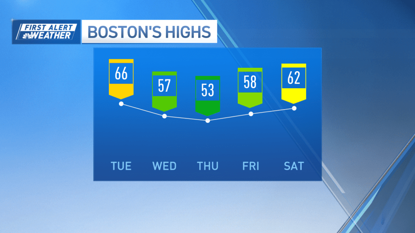
Lots of sunshine Tuesday, mild temps stick around this week
Clear skies through Tuesday bring another warm day regionwide. While not as hot as Monday, we’re still under early summer warmth with highs in the upper 60s (near 66° in Boston). There will be a partly cloudy sky with mild air Tuesday night and the overnight hours remain dry. Wednesday turns cooler, as our winds shift from the east,...
-
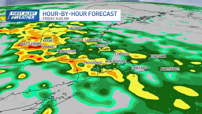
Next storm to bring heavy rain, isolated lightning and thunder, strong winds
We’re experiencing a little bit of déjà vu as Wednesday morning starts with cool air and clear skies. But Central Massachusetts and MetroWest Boston will see another day of soaring temperatures in the mid to upper 60s. At the coast, an onshore wind will spoil the fun, only keeping us in the upper 50s. Partly cloudy skies trend through...
-
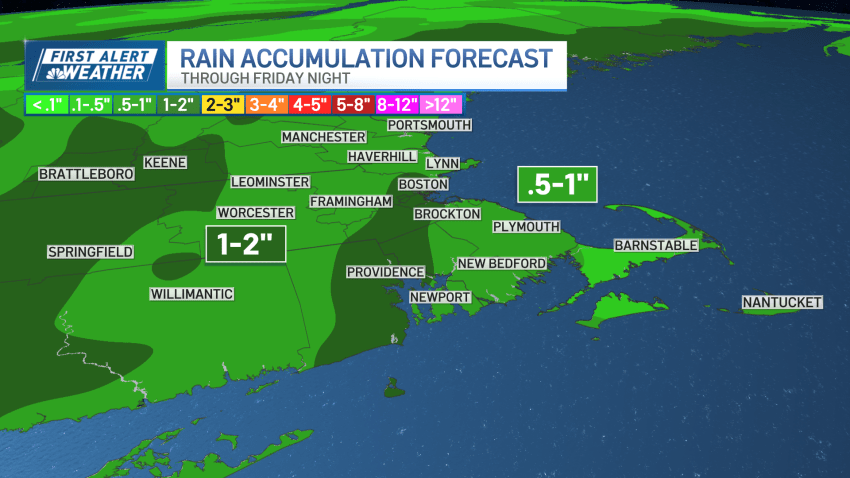
First Alert Friday: Heavy rain, strong winds expected later this week
It’s a chilly start to Tuesday, with temperatures in the 40s. With clear skies, though, we’ll see a warmup through central Massachusetts and MetroWest Boston. The reason temperatures are not the warmest at the coast on Tuesday is due to an onshore wind, so we’re only in the low 50s for highs. But, inland, for a second day, high...
-
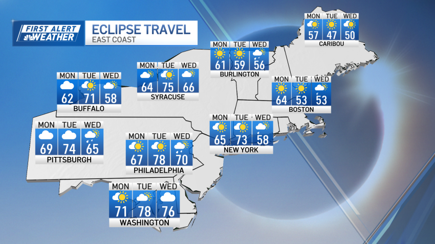
Some clouds Monday but New England will still have a clear view of the solar eclipse
The total solar eclipse is here. We’re in store for an amazing and rare sight as the moon covers the sun for a brief moment of darkness Monday. The skies are mostly cloudy with highs in the low 60s, though there will be clouds approaching at the start of the eclipse. That shouldn’t ruin the view for anyone in...
-
LIVE RADAR: Track the nor'easter hitting Boston, bringing snow to some
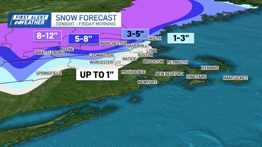
April’s first winter storm is knocking at our door. Here’s how it will play out — and scroll down to explore interactive radar. Light rain began Wednesday morning in scattered pockets across the Greater Boston area, with downpours by the evening. The steadier rain will be reserved for the afternoon and evening drive. This is when rainfall rates will...
-
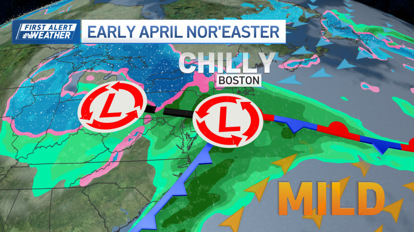
A powerful nor'easter is headed our way. Which areas will see significant snowfall?
We’re in the calmer and cloudy conditions Tuesday – which will also bring cooler air. While there will be a breeze, it’s a far cry from our gusty and windy week ahead. High temperatures are near 45 degrees, with onshore flow across the coast. Further inland, we’ll touch the upper 40s. Light rain and scattered showers pop up for...
-
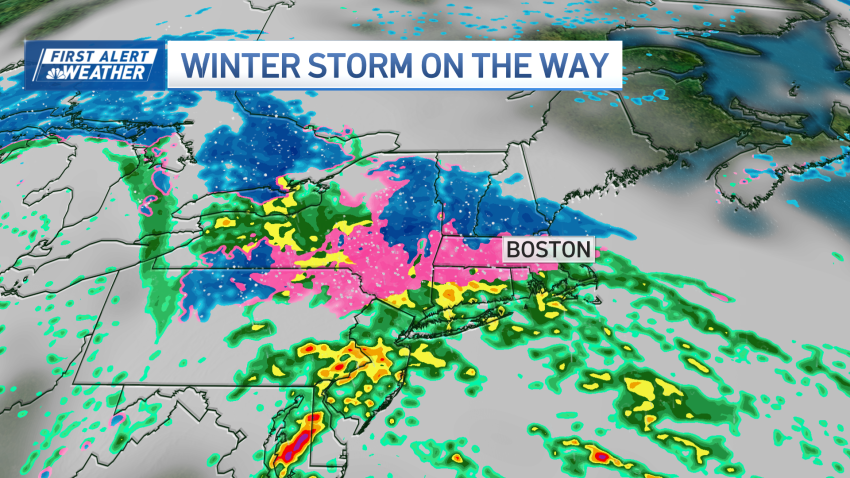
Messy early April nor'easter to bring heavy rain, sleet, snow to Mass., NH
We’re staring down one last tranquil weather day before our weather drastically changes. We’re in and out of the clouds Monday, but they should let up around 2 p.m. This will be around the peak heating of the day, so high temperatures approach 60 degrees. Throughout Monday night, a weaker weather system to our south will bring clouds back...
-
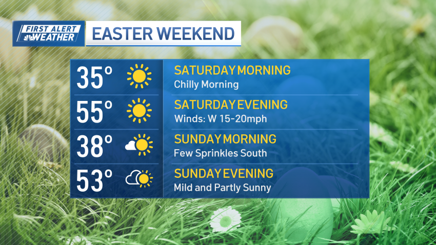
Mild and dry weather on the way for Easter weekend
After a rather wet two days, rain has almost shifted out. The rain tapers off through midday, with clouds breaking apart by the afternoon. Behind the storm, winds crank from with peak gusts between 25 and 30 miles per hour. The northwest wind brings the chill Friday night, but drier air for Saturday. With clear skies Friday night, Saturday morning…
-
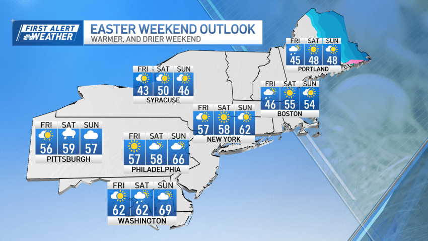
Rain continues Thursday ahead of a warmer, drier Easter weekend
We’re back underneath downpours for the day, as a stalling weather system hangs around. So far, most of the rain has been lighter through the early morning hours, but we’ll expect downpours to become greater by the early afternoon. The rainfall rates aren’t too steep, so while there will be puddles on the road, widespread flooding isn’t expected to...
-
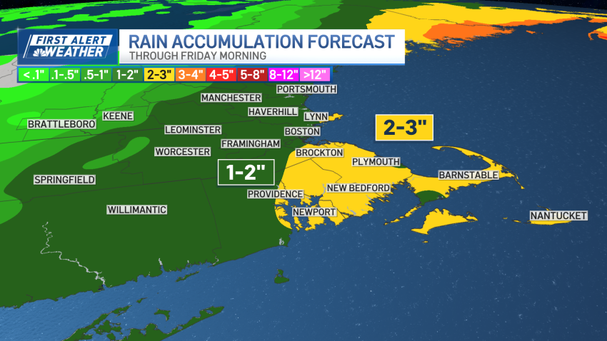
Another round of heavy rain on the way ahead of Easter weekend
Wednesday starts on a dreary, cloudy note, with milder air. Temperatures are roughly in the low 40s with clouds overhead, but winds are much calmer Wednesday. Breaks in the clouds will support high temperatures in mid-50s. The exception to the rule will be across the coast. We’re in a lull, relatively speaking, until our next several rounds of rain...


