
Unseasonably mild temperatures continue Tuesday.
Much of our older snowpack from last week will melt away with temperatures reaching into the 50s and 60s south, and mid to upper 40s to the north. In Boston, the highest maximum temperature record for Tuesday is 64 degrees, set back in 1907. We will likely come very close to tying this record in the afternoon.
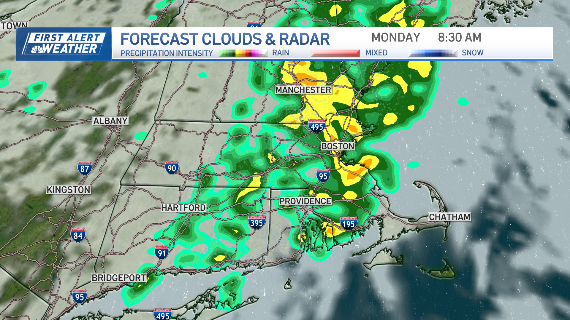
Another round of showers develops in the afternoon, ahead of an approaching cold front from the Great Lakes. Winds across the region will blow 10 to 15 mph, gusting to 25 to 30 mph.
Overnight, rain transitions to a mix and then to snow across New England as a cold front ushers in much cooler air into the region. Lows drop down to the upper 20s across the south, teens to low 20s north.
Snow will impact the morning commute Wednesday in southeast New England, focused especially on southeast Connecticut, Rhode Island and southeast Massachusetts including the Cape. It will reduce visibilities and cause slick road conditions. Steady snows are expected to end late morning to early afternoon as moisture shifts offshore.
As of Tuesday morning, our NBC10 Boston, NECN and Telemundo New England First Alert Team snow forecast ranges from very little in southern New Hampshire to perhaps an inch or two near the Massachusetts Turnpike, to a few inches possible in southeast Massachusetts.
Storm track and timing of the cold air remain critical to the outcome of this forecast with a sharp cut-off in amounts expected somewhere near the Mass. Pike. The new cold makes a stand Wednesday with high temperatures only in the low to mid 30s across the south and upper 20s to low 30s across the North Country.
Local
In-depth news coverage of the Greater Boston Area.

An area of high pressure noses into New England during the afternoon and evening. On Thursday, large high pressure and sunny skies crest over New England with high temperatures reaching to the 20s inland, lower to mid-30s towards the coastal plains. Wind chill values will drop to the teens and lower 20s during the day.
On Friday, expect a mostly dry day ahead of another area of low pressure developing over the Carolinas before a night mix moves in. Heavy rain should fall Friday night into Saturday with an inch to 1.5 inches when all is said and done, resulting in localized urban and street flooding.
Rising water levels in some of our local rivers will need to monitored as well. Mild temperatures are expected Saturday, generally in the 50s, with showers of rain and mix, south to north, lingering into Sunday.
A cold front sweeps the region Monday and brings gusty northwest winds and colder air to New England on the First Alert 10-Day Forecast on NBC10 Boston and necn.