Overnight: Clearing skies, colder & breezy. Lows in the upper 20’s and lower 30’s.
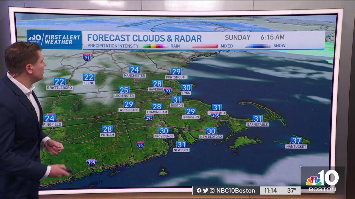
Sunday: a mix of sun and clouds, highs around 40.
Sunday Night: Clear & cold, lows around 30.
Clouds give way to partial clearing, as temperatures top out in the lower 40s for the rest of Saturday.
Any lingering rain or snow well North departs by evening. Clear skies tonight, with upper 20’s and lower 30’s. Beware of slick spots early Sunday morning.
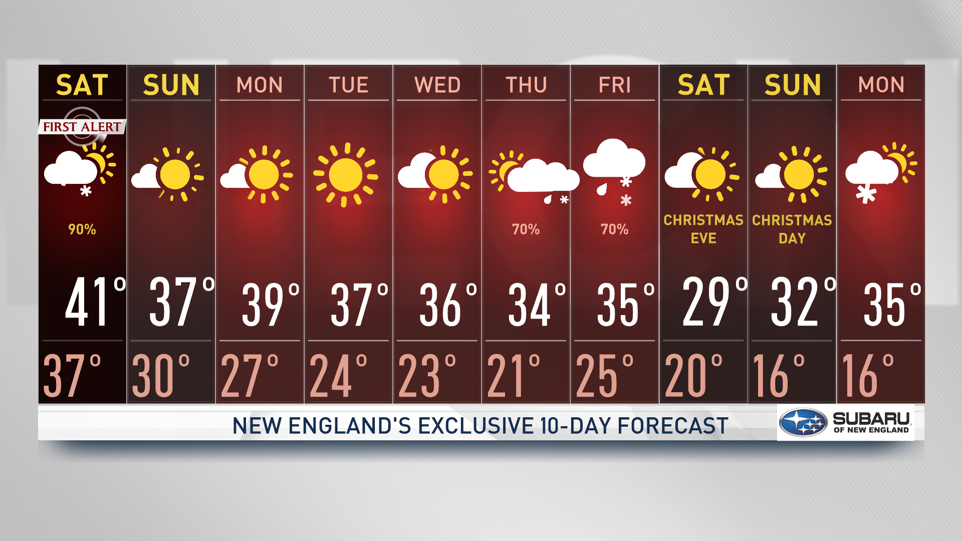
Sunday is partly cloudy and seasonable. Highs either side of 40. Monday is mostly sunny and breezy, highs around 40. Tuesday is mostly sunny and cooler, highs in the middle and upper 30’s.
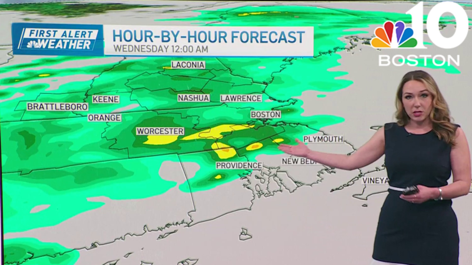
Wednesday is partly cloudy with highs in the middle 30’s. A storm arrives late Thursday with primarily rain. Temperatures rise through the 40’s. Friday, is rainy and windy. Highs in the upper 40’s.
Get Boston local news, weather forecasts, lifestyle and entertainment stories to your inbox. Sign up for NBC Boston’s newsletters.
Seasonable temperatures and pleasant conditions are expected to last through much of next week. Holiday travel is advised through Wednesday.
Later next week, conditions look favorable for another large coast-to-coast storm. While it’s too early to lay out specifics, it does appear that this system will impact much of the region with another dose of heavy rain and snow.
Weather


Strong winds and wind chills in the 20s
The wind will continue to remain strongest at the coast, gusting 40-50 mph. Saturday behind the storm center, gusts to 40 mph will be common, with a few higher gusts possible on Cape Cod in particular. Sunday brings a bit less wind but certainly a blustery feel. Wind chill values will be running in the 20s for most Sunday afternoon.
Tracking another storm for next week
Otherwise, it’ll be a chilly but quiet stretch of weather from Saturday afternoon through midweek next week, before the next storm takes shape and once again holds potential to be a coastal storm of either snow or rain. This storm is one our First Alert Team has shared with you all week. What’s yet to be determined, of course, is storm track, exact intensity and, therefore, impacts from rain and snow. At this point, we know there’s a lot of energy involved so the potential for a powerful storm is there for Thursday night into Friday the 23. White Christmas anyone?