


From the NBC10 Boston First Alert Weather Center… Today: Breezy all day, highs in the low 60s south, with mostly cloudy skies intending to bring breaks of sun and warm up. Tonight: Lows in the 50s, mostly cloudy with light isolated showers possible. Friday: Highs in the mid 50s west wind 9-13 mph with 25 mph gusts. Saturday: Showers most of the day, highs in the low 40s. Sunday: Mostly sunny, highs in the upper 30s with moderate to gusty northwest wind. Cape Cod Radio Forecast Today: lingering showers AM, patchy fog, drying out by 9am, mostly cloudy, breezy and some breaks of sun in the afternoon. max wind gusts 40 mph this evening through tonight. Tonight: Breezy, gusts from 30-40 mph at times. Lows in the 50s. Friday: Highs in the mid 50s, mostly sunny, gusts close to 30 mph. Saturday: Showers most of the day. Highs in the low 40s. Sunday: Partly sunny, highs in the low 40s, breezy; gusts around 20 mph.
A warm front passed through the region overnight Wednesday and will push through northern Maine early this afternoon providing the area with near record-warmth.
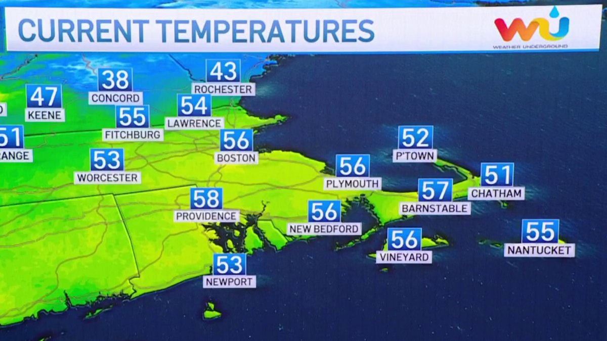
In terms of records, Boston’s record high temperatures for today is 64 degrees from 1971. We’ll come close to that and possibly tie it or break it, especially if the sun peaks out long enough. Much of the day will be under the clouds with a few spot sprinkles and showers around, a gusty southwest wind will also develop this afternoon. Highs temps reach the upper 50s to low 60s south, 40s and 50s north.
A cold front slides through late tonight with a few sprinkles, but we won’t be seeing much in the way of cold air behind it as Friday will feature temperatures in the 40s and 50s south, 40s north with a few clouds and a gusty northwest wind.
Cold air will drain into the region Friday night and this will set the stage as another system arrives Saturday with more precipitation. Even though it will track south of New England, with the lack of cold air in place, we will have to watch the rain/snow line very carefully during the day and into Saturday night.
Get Boston local news, weather forecasts, lifestyle and entertainment stories to your inbox. Sign up for NBC Boston’s newsletters.
Currently, it looks like it’ll be mostly wet along the coast with some snow at the onset and perhaps later Saturday night into Sunday morning as precipitation winds down. Interior locations such as northern Worcester County into New Hampshire will see the best chance for frozen precipitation, and north of that will likely be all snow with several inches likely across those areas.

