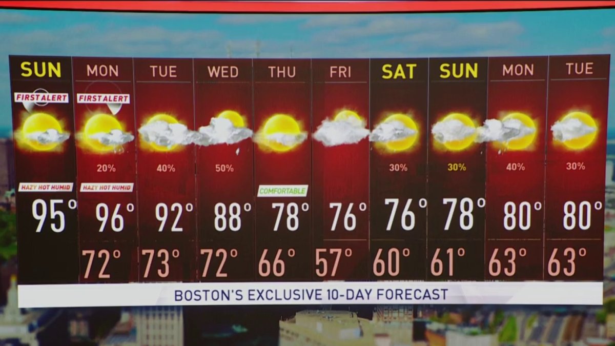
Today (Sunday): Hot and humid, isolated late storm. Highs in the 90s. Tonight: Partly cloudy, patchy fog, warm and muggy. Lows in the 60s and 70s. Monday: Heat continues. Mostly sunny, very humid. Isolated afternoon storm. Highs in the mid 90s, heat index near 100. Cape Cod Forecast: Today (Sunday): Humid, sunny. Highs in the mid to upper 80s. Tonight: Partly cloudy, patchy dense fog, muggy. Lows in the 60s. Monday: Not as hot, still humid, mostly sunny. Highs 70-75.
Over the course of the year, Boston averages 14 days above 90°. Yesterday was already the third time this season, with several more on the way. Saturday initiated what will likely be a four or five-day heatwave across New England.
The next couple of days, including today, will get hotter and more humid. Temperatures this afternoon will reach the low to mid 90s and by Monday and Tuesday it’s possible that we could be in the mid to upper 90s. If you add in the humidity, it will feel like it’s 100° at times. Overnights will be very warm and if you don’t have the proper means to keep you cool, it could be dangerously cool with lows in the 70s. When we have warm overnights, you body doesn’t have a chance to cool down.
Showers and thunderstorms will become a bit more numerous Tuesday and even into Wednesday. At this point, widespread severe weather doesn’t look likely. Once the cold front moves through temperatures will drop back to seasonable levels – in the upper 70s and low 80s.
Get Boston local news, weather forecasts, lifestyle and entertainment stories to your inbox. Sign up for NBC Boston’s newsletters.