While the National Hurricane Center is keeping close tabs on Hurricane Lee's path, there are things that people in the Boston area and across New England need to know no matter how close the storm comes to shore.
Where will Hurricane Lee make landfall?
As of Wednesday morning, the hurricane looks to be making a run up somewhere between eastern Maine and Nova Scotia, but that remains just a prediction of the probable path the storm takes — it could travel anywhere within that cone.
So, while the center of the cone is important, so too are the edges because the storm may deviate on either side.
Get Boston local news, weather forecasts, lifestyle and entertainment stories to your inbox. Sign up for NBC Boston’s newsletters.
The storm should also change as it moves north, transitioning from a tropical system, with a concentric ring of wind, to a post-tropical one, with the ring collapsing.
The only times that doesn't happen is when there's not enough cool air interacting with the storm. While we've had some really warm and humid air lately, we think that more comfortable air will feed into the storm, making the the transition likely.
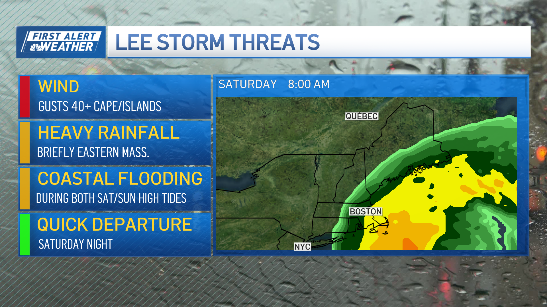
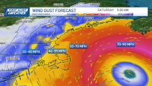
That will likely bring maximum wind gusts of 40-55 mph in coastal areas and inland in southeastern Massachusetts, going up to 70 to 80 mph on the Cape and Islands. Still, that could change as the track of the storm changes.
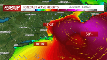
Waves are guaranteed — they're likely to be 50 mph at the center of the storm, and 10 to 15 mph off the outer Cape.
That translates to big surf, beach erosion and rip currents. And by Saturday, it could bring waves of 15 to 25 feet to shore, as well as a two- or three-foot storm surge.
All in all, that could up to minor or moderate coastal flooding, depending on the track of the storm.
This means that people who live on the coast should keep their flexible Saturday, taking the time to secure anything lightweight outside.

Stay with NBC10 Boston's First Alert team for updates through the rest of the week and as the storm arrives in the area.