Widely varied rainfall amounts will fall across New England over the coming 24 hours, from localized amounts over five inches, with pockets of flooding in western Connecticut, to nothing at all in some of northern New England.
The culprit is a storm that – in some way, shape and form – has been stalled over the ocean south of New England for nearly a week. After delivering showers at the start of the week, the storm center weakened and drifted south to allow for dry air and pleasant weather from a Canadian high pressure dome from Tuesday onward. Now, new atmospheric energy at the jet stream level has arrived to the East Coast, reviving this storm and causing it to both strengthen and expand.

As a result, tropical moisture is being fed northward and converging around a weak wind shift in the lower few thousand feet of the atmosphere, fueled by the aforementioned jet stream energy aloft and cranking out heavy rain Friday into Saturday in Connecticut and, to a lesser extent, western Massachusetts. Farther east, raindrops fall – just not as many and not as heavy, as the lingering dry air from the Canadian high pressure dome eats away at some of the rain, meaning a fraction of an inch for most, though far southeast Massachusetts, southern Rhode Island and the Cape & Islands will likely still see over one inch of rain, all told, with Cape and Island north-northeast gusts to 35 mph for a raw-feeling day Saturday.
Get Boston local news, weather forecasts, lifestyle and entertainment stories to your inbox. Sign up for NBC Boston’s newsletters.
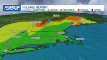
Northern New England remains firmly enough in the dry Canadian air that little more than some Friday and Friday night showers in central and southern Vermont and New Hampshire fall, otherwise Saturday weather looks lovely in the mountains where foliage reports now indicate approaching peak color in the high terrain of the northern Green Mountains, with low to moderate color elsewhere.
Although southern New England sees rain filling in Friday and continuing Friday night, Saturday the north-northeast wind will pull drier air southward, likely ending the rain by 9 a.m. as far south as the Mass. Turnpike, by noon to Brockton, Mass., and Hartford, Conn., and not until late afternoon at the South Coast.
The abundance of clouds will keep most of Southern New England rather cool, but the splendid weather of Northern New England spills south for the remainder of our region Sunday with any morning clouds on the Cape yielding to sunshine as nearly all New Englanders rebound to the 70s Sunday afternoon. That splendid weather ending the weekend will extend through nearly all of next week, with the next chance of showers not arriving until Friday into Saturday – specific details of which are still to be determined from this far out in our exclusive First Alert 10-day forecast.


