
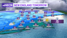
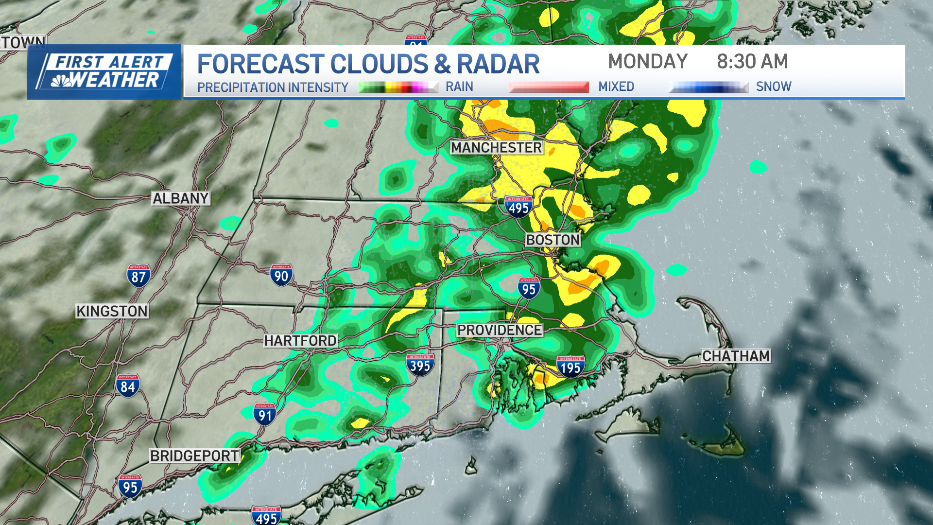
The wind diminishes after sunset and tonight we see colder lows in the single digits and teens early tonight. The wind direction flips by morning and we slowly see temps rise especially in southern New England. Highs reach the 40s across southern New England, with highs in the 30s north.
STAY IN THE KNOW
Watch NBC10 Boston news for free, 24/7, wherever you are. |
|
Get Boston local news, weather forecasts, lifestyle and entertainment stories to your inbox. Sign up for NBC Boston’s newsletters. |
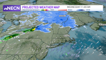
Our Next Chance for Snow
Our next system already heads in for Wednesday across northern New England. A low-pressure system over Canada brings in light snow for the northern third of New England, with snow accumulations of a coating to 2" through Wednesday night.
Get top local stories in Boston delivered to you every morning. Sign up for NBC Boston's News Headlines newsletter.
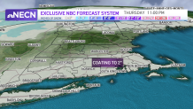
Then a cold front moves across southern New England for Thursday and this will cool off our temps for Thursday afternoon. Before that, Thursday morning swings in light snow showers for the morning commute. A coating to 2" of snow is possible through late Thursday morning for the southern third of New England. The track is not locked in yet, so that coating to 2" is possible from Boston, to the Pike and for areas south.
More Cold and Subzero Wind Chills
Weather Stories

Thursday night our temps tumble to the single digits again with subzero wind chills. Friday afternoon is another cold day as highs only stay in the teens.
Another Storm Possible Saturday
We’re watching another storm system for Saturday. This one is a coastal storm that could swing in some wind and snow across southern and eastern New England. Forecast models are not in agreement on the track, but the Euro had the storm passing near the benchmark at one point, while the GFS is more south. However, the GFS is trending more north as of today. And the Euro this afternoon is trending more south. We will watch the model adjustments all week and will keep you posted. The storm heads out by Sunday morning, with temps in the 30s and some sun. Next week our temps stay seasonable for mid-January.