Our sunshine and mild temperatures are being replaced with clouds and cooler air for the short term.
The backdoor cold front we’ve been tracking through New England is on the move. It continues to slide east to west, marked most notably by low clouds and an increase in the northeast wind.
WATCH ANYTIME FOR FREE
Stream NBC10 Boston news for free, 24/7, wherever you are. |
We’ll drop into the 50s overnight Friday into Saturday, with overcast skies and a few sprinkles and light rain showers.
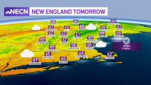
Expect little in the way of sun Saturday either, though we should manage to stay dry. A few late day breaks of sun are possible before sunset, particularly in eastern areas. Highs will be either side of 60.
Get updates on what's happening in Boston to your inbox. Sign up for our News Headlines newsletter.

Much of the same is forecast for Sunday: many clouds, a few spotty light showers and highs in the mid 60s.
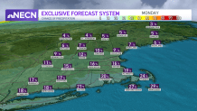
On Monday, marathon runners and spectators could encounter a quick shower in the morning, but even if that does come to fruition, it won’t be a big deal at all. I do anticipate some sun to break through and skies to turn partly cloudy in spots during the afternoon, which will boost our temperature to around 70.

Next week still looks fairly quiet, with the greatest chance of showers coming on Wednesday and then again on Saturday (no washouts). The 70s are likely again, too, with a gradual and slight cooldown heading into next weekend in our exclusive 10 day forecast.

