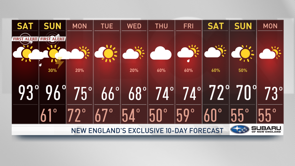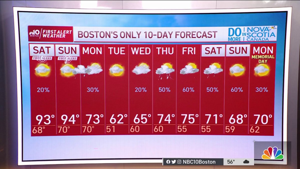
Friday night: A round of showers/thunder, otherwise variable clouds, pockets of fog. Lows in the 60s. Saturday: Hazy, record hot, humid. Chance late thunder far north. Highs in the 90s, heat index 95+. Sunday: Continued hazy, record hot & humid, highs in the 90s, heat index 95+, chance late and evening thunder.
Our humidity is on the rise and the change in the air is beginning to feel more like summer as we anticipate near record-highs this weekend.
Potentially dangerous heat on Saturday

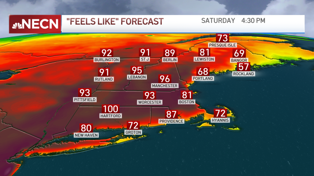
Heat indices in the mid 90s to 100 degrees will pose a risk to those outdoors doing strenuous work. Children, seniors, pregnant women, and our pets must get extra attention these upcoming days. Constant hydration and breaks will be necessary. The City of Boston has declared a heat emergency and is opening cooling centers.
Get Boston local news, weather forecasts, lifestyle and entertainment stories to your inbox. Sign up for NBC Boston’s newsletters.
While today is a transition day, we’ll see some disturbance filling in tonight bringing the chance of downpours in southern New England advancing quickly. With a mostly sunny sky, we’re feeling the punch of humidity and summer temperatures as we step outside Saturday and Sunday.
Severe storms possible Sunday
Weather Stories


There's a slight chance of showers for northern New England on Saturday, but a cold front approaches on Sunday and this will increase the potential for strong thunderstorms along northern New England. With a push in the cold air mass into a warm and humid atmosphere, our instability will grow; hot air will be forced up and we’ll see increasing clouds growing dense and full of energy. This might bring out the potential of heavy rain, strong localized wind gusts and lightning. Hail won’t be ruled out in strong storms as well.
Next week brings another cold down to near seasonable temperatures. Our highs will range from the mid to upper 60s along some 70s. Rain chances will return by the end of next week; all of that is reflected in our exclusive 10-day forecast.