


From the NBC10 Boston First Alert Weather Center… Today (Thursday): Humid, warm, shower from time to time. Highs near 80. Overnight Thursday Night: A few showers, humid. Lows in the 60s. Friday: A round of downpours/thunder from west to east, AM to PM. Highs in the 70s. Cape Cod Radio Forecast: Today (Thursday): Humid, sun and clouds, slight chance of a passing shower. Highs in the middle 70s. Overnight Thursday Night: Humid with the chance of a shower or two. Lows in the upper 60s. Friday: Continued humid, chance of an isolated AM shower, otherwise late day showers, downpours and thunder arrive. Highs in the middle 70s.
Downpours and thunder are on tap for Friday.
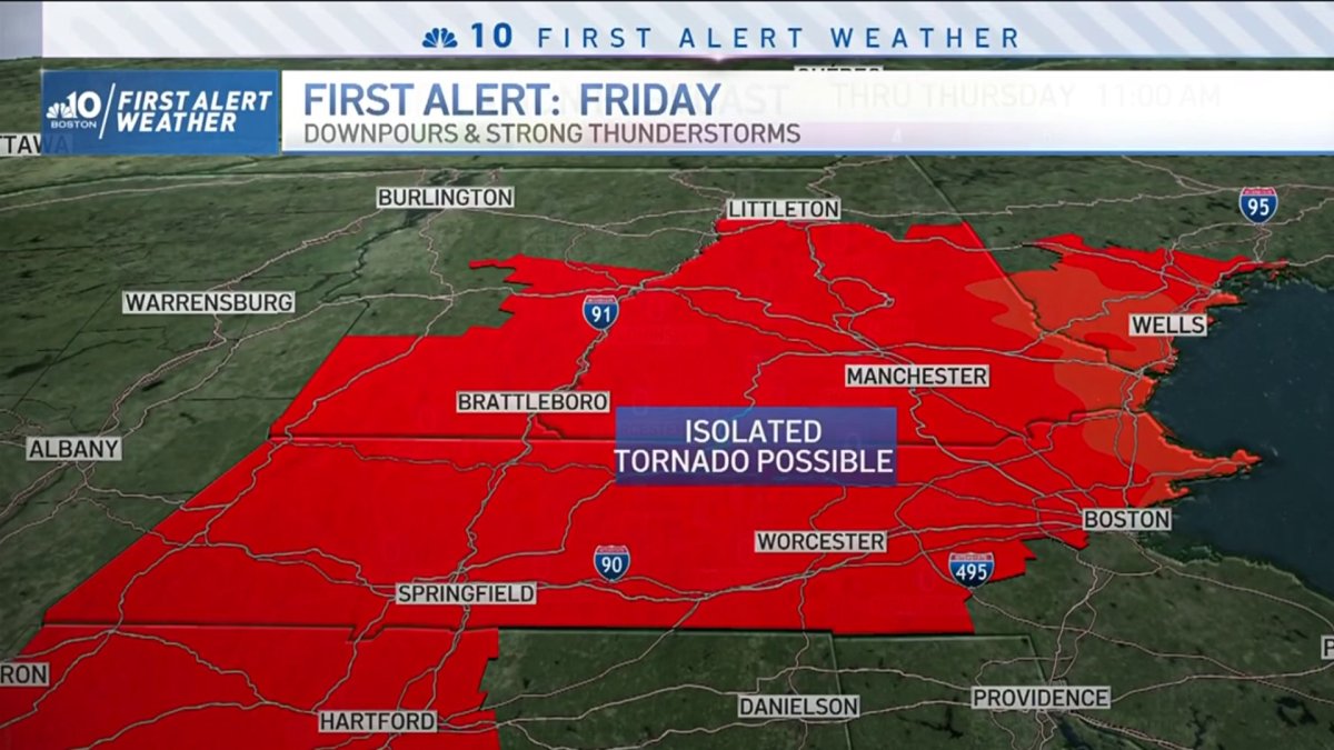
Preparation is key folks, and this time we must be aware of the potential for severe weather, which is why we have issued a First Alert for tomorrow.
A cold front will be pushing in on western New England as soon as tonight, with an easterly movement; this front will take its sweet time moving across the region. What we’ll see is a cluster of thunderstorms moving on beginning in western Massachusetts and into the east of New England from tonight and into Friday morning.
But with it’s slow movement, these storms will last until tomorrow night; as they interact with daytime heating, instability will increase and storm energy will begin to build on, allowing for some of these storms to become strong to severe. These storms will be capable of producing damaging wind gusts, and spinning in the atmosphere that can give away for tornado formation (hoping this is not the case). But again, preparation is key, and being weather-aware can allow us to be on the look out for any possible strong cells. Heavy downpours, lightning and small hail will also be possible.
Get Boston local news, weather forecasts, lifestyle and entertainment stories to your inbox. Sign up for NBC Boston’s newsletters.
While the forecast shows some lingering showers on eastern New England for Saturday morning, good news is we will see a mostly dry afternoon and evening. Sunday is looking overall great, and mostly dry, but a few pop-up showers could be possible as a shortwave moves through Vermont and New Hampshire. Our highs will climb into the 70s once again and drop by next week as soon as another cold front pushes in and brings the 60s back making it feel like fall, finally.

