Saturday morning features rain and windy conditions. The heaviest window of rain will be from 4 to 9 a.m.
Once we reach the late morning, rain will taper off with the wind staying high into the early afternoon. Higher elevations and northern New England will see snow through Saturday.
Flood warnings for Mass., Maine, Rhode Island
The highest flood risk will be for the east-facing beaches during high tide, Hampton Beach looks to crest with water at 13.7 feet, very similar to the flood on Hampton Beach on Wednesday morning, which saw a crest of 13.6 feet. There is moderate to major flood potential on the east-facing beaches.
Get Boston local news, weather forecasts, lifestyle and entertainment stories to your inbox. Sign up for NBC Boston’s newsletters.
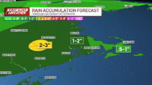
Generally, 1-2 inches of rain creates a flood risk across the board as area streams and rivers are already high and the ground is saturated from rain earlier this week.
Strong wind gusts could cause isolated power outages
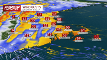
Wind gusts will ramp up this morning to 30-55 mph. The East Coast, Capes and Islands could see gusts up to 65 mph at times. The wind begins to calm around noon.
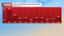
Beyond the rain, Saturday will be warm, with temperatures hovering in the mid to upper 50s Saturday afternoon even after we dry out. It will be very warm until a cold front swings in early evening Saturday. This will usher in mild conditions Sunday, highs in the low 40s, and downright COLD conditions into next week.
Local
In-depth news coverage of the Greater Boston Area.

Lows next week will be in the upper teens and low 20s. Highs in the upper 20s and low 30s.
Track the storm with live radar
Snowstorm coming next week?
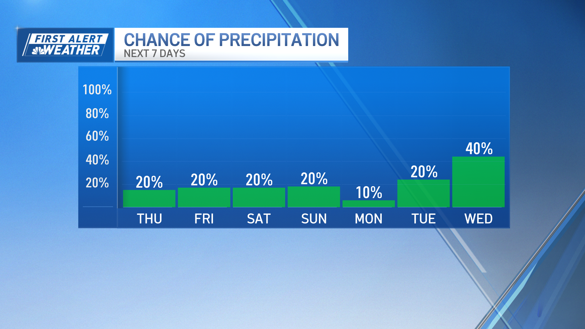
Our next precipitation chances come in Tuesday into Wednesday. There could be some snow with this system. Watching as it comes closer on timing and track of this low pressure.